
Puthunagaram is a town and gram panchayat in the Palakkad district, state of Kerala, India.It is about 10 km south of Palakkad and 8 Km from Kollengode. Palakkad-Pollachi railway line passes through this town.
Bharveli is a census town in Balaghat district in the state of Madhya Pradesh, India.
Choornikkara is a census town in Aluva in Ernakulam District in Kerala, India.

Devarshola is a panchayat town in The Nilgiris district in the state of Tamil Nadu, India.Devarshola comes under the administration of Gudalur revenue division and the taluk of Gudalur. It is one of the major tourist attractions in gudalur forest division and nearby to Mudumalai, Bandipur and Wayanad National parks. The state highway SH-98 Passing through the town which connects Gudalur and Sulthan Bathery.
Dhampur is a city and a municipal board in Bijnor district in the state of Uttar Pradesh, India. It is located at 29.51°N 78.50°E, and lies in Northern India.
Ezhudesam is a town panchayat in Kanniyakumari district in the state of Tamil Nadu, India.
Katpar is a census town in Bhavnagar district in the Indian state of Gujarat.
Keezhapavur or Keelapavoor is a town panchayat, in Tenkasi district in the Indian state of Tamil Nadu.
Nallur (Nalloor) is a panchayat town in Kanniyakumari district in the Indian state of Tamil Nadu.
Naranammalpuram is a panchayat town in Tirunelveli district in the Indian state of Tamil Nadu.
Pappakurichi is a census town in Tiruchirappalli district in the Indian state of Tamil Nadu. It was merged with the Tiruchirappalli Corporation in 2011.
Peerkankaranai is a neighborhood of Tambaram and part of the Chennai Metropolitan Area in the Indian state of Tamil Nadu. Originally a town panchayat,it was merged with the Tambaram Municipal Corporation in 2021.
Sayalgudi is a town panchayat in Ramanathapuram district of Tamil Nadu State in India.
Thevaram is a town in Theni district in the Indian state of Tamil Nadu. Thevaram is located in Tamil Nadu near on border of Kerala at the Eastern side foot-hill of the Western Ghats. It is connected with State Highway SH100.
Thiruporur is a panchayat town in Chengalpattu district in the Indian state of Tamil Nadu. The Thiruporur Kandaswamy temple is situated in the center of the town. There is a large temple tank in the vicinity of the temple. Thiruporur is located on Old Mahabalipuram Road and is flanked by Kelambakkam on one side and Alathur Pharmaceutical Industrial Estate on the other side, both of which are also on Old Mahabalipuram Road.
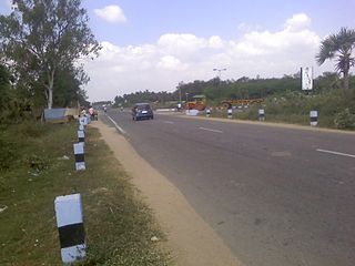
Thiruvalam also known as Thiruvallam, an ancient Temple Town built around Sri Dhanurmadhyambigai Sametha Sri Vilavanadeeswarar Temple, is part of Vellore City.
Jafarabad is a town and nagar panchayat in Jaunpur district in the Indian state of Uttar Pradesh.
Narasingapuram is a Municipality in Attur taluk, Salem district in the Indian state of Tamil Nadu. As of 2011, the town had a population of 23,084.
Shirahatti is a panchayat town in Gadag district in the Indian state of Karnataka.
Kerur is a town in Bagalkot district in Karnataka, which located on NH 218. It has an average elevation of 617 meters (2024 feet). It's the birthplace of Jagadish Shettar, a former Chief Minister of Karnataka. Kerur is a Town Panchayat city in the district of Bagalkot, Karnataka. The Kerur city is divided into 16 wards for which elections are held every five years. The Kerur Town Panchayat has a population of 19,731 of which 9,929 are males while 9,802 are females as per report released by Census India 2011.

 India
India 