Natchiowatchouan River

Last updated
Natchiowatchouan
Nottaway map.png
Watershed of Nottaway River
Location
Country Canada
Province Quebec
Region Eeyou Istchee Baie-James (municipality)
Physical characteristics
SourceForested creek
 - location Eeyou Istchee Baie-James (municipality), Nord-du-Québec, Quebec
 - coordinates 50°02′59″N77°35′42″W / 50.04972°N 77.59500°W / 50.04972; -77.59500
 - elevation265 m (869 ft)
Mouth Nottaway River
 - location
Eeyou Istchee Baie-James (municipality), Nord-du-Québec, Quebec
 - coordinates
50°10′28″N77°30′41″W / 50.17444°N 77.51139°W / 50.17444; -77.51139 Coordinates: 50°10′28″N77°30′41″W / 50.17444°N 77.51139°W / 50.17444; -77.51139
 - elevation
244 m (801 ft)

The Natchiowatchouan River is a tributary of the Nottaway River (via Lake Soscumica), in the administrative region of Nord-du-Québec, in the Canadian province of Quebec, in Canada. Most of the course of the river flows into Millet Township.

Nottaway River tributary of South-East shore James Bay, flowing in munipality of Eeyou Istchee Baie-James, in administrative region of Nord-du-Québec, in Quebec, in Canada

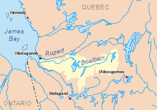
The Nottaway River is a river in Quebec, Canada. The river drains Lake Matagami and travels 225 kilometers (140 mi) north-west before emptying into Rupert Bay at the south end of James Bay. Its drainage basin is 65,800 square kilometers (25,400 sq mi) and has a mean discharge of 1190 m³/s. Its source is the head of the Mégiscane River, which is 776 kilometers (482 mi) from the mouth.

Nord-du-Québec Place in Quebec, Canada

Nord-du-Québec is the largest, but the least populous, of the seventeen administrative regions of Quebec, Canada. With nearly 750,000 square kilometres (290,000 sq mi) of land area, and very extensive lakes and rivers, it covers much of the Labrador Peninsula and about 55% of the total land surface area of Quebec, while containing a little more than 0.5% of the population.

Provinces and territories of Canada Top-level subdivisions of Canada

The provinces and territories of Canada are sub-national governments within the geographical areas of Canada under the authority of the Canadian Constitution. In the 1867 Canadian Confederation, three provinces of British North America—New Brunswick, Nova Scotia, and the Province of Canada —were united to form a federated colony, becoming a sovereign nation in the next century. Over its history, Canada's international borders have changed several times, and the country has grown from the original four provinces to the current ten provinces and three territories. Together, the provinces and territories make up the world's second-largest country by area.

Contents

Forestry is the main economic activity of the sector. Recreational tourism (especially hunting and fishing) comes second, thanks to the navigable water body of Lake Soscumica, including the tributaries.

The hydrographic slope of Lake Soscumica is accessible via the James Bay Highway (North-South direction) to 22.8 kilometres (14.2 mi) to the East. The west side of the lake is served by a winter road (North-South direction). The surface of the river is usually frozen from early November to mid-May, however, safe ice circulation is generally from mid-November to mid-April.

Geography

The main neighboring hydrographic slopes are:

Bell River (Quebec) river in Northern Quebec, tributary of Nottaway river, in Canada

The Bell River is a tributary of the south shore of Lake Matagami, which flows into the Nottaway River, a tributary of Rupert Bay. The Bell River flows into the Abitibi-Témiscamingue and Eeyou Istchee Baie-James regions in the administrative region of Nord-du-Québec, in Quebec, in Canada.

Deux Lacs River tributary of the Nottaway River, northwestern Quebec, Canada

The Deux-Lacs River is a tributary of the Nottaway River, in the administrative region of Nord-du-Québec, in the Canadian province of Quebec, in Canada. The course of the river flows in the cantons of Péruse, Paramé and Villieu.

Kitchigama River tributary of river Nottaway, flowing in municipality of Eeyou Istchee Baie-James, in administrative of Nord-du-Québec, in Quebec, in Canada

The Kitchigama River is a river in the Eeyou Istchee Baie-James, in the administrative region of Nord-du-Québec, in Quebec, in Canada. It is a tributary of the Nottaway River.

From its source, the Natchiowatchouan River flows over 29.3 kilometres (18.2 mi) according to the following segments:

The Natchiowatchouan River empties onto the western shore of Soscumica Lake. This confluence is located at:

Soscumica Lake lake crossed by the Nottaway River in northwestern Quebec, Canada

Soscumica Lake is a lake of the southern portion of Eeyou Istchee James Bay (municipality), in the administrative region of Nord-du-Québec, in the province of in south-western Quebec, Canada. The southern part of Lake Soscumica extends into Millet Township.

Rupert Bay is a large bay located on the south-east shore of James Bay, in Canada. Although the coast is part of the province of Quebec, the waters of the bay are under jurisdiction of Nunavut Territory.

Toponymy

The toponym "Natchiowatchouan" was formalized on December 5, 1968, at the Commission de toponymie du Québec, i.e. at the creation of this commission [2]

Related Research Articles

Davoust River watercourse in Canada

The Davoust River is a tributary of the northeast shore of the Nottaway River, flowing into the municipality of Eeyou Istchee Baie-James (municipality), in the administrative region of Nord-du-Québec, in Quebec, in Canada.

Muskiki River tributary of the Nottaway River, northwestern Quebec, Canada

The Muskiki River is a tributary of the Nottaway River (via Lake Soscumica, in the administrative region of Nord-du-Québec, in the Canadian province of Quebec, at Canada.

The Richerville River is a tributary of the Nottaway River, in the administrative region of Nord-du-Québec, in the Canadian province from Quebec, to Canada.

Iroquois River (Nottaway River tributary) tributary of the Nottaway River, northwestern Quebec, Canada

The Iroquois River is a tributary of the Nottaway, in the administrative region of Nord-du-Québec, in the Canadian province of Quebec, in Canada.

Subercase River (Kitchigama River) tributary of Grasset Lake (Nottaway River Hydrographic Slope) in northwestern Quebec, Canada

The Subercase River is a tributary of Grasset Lake (watershed of Nottaway River, in the Nord-du-Québec administrative region, in the Canadian province of Quebec, in Canada. The course of the river crosses the townships of Desmazures, Daloigny, La Gauchetière, Saint Hélène, Subercase and Grasset.

Pahunan River tributary of the Kitchigama River, in Northern Quebec, in Quebec, in Canada

The River Pahunan is a tributary of the Kitchigama River, in the administrative region of Nord-du-Québec, in the Canadian province the Quebec, in Canada. The course of this river flows in the townships of Grasset, the Forest and Paramé.

Ourse River tributary of the Allard River, in Eeyou Istchee Baie-James, Northern Quebec, Canada

The Ourse River is a tributary of the Allard River, in Eeyou Istchee Baie-James (municipality), in the administrative region of Nord-du-Québec, in Canadian province of Quebec, in Canada. The course of this river flows in the cantons of Vezza and Cavelier.

Chabinoche River tributary of Evans Lake, northwestern Quebec, Canada

The Chabinoche River is a tributary of Evans Lake, in Eeyou Istchee Baie-James (municipality), in the administrative region of Nord-du-Québec, in the Canadian province of Quebec, in Canada.

Canet River river in Nord-du-Québec, Quebec, Canada

The Canet River is a tributary of Matagami Lake, flowing into the territory of Eeyou Istchee Baie-James (municipality), in the administrative region of Nord-du-Québec, in Quebec, in Canada.

Gouault River tributary of Matagami Lake flowing in the municipality of Eeyou Istchee Baie-James, in the Nord-du-Québec region, in Quebec, Canada.

The Gouault River is a tributary of the west shore of Matagami Lake which empties into the Nottaway River via Soscumica Lake. The Gouault River flows in the municipality of Eeyou Istchee Baie-James (municipality), in the administrative region of Nord-du-Québec, Quebec, the Canada.

Pauschikushish Ewiwach River tributary of Dana Lake in northwestern Quebec, Canada

The Pauschikushish River Ewiwach is a tributary of Dana Lake in Regional County Municipality (RCM) of Eeyou Istchee Baie-James (municipality), in the administrative region of Nord-du-Québec, in the Canadian province of Quebec, in Canada.

Matawawaskweyau River tributary of the Pauschikushish Ewiwach River in northwestern Quebec, Canada

The Matawawaskweyau River is a tributary of the Pauschikushish Ewiwach River in Regional County Municipality (RCM) of Eeyou Istchee James Bay (municipality), in the administrative region of Nord-du-Québec, Canadian province of Quebec, in Canada.

Iskaskunikaw River tributary of the Pauschikushish Ewiwach River in northwestern Quebec, Canada

The Iskaskunikaw River is a tributary of the Pauschikushish Ewiwach River in Regional County Municipality (RCM) of Eeyou Istchee James Bay (municipality), in the administrative region of Nord-du-Québec, Canadian province of Quebec, Canada.

Kakaskutatakuch River tributary of the Iskaskunikaw River in northwestern Quebec, Canada

The Kakaskutatakuch River is a tributary of the Iskaskunikaw River in Regional County Municipality (RCM) of Eeyou Istchee James Bay (municipality) in the area of the Nord-du-Québec, Canadian province of Quebec, in Canada.

Kauskatitineu River tributary of Lake Tast in northwestern Quebec, Canada

The Kauskatitineu River is a tributary of Du Tast Lake, in Regional County Municipality (RCM) of Eeyou Istchee Baie-James (municipality), in the administrative region of Nord-du-Québec, in the Canadian province of Quebec, in Canada.

Iyinu Kaniput River tributary of Dana Lake, in Northern Quebec, Canada

The Iyinu Kaniput River is a tributary of Dana Lake, in Regional County Municipality (RCM) of Eeyou Istchee Baie-James (municipality), in the administrative region of Nord-du-Québec, in the Canadian province of Quebec, in Canada.

Utamikaneu River watercourse in Canada

The Utamikaneu River is a tributary of Dana Lake, in Regional County Municipality (MRC) of Eeyou Istchee Baie-James (municipality), in the administrative region of Nord-du-Québec, in the Canadian province of Quebec, in Canada.

Chensagi River tributary of Lake Maicasagi, Waswanipi Slope, Northwestern Quebec, Canada

The Chensagi River is a tributary of Maicasagi Lake, in Regional County Municipality (RCM) of Eeyou Istchee James Bay (municipality), in the administrative region from Nord-du-Québec, in the Canadian province of Quebec, in Canada.

References

Map all coordinates using: OpenStreetMap  
Download coordinates as: KML  ·  GPX
  1. Distances from the Department of Natural Resources Canada's Atlas of Canada (published on the Internet).
  2. Commission de toponymie du Québec - Bank of Place Names - Toponym: "Natchiowatchouan"

See also