Related Research Articles
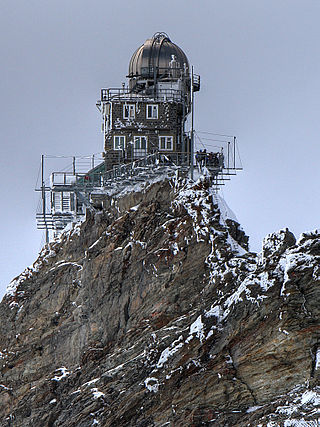
An observatory is a location used for observing terrestrial, marine, or celestial events. Astronomy, climatology/meteorology, geophysics, oceanography and volcanology are examples of disciplines for which observatories have been constructed.

Space weather is a branch of space physics and aeronomy, or heliophysics, concerned with the varying conditions within the Solar System and its heliosphere. This includes the effects of the solar wind, especially on the Earth's magnetosphere, ionosphere, thermosphere, and exosphere. Though physically distinct, space weather is analogous to the terrestrial weather of Earth's atmosphere. The term "space weather" was first used in the 1950s and popularized in the 1990s. Later, it prompted research into "space climate", the large-scale and long-term patterns of space weather.

Earth's magnetic field, also known as the geomagnetic field, is the magnetic field that extends from Earth's interior out into space, where it interacts with the solar wind, a stream of charged particles emanating from the Sun. The magnetic field is generated by electric currents due to the motion of convection currents of a mixture of molten iron and nickel in Earth's outer core: these convection currents are caused by heat escaping from the core, a natural process called a geodynamo.

A geomagnetic storm, also known as a magnetic storm, is a temporary disturbance of the Earth's magnetosphere caused by a solar wind shock wave.

Polar drift is a geological phenomenon caused by variations in the flow of molten iron in Earth's outer core, resulting in changes in the orientation of Earth's magnetic field, and hence the position of the magnetic north- and south poles.
This is a list of meteorology topics. The terms relate to meteorology, the interdisciplinary scientific study of the atmosphere that focuses on weather processes and forecasting.
Ernest Harry Vestine was an American geophysicist and meteorologist.
SANSA Space Science, previously the Hermanus Magnetic Observatory (HMO) is South Africa's national geomagnetic research facility. The observatory is situated in the town of Hermanus in the Western Cape Province and forms part of the South African National Space Agency.

In geophysics, a magnetic anomaly is a local variation in the Earth's magnetic field resulting from variations in the chemistry or magnetism of the rocks. Mapping of variation over an area is valuable in detecting structures obscured by overlying material. The magnetic variation in successive bands of ocean floor parallel with mid-ocean ridges was important evidence for seafloor spreading, a concept central to the theory of plate tectonics.
The United States Coast and Geodetic Survey was the first scientific agency of the United States Government. It existed from 1807 to 1970, and throughout its history was responsible for mapping and charting the coast of the United States, and later the coasts of U.S. territories. In 1871, it gained the additional responsibility of surveying the interior of the United States and geodesy became a more important part of its work, leading to it being renamed the U.S. Coast and Geodetic Survey in 1878.

The International Association of Geomagnetism and Aeronomy (IAGA) is an international scientific association that focuses on the study of terrestrial and planetary magnetism and space physics.

The United States Geological Survey (USGS), founded as the Geological Survey, is an agency of the U.S. Department of the Interior whose work spans the disciplines of biology, geography, geology, and hydrology. The agency was founded on March 3, 1879, to study the landscape of the United States, its natural resources, and the natural hazards that threaten it. The agency also makes maps of extraterrestrial planets and moons based on data from U.S. space probes.
The International Real-time Magnetic Observatory Network (INTERMAGNET) is a world-wide consortium of institutes operating ground-based magnetometers recording the absolute level of the Earth's time-varying magnetic field, to an agreed set of standards. INTERMAGNET has its roots in discussions held at the Workshop on Magnetic Observatory Instruments in Ottawa, Canada, in August 1986 and at the Nordic Comparison Meeting in Chambon La Foret, France, in May 1987. A pilot scheme between USGS and BGS was described in the sessions of Division V of the International Association of Geomagnetism and Aeronomy at the 19th General Assembly of the International Union of Geodesy and Geophysics in Vancouver, Canada, in August 1987. This scheme used the GOES East satellite to successfully transfer geomagnetic data between the two organisations. INTERMAGNET was founded soon after in order to extend the network of observatories communicating in this way. 62 different institutes are now members of the INTERMAGNET consortium, and, since 1991, data have been contributed to INTERMAGNET from approximately 150 observatories. INTERMAGNET is a member of the World Data System of the International Science Council, and it is closely associated with the International Association of Geomagnetism and Aeronomy.

Scott Ellsworth Forbush was an American astronomer, physicist and geophysicist who is recognized as having laid the observational foundations for many of the central features of solar-interplanetary-terrestrial physics, which at the time was an underdeveloped field of study. In 1937 Forbush discovered the Forbush Effect: an occasional decrease in the intensity of cosmic rays as observed on Earth that is caused by the solar wind and its interaction with the magnetosphere. Scott conducted most of his research during his career at the Department of Terrestrial Magnetism (DTM) of the Carnegie Institution of Washington where he was appointed chairman of a section on theoretical geophysics in 1957. Forbush used statistical methods in analyses of magnetic storms, solar activity, rotation of the Earth, and the rotation of the sun, and the correlation of this geophysical and solar phenomena with temporal variations of cosmic-ray intensity.

Carnegie was a brigantine yacht, equipped as a research vessel, constructed almost entirely from wood and other non-magnetic materials to allow sensitive magnetic measurements to be taken for the Carnegie Institution's Department of Terrestrial Magnetism. She carried out a series of cruises from her launch in 1909 to her destruction by an onboard explosion while in port in 1929. She covered almost 300,000 miles (500,000 km) in her twenty years at sea.

The north magnetic pole, also known as the magnetic north pole, is a point on the surface of Earth's Northern Hemisphere at which the planet's magnetic field points vertically downward. There is only one location where this occurs, near the geographic north pole. The geomagnetic north pole is the northern antipodal pole of an ideal dipole model of the Earth's magnetic field, which is the most closely fitting model of Earth's actual magnetic field.

The south magnetic pole, also known as the magnetic south pole, is the point on Earth's Southern Hemisphere where the geomagnetic field lines are directed perpendicular to the nominal surface. The Geomagnetic South Pole, a related point, is the south pole of an ideal dipole model of the Earth's magnetic field that most closely fits the Earth's actual magnetic field.

The history of geomagnetism is concerned with the history of the study of Earth's magnetic field. It encompasses the history of navigation using compasses, studies of the prehistoric magnetic field, and applications to plate tectonics.
The Indian Institute of Geomagnetism is an autonomous research institution established by the Government of India's Department of Science and Technology. The facility is engaged in basic and applied research in geomagnetism, as well as allied areas of geophysics, atmospheric physics and space physics, as well as plasma physics. The institute currently operates 12 magnetic observatories and actively participates in the Indian Antarctic Program.

William John Peters was an American explorer and scientist who worked extensively in the Arctic and tropics. His significant contributions the study of geomagnetism at sea in the early 1900s helped lay the foundation for the current scientific understanding of Earth's magnetism.
References
- ↑ USGS Geomagnetism Program FDSN
- ↑ Nelson, James H. (1962) Magnetism of the Earth C&GS Pub 40-1 p38
- ↑ Love, Jeffrey J. & Finn, Carol A. (2011) The USGS Geomagnetism Program and Its Role in Space Weather Monitoring AGU Space Weather Volume 9, Issue 7