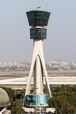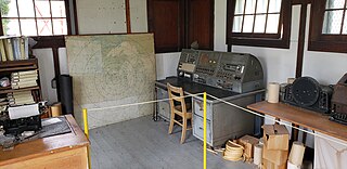
Air traffic control (ATC) is a service provided by ground-based air traffic controllers who direct aircraft on the ground and through a given section of controlled airspace, and can provide advisory services to aircraft in non-controlled airspace. The primary purpose of ATC worldwide is to prevent collisions, organize and expedite the flow of air traffic, and provide information and other support for pilots.

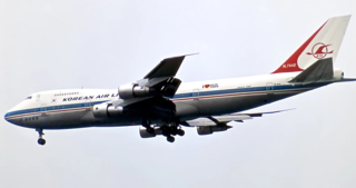
Korean Air Lines Flight 007 (KE007/KAL007) was a scheduled Korean Air Lines flight from New York City to Seoul via Anchorage, Alaska. On September 1, 1983, the flight was shot down by a Soviet Sukhoi Su-15 interceptor. The Boeing 747 airliner was en route from Anchorage to Seoul, but owing to a navigational mistake made by the crew, the airliner drifted from its original planned route and flew through Soviet prohibited airspace. The Soviet Air Forces treated the unidentified aircraft as an intruding U.S. spy plane, and destroyed it with air-to-air missiles, after firing warning shots. The Korean airliner eventually crashed into the sea near Moneron Island west of Sakhalin in the Sea of Japan. All 269 passengers and crew aboard were killed, including Larry McDonald, a United States representative. The Soviet Union found the wreckage under the sea two weeks later on September 15 and found the flight recorders in October, but this information was kept secret by the Soviet authorities until 1992, after the country's collapse.

Search and rescue (SAR) is the search for and provision of aid to people who are in distress or imminent danger. The general field of search and rescue includes many specialty sub-fields, typically determined by the type of terrain the search is conducted over. These include mountain rescue; ground search and rescue, including the use of search and rescue dogs ; urban search and rescue in cities; combat search and rescue on the battlefield and air-sea rescue over water.

A flight service station (FSS) is an air traffic facility that provides information and services to aircraft pilots before, during, and after flights, but unlike air traffic control (ATC), is not responsible for giving instructions or clearances or providing separation. They do, however, relay clearances from ATC for departure or approaches. The people who communicate with pilots from an FSS are referred to as flight service specialists.

The AN/APG-63 and AN/APG-70 are a family of all-weather multimode radar systems designed by Hughes Aircraft for the F-15 Eagle air superiority fighter. These X band pulse-Doppler radar systems are designed for both air-air and air-ground missions; they are able to look up at high-flying targets and down at low-flying targets without being confused by ground clutter. The systems can detect and track aircraft and small high-speed targets at distances beyond visual range down to close range, and at altitudes down to treetop level. The radar feeds target information into the aircraft's central computer for effective weapons delivery. For close-in dogfights, the radar automatically acquires enemy aircraft and projects this information onto the cockpit head-up display. The name is assigned from the Army Navy Joint Electronics Type Designation System.

The International Cospas-Sarsat Programme is a satellite-aided search and rescue (SAR) initiative. It is organized as a treaty-based, nonprofit, intergovernmental, humanitarian cooperative of 45 nations and agencies. It is dedicated to detecting and locating emergency locator radio beacons activated by persons, aircraft or vessels in distress, and forwarding this alert information to authorities that can take action for rescue. Member countries support the distribution of distress alerts using a constellation of around 65 satellites orbiting the Earth which carry transponders and signal processors capable of locating an emergency beacon anywhere on Earth transmitting on the Cospas-Sarsat frequency of 406 MHz.

In air traffic control, an area control center (ACC), also known as a center or en-route center, is a facility responsible for controlling aircraft flying in the airspace of a given flight information region (FIR) at high altitudes between airport approaches and departures. In the US, such a center is referred to as an air route traffic control center (ARTCC).
The AN/APG-76 radar is a pulse Doppler Ku band multi-mode radar developed and manufactured by Northrop Grumman.

National Airlines Flight 967, registration N4891C, was a Douglas DC-7B aircraft that disappeared over the Gulf of Mexico en route from Tampa, Florida, to New Orleans, Louisiana, on November 16, 1959. All 42 on board were presumed killed in the incident.
The En Route Automation Modernization (ERAM) system architecture replaces the En Route Host computer system and its backup. ERAM provides all of today's functionality and:
Radar MASINT is a subdiscipline of measurement and signature intelligence (MASINT) and refers to intelligence gathering activities that bring together disparate elements that do not fit within the definitions of signals intelligence (SIGINT), imagery intelligence (IMINT), or human intelligence (HUMINT).
The National Airspace System (NAS) is the airspace, navigation facilities and airports of the United States along with their associated information, services, rules, regulations, policies, procedures, personnel and equipment. It includes components shared jointly with the military. It is one of the most complex aviation systems in the world, and services air travel in the United States and over large portions of the world's oceans.

The Los Angeles Air Route Traffic Control Center is an air traffic control center located in Palmdale, California, United States. Located adjacent to United States Air Force Plant 42 and the Palmdale Regional Airport, it is one of 22 Air Route Traffic Control Centers (ARTCC) operated by the United States Federal Aviation Administration (FAA).
PIRAZ is a United States Navy acronym for Positive Identification Radar Advisory Zone. The zone is defined by the air search radar coverage of a ship patrolling a designated PIRAZ station. The concept was similar to radar picket stations established in World War II. The PIRAZ ship requires a Naval Tactical Data System radio-linked computer installation to effectively identify and track all aircraft anticipated to enter the airspace of the zone during combat.

The Cyprus Air Command, also known as the Cyprus Air Force or Cypriot Air Force, is the armed air wing of the National Guard. This force is equipped with attack and anti-tank helicopters, surface-to-air missile systems and integrated radar systems.

Anchorage Air Route Traffic Control Center (PAZA/ZAN) is located just outside the main gate of Joint Base Elmendorf-Richardson at 700 North Boniface Parkway in Anchorage, Alaska, United States. The Anchorage ARTCC is one of 22 Air Route Traffic Control Centers in the United States.

The United States Air Force's 24th Expeditionary Air Support Operations Squadron is a combat support unit. The 24th provides tactical command and control of airpower assets to the Joint Forces Air Component Commander and Joint Forces Land Component Commander for combat operations. It was first activated in 1946 in the Panama Canal Zone as the 630th Aircraft Control Squadron, but was inactivated two years later. It was activated again in 1953 as the 630th Aircraft Control and Warning Squadron, a Tactical Air Command radar unit that replaced an Air National Guard unit mobilized for the Korean War. It transferred to Air Defense Command, which inactivated it the following year.
Minneapolis Air Route Traffic Control Center (ZMP), (radio communications, "Minneapolis Center") is one of 22 Area Control Centers. It is located at 512 Division Street in Farmington, Minnesota, United States.

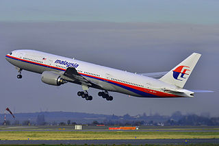
Malaysia Airlines Flight 370 (MH370/MAS370) was an international passenger flight operated by Malaysia Airlines that disappeared from radar on 8 March 2014 while flying from Kuala Lumpur International Airport in Malaysia to its planned destination, Beijing Capital International Airport in China. The reason for its disappearance has not been determined.


