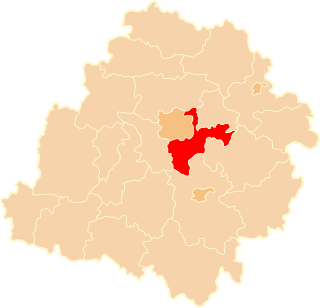
Lekarzewice is a village in the administrative district of Gmina Osięciny, within Radziejów County, Kuyavian-Pomeranian Voivodeship, in north-central Poland. It lies approximately 6 kilometres (4 mi) east of Osięciny, 20 km (12 mi) east of Radziejów, and 47 km (29 mi) south of Toruń.
Natolin Kiernoski is a village in the administrative district of Gmina Kiernozia, within Łowicz County, Łódź Voivodeship, in central Poland.
Słotwiny is a village in the administrative district of Gmina Koluszki, within Łódź East County, Łódź Voivodeship, in central Poland. It lies approximately 4 kilometres (2 mi) south-east of Koluszki and 27 km (17 mi) east of the regional capital Łódź.
Albertów is a village in the administrative district of Gmina Lutomiersk, within Pabianice County, Łódź Voivodeship, in central Poland. It lies approximately 6 kilometres (4 mi) north of Lutomiersk, 22 km (14 mi) north-west of Pabianice, and 20 km (12 mi) west of the regional capital Łódź.
Żurawieniec is a village in the administrative district of Gmina Lutomiersk, within Pabianice County, Łódź Voivodeship, in central Poland. It lies approximately 10 kilometres (6 mi) north-west of Lutomiersk, 27 km (17 mi) north-west of Pabianice, and 27 km (17 mi) west of the regional capital Łódź.
Rzepki is a village in the administrative district of Gmina Czarnocin, within Piotrków County, Łódź Voivodeship, in central Poland. It lies approximately 5 kilometres (3 mi) north-west of Czarnocin, 23 km (14 mi) north of Piotrków Trybunalski, and 24 km (15 mi) south-east of the regional capital Łódź.
Gościnna is a village in the administrative district of Gmina Gorzkowice, within Piotrków County, Łódź Voivodeship, in central Poland. It lies approximately 5 kilometres (3 mi) north-east of Gorzkowice, 18 km (11 mi) south of Piotrków Trybunalski, and 61 km (38 mi) south of the regional capital Łódź.
Szczepanowice is a village in the administrative district of Gmina Gorzkowice, within Piotrków County, Łódź Voivodeship, in central Poland. It lies approximately 3 kilometres (2 mi) north-east of Gorzkowice, 19 km (12 mi) south of Piotrków Trybunalski, and 63 km (39 mi) south of the regional capital Łódź.
Polesie is a village in the administrative district of Gmina Grabica, within Piotrków County, Łódź Voivodeship, in central Poland. It lies approximately 10 kilometres (6 mi) south-east of Grabica, 6 km (4 mi) north-west of Piotrków Trybunalski, and 41 km (25 mi) south of the regional capital Łódź.
Wykno is a village in the administrative district of Gmina Łęki Szlacheckie, within Piotrków County, Łódź Voivodeship, in central Poland. It lies approximately 8 kilometres (5 mi) north of Łęki Szlacheckie, 19 km (12 mi) south-east of Piotrków Trybunalski, and 64 km (40 mi) south of the regional capital Łódź.
Kęszyn is a village in the administrative district of Gmina Rozprza, within Piotrków County, Łódź Voivodeship, in central Poland. It lies approximately 12 kilometres (7 mi) south of Piotrków Trybunalski and 55 km (34 mi) south of the regional capital Łódź.
Pieńki is a village in the administrative district of Gmina Rozprza, within Piotrków County, Łódź Voivodeship, in central Poland. It lies approximately 4 kilometres (2 mi) north of Rozprza, 9 km (6 mi) south-west of Piotrków Trybunalski, and 52 km (32 mi) south of the regional capital Łódź.
Kałek is a village in the administrative district of Gmina Sulejów, within Piotrków County, Łódź Voivodeship, in central Poland. It lies approximately 7 kilometres (4 mi) west of Sulejów, 9 km (6 mi) south-east of Piotrków Trybunalski, and 52 km (32 mi) south-east of the regional capital Łódź.
Korytnica is a village in the administrative district of Gmina Sulejów, within Piotrków County, Łódź Voivodeship, in central Poland. It lies approximately 7 kilometres (4 mi) north-west of Sulejów, 9 km (6 mi) east of Piotrków Trybunalski, and 51 km (32 mi) south-east of the regional capital Łódź.
Rokszyce is a village in the administrative district of Gmina Biała Rawska, within Rawa County, Łódź Voivodeship, in central Poland. It lies approximately 3 kilometres (2 mi) west of Biała Rawska, 15 km (9 mi) east of Rawa Mazowiecka, and 68 km (42 mi) east of the regional capital Łódź.
Dąbrówka is a village in the administrative district of Gmina Czerniewice, within Tomaszów Mazowiecki County, Łódź Voivodeship, in central Poland. It lies approximately 3 kilometres (2 mi) south of Czerniewice, 16 km (10 mi) north-east of Tomaszów Mazowiecki, and 50 km (31 mi) east of the regional capital Łódź.
Mała Wola is a village in the administrative district of Gmina Czerniewice, within Tomaszów Mazowiecki County, Łódź Voivodeship, in central Poland. It lies approximately 5 kilometres (3 mi) south-east of Czerniewice, 19 km (12 mi) north-east of Tomaszów Mazowiecki, and 55 km (34 mi) east of the regional capital Łódź.
Dionizów is a village in the administrative district of Gmina Zduńska Wola, within Zduńska Wola County, Łódź Voivodeship, in central Poland. It lies approximately 4 kilometres (2 mi) north of Zduńska Wola and 38 km (24 mi) south-west of the regional capital Łódź.
Ławki is a village in the administrative district of Gmina Trzemeszno, within Gniezno County, Greater Poland Voivodeship, in west-central Poland. It lies approximately 8 kilometres (5 mi) north of Trzemeszno, 18 km (11 mi) north-east of Gniezno, and 66 km (41 mi) north-east of the regional capital Poznań.
Nowa Jabłona is a village in the administrative district of Gmina Niegosławice, within Żagań County, Lubusz Voivodeship, in western Poland. It lies approximately 8 kilometres (5 mi) north-east of Niegosławice, 34 km (21 mi) east of Żagań, and 40 km (25 mi) south-east of Zielona Góra.