Related Research Articles
Baitadi District, historical name “Bairath” (बैराथ), a part of Sudurpashchim Province, is one of the 77 districts of Nepal. It is a Hill district. Baitadi, with Dasharathchand as its headquarters, covers an area of 1,519 km2 (586 sq mi) and has a population of 250,898 according to the census (2011). The Baitadi district entails 56 village development councils (VDCs) and two municipality in the past. Now, by federal policy there are 10 local units; 4 Municipalities and 6 Rural Municipalities. Baitadi falls into the farthest western regional district of Nepal touching Jhulaghat, India, Nepal's neighboring country, to its border.

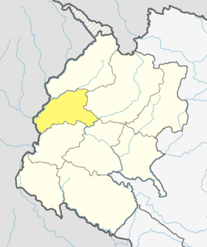
Darchula District (Nepali: दार्चुला जिल्लाpronounced [ˈdaɾt͡sula], a part of Sudurpashchim Province, is one of the nine districts of province and one of seventy-seven districts of Nepal. The district, with Khalanga as its district headquarters, covers an area of 2,322 km2 and has a population of 133,274. Darchula Lies in the west-north corner of the country.

The 2007 South Asian floods were a series of terrible floods in India, Nepal, Bhutan, Pakistan and Bangladesh. News Agencies, citing the Indian and Bangladeshi governments, place the death toll in excess of 2,000. By 3 August approximately 20 million had been displaced and by 10 August some 30 million people in India, Bangladesh and Nepal had been affected by flooding.

Boharigau is a village development committee in Darchula District in Sudurpashchim Province of western Nepal. At the time of the 1991 Nepal census it had a population of 3262 people living in 572 individual households.
Byans is a rural area of Byans Rural Municipality, previously it was a Village development committee (VDC) of Darchula District in Sudurpashchim Province of western Nepal. At the time of the 1991 Nepal census it had a population of 723 people living in 150 individual households.
Dhari is a village development committee in Darchula District in the Mahakali Zone of western Nepal. At the time of the 1991 Nepal census it had a population of 2981 people living in 525 individual households.
Ghusa is a village development committee in Darchula District in the Mahakali Zone of western Nepal. At the time of the 1991 Nepal census it had a population of 1026 people living in 165 individual households.
Hunainath is a village development committee in Darchula District in the Mahakali Zone of western Nepal. At the time of the 1991 Nepal census it had a population of 1631.It is named after the Hunainath, a god in Nepal.
Huti is a village development committee (VDC) in Darchula District in the Mahakali Zone of western Nepal. At the time of the 1991 Nepal census it had a population of 2317 people living in 417 individual households. It is named after the village of Huti. The Brama Devta temple is located there at Huti-2 and is visited by many pilgrims.
Khalanga is a town and the district headquarters of the Darchula District in the Sudurpashchim Province province of Nepal. It is part of the Mahakali Municipality in the Mahakali Zone. The town is located on the bank of Mahakali River and the border with Uttarakhand state, India. The town on the Indian side of the border also has similar name, spelt as Dharchula.
Khar is a village development committee (VDC) of Darchula District in the Mahakali Zone of Far-Western Development Region, Nepal. Geographically khar is located 29.79 N and 80.64 E, its nearest border to the district headquarters is Dallekh which is 10- 12 kilometer north east to the Darchula. The Khar VDC is surrounded by Sipti and Dhuligada VDC to the East and South, Katai to the West, and Eyarkot to the North. According to national census 2011 khar VDC has total population 4,272 residing 698 households.
Latinath is a village development committee in Darchula District in the Mahakali Zone of western Nepal. At the time of the 1991 Nepal census it had a population of 3392 people living in 587 individual households. In this development region one of the famous temple of this district is located which is called "latainath" or "latinath".
Malikarjun is a former village development committee that is now a Rural Municipality in Darchula District in Sudurpashchim Province of far western Nepal. Mallikarjun is named after the famous temple of lord Shiva Shree Shailyn shikar Malikarjun. At the time of the 1991 Nepal census it had a population of 1814 people living in 331 individual households.
Pipalchauri is a village development committee in Darchula District in the Mahakali Zone of western Nepal. At the time of the 1991 Nepal census it had a population of 1854 people living in 293 individual households.
Sipti is a village development committee in Darchula District in the Mahakali Zone of western Nepal. At the time of the 2011 Nepal census it had a population of 4,339 people living in 749 individual households.

Byas is a rural municipality located in Darchula District of Sudurpashchim Province of Nepal.
In mid-July 2019, monsoonal downpours caused widespread flooding and landslides across South Asia. As of 14 July, at least 89 people died across Bangladesh, China, India, and Nepal. Hardest-hit is Nepal, where at least 55 deaths occurred.

Bungal is a municipality located in Bajhang District of Sudurpashchim province of Nepal. It is surrounded by Darchula District in the west, Baitadi District in the south, Surma, Chabispathivera, Durgathali, Kedarseu and Bithadchir in the East and Saipal touches it from the North.
Shailyashikhar Municipality is a municipality located in Darchula District of Sudurpashchim Province of Nepal.
References
- ↑ "Woman dies falling off moving jeep".
- ↑ "Flood destroys six homes in Naugadh village". 12 July 2018. Retrieved 13 August 2018.
- ↑ "स्थानीय तह निर्वाचन २०७४". cleanelection.org.
- ↑ "The Rising Nepal: Rains sweep away bridge, forcing school to put off exam". therisingnepal.org.np.