| Nazarje | |
|---|---|
| Town | |
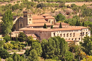
Vrbovec Mansion | |
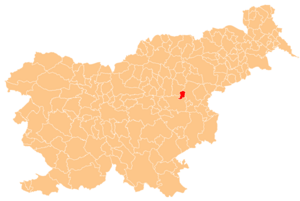
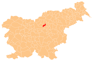
 Nazarje Location in Slovenia | |
| Coordinates: 46°19′12.75″N14°57′11.26″E / 46.3202083°N 14.9531278°E Coordinates: 46°19′12.75″N14°57′11.26″E / 46.3202083°N 14.9531278°E | |
| Country | |
| Traditional region | Styria |
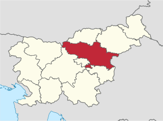
| Statistical region | Savinja |
| Municipality | Nazarje |
| Area | |
| • Total | 0.9 km2 (0.3 sq mi) |
| Elevation | 386.6 m (1,268.4 ft) |
| Population (2012) | |
| • Total | 880 |
| [1] | |

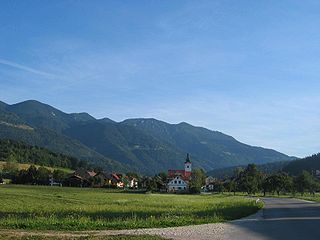
Nazarje (pronounced [ˈnaːzaɾjɛ] ) is a town at the confluence of the Savinja and Dreta rivers in northern Slovenia. It is the largest town and the centre of the Municipality of Nazarje. Traditionally it belongs to the region of Styria and is now included in the Savinja Statistical Region. [2]

The Savinja is a river in northeast Slovenia which flows mostly in the Upper and Lower Savinja Valley and through the cities of Celje and Laško. The Savinja is the main river of the Savinja Alps. It flows into the Sava River at the town of Zidani Most. It has often flooded, such as in the 1960s, 1990, and 1995. The Savinja has a length of 101.75 kilometres (63.22 mi) and a catchment area of 1,847.7 km2 (713.4 sq mi).

The Dreta is a river in Styria, northeastern Slovenia. The river is 29 km (18 mi) long. Its source is near the Črnivec Pass in the Kamnik Alps. It flows through the town of Gornji Grad, Bočna, and Šmartno ob Dreti, and merges with the Savinja River in Nazarje. The Dreta Valley is named after the river.

Slovenia, officially the Republic of Slovenia, is a sovereign state located in southern Central Europe at a crossroads of important European cultural and trade routes. It is bordered by Italy to the west, Austria to the north, Hungary to the northeast, Croatia to the southeast, and the Adriatic Sea to the southwest. It covers 20,273 square kilometers (7,827 sq mi) and has a population of 2.07 million. One of the successor states of the former Yugoslavia, Slovenia is a parliamentary republic and a member of the United Nations, of the European Union, and of NATO. The capital and largest city is Ljubljana.
The settlement gets its name from the monastic church dedicated to Mary of Nazareth. Right next to it is the 17th-century Franciscan monastery. Close by is Vrbovec Castle, originally a 12th-century building with 16th-century adaptations. It was badly damaged by fire in the Second World War. It was restored between 1988 and 1992 by the local forestry association and now houses a forestry and woodworking museum. [3]
A monastery is a building or complex of buildings comprising the domestic quarters and workplaces of monastics, monks or nuns, whether living in communities or alone (hermits). A monastery generally includes a place reserved for prayer which may be a chapel, church, or temple, and may also serve as an oratory.

A church building or church house, often simply called a church, is a building used for Christian religious activities, particularly for Christian worship services. The term is often used by Christians to refer to the physical buildings where they worship, but it is sometimes used to refer to buildings of other religions. In traditional Christian architecture, the church is often arranged in the shape of a Christian cross. When viewed from plan view the longest part of a cross is represented by the aisle and the junction of the cross is located at the altar area.

The Annunciation, also referred to as the Annunciation to the Blessed Virgin Mary, the Annunciation of Our Lady, or the Annunciation of the Lord, is the Catholic and Eastern Orthodox celebration of the announcement by the Archangel Gabriel to the Blessed Virgin Mary that she would conceive and become the mother of Jesus, the Son of God, marking His Incarnation. Gabriel told Mary to name her son Yeshua, meaning "YHWH is salvation".