Related Research Articles

Scaldwell is a village and civil parish in the West, Northamptonshire, England.

Lamport is a village and civil parish in West Northamptonshire, England. The village is on the A508, about 8 miles (13 km) south of Market Harborough and 8 miles (13 km) north of Northampton. Nearby is Lamport Hall. At the time of the 2001 census, the parish's population was 207 people, including Hanging Houghton and increasing to 225 at the 2011 Census.

Finedon is a small town in North Northamptonshire, with a population at the 2011 census of 4,309 people. In 1086 when the Domesday Book was completed, Finedon was a large royal manor, previously held by Queen Edith, wife of Edward the Confessor. From the 1860s the parish was much excavated for its iron ore, which lay underneath a layer of limestone and was quarried over the course of 100 years or more. Local furnaces produced pig iron and later the quarries supplied ore for the steel works at Corby. A disused quarry face in the south of the parish is a geological SSSI.

Ab Kettleby is a village and civil parish in the Melton district of Leicestershire, England, located 3 miles (4.8 km) north of Melton Mowbray, on the A606 road. It had a population of 501 in 2001; at the 2011 census this had increased to 529.

Eaton is a village and civil parish in Leicestershire, England, situated in the Vale of Belvoir. The population at the 2011 census was 648. The civil parish includes nearby Eastwell to the west of the village. Eaton has a church, a village hall and a children's park, but the public house called The Castle and its adjacent shop have closed.
The Kettering Ironstone Railway was an industrial 3 ft narrow gauge railway that served the ironstone quarries around Kettering.
The Hook Norton ironstone quarries (Brymbo) were ironstone quarries near Hook Norton in Oxfordshire, England. The quarries were in operation from 1899 to 1946 supplying ironstone to the Brymbo Steelworks in Wrexham and were served by the Brymbo Ironworks Railway, an extensive, 2 ft narrow gauge industrial railway.

Knipton is a small English village in the civil parish of Belvoir, in the county of Leicestershire. It lies about 6 miles (10 km) from the town of Grantham, just off the A607, and 10 miles (16 km) from Melton Mowbray. It borders the Duke of Rutland's estate at Belvoir Castle. Although the village is in Leicestershire, it has a Nottinghamshire postcode and a Lincolnshire (Grantham) STD code.
The Rosedale Railway was an 19.5-mile (31.4 km) goods-only railway line running from Battersby Junction via Ingleby Incline, across the heights of the North York Moors in North Yorkshire, England to reach iron ore deposits in the remote hills of the Rosedale valley. It opened to traffic as a narrow gauge railway to Ingleby Incline top in 1858, converted to standard gauge and opened to Rosedale West in 1861, and closed completely in 1929. Apart from Ingleby Incline, no major engineering works were constructed, and as such, particularly the east branch, the railway followed the contours of the surrounding hillside. The former trackbeds of the railway are in use by walkers and cyclists.
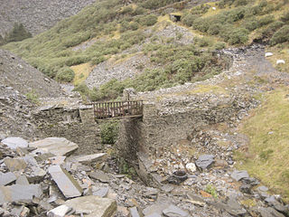
Some industrial narrow-gauge railways in the United Kingdom and the Isle of Man were primarily built to serve quarrying, mining, and similar industries. Some of these narrow-gauge railways offered passenger services for employees or workmen, but they did not run public passenger trains. They are listed by the primary industry they served.

Eastwell is a village and ecclesiastical parish in Leicestershire, England.
The Hook Norton Ironstone Partnership was the first company to quarry ironstone at Hook Norton on a large scale. Although only in operation for twelve years, its quarries subsequently became part of the Brymbo Steelworks quarries and relics of the Partnership's railways and tramways can still be seen today.
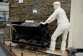
The Irchester Narrow Gauge Railway Museum is a small railway museum and metre gauge railway near Irchester, in the Wellingborough district of Northamptonshire, England.

Wellingborough Loco Shed was a stabling point located in Wellingborough, Northamptonshire, England. The depot was situated on the Midland Main Line and was located just north of Wellingborough station.

Finedon Top Lodge Quarry, also known as Finedon Gullet is a 0.9 hectare geological Site of Special Scientific Interest east of Wellingborough in Northamptonshire. It is a Geological Conservation Review site revealing a sequence of middle Jurassic limestones, sandstones and ironstones, and is the type section for a sequence of sedimentary rocks known as the 'Wellingborough Member'. It was created by quarrying for the underlying ironstone for use at Wellingborough and Corby Steelworks; the ore was transported by the 1,000 mm gauge Wellingborough Tramway.

The Waltham Iron Ore Tramway was a 1,000 mm gauge industrial tramway serving the ironstone pits of the Waltham Iron Ore Company, a subsidiary of the Staveley Coal and Iron Company. It was located to the north of the village of Branston in Leicestershire on the edge of the Belvoir Estate. The tramway operated from 1884 until 1958.
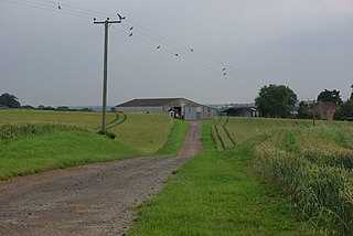
The Finedonhill Tramway was a British industrial narrow-gauge railway which operated under various ownership between 1875 and 1926.
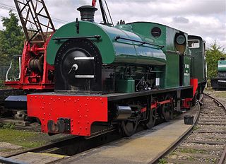
The Wellingborough Tramway was an industrial narrow-gauge railway that connected a series of ironstone mines and quarries with the Midland Railway and later with the ironworks on the north side of Wellingborough. In various forms, the tramway operated between 1875 and 1966.
The Eaton Branch Railway was a standard gauge industrial railway built to serve ironstone quarries around the village of Eaton in Leicestershire. It operated from 1884 until 1965.

Grinkle Mine, was an ironstone mine working the main Cleveland Seam near to Roxby in North Yorkshire, England. Initially, the ironstone was mined specifically for the furnaces at the Palmer Shipbuilders in Jarrow on the River Tyne, but later, the mine became independent of Palmers. To enable the output from the mine to be exported, a 3-mile (4.8 km) narrow-gauge tramway was constructed that ran across three viaducts and through two tunnels to the harbour of Port Mulgrave, where ships would take the ore directly to Tyneside.
References
- 1 2 Tonks, Eric (May 1990). The Ironstone Quarries of the Midlands Part 4: The Wellingborough Area. Cheltenham: Runpast Publishing. ISBN 1-870-754-042.
- 1 2 3 Quine, Dan (2016). Four East Midlands Ironstone Tramways Part Three: Wellingborough. 108. Garndolbenmaen: Narrow Gauge and Industrial Railway Modelling Review.
Coordinates: 52°19′34″N0°39′52″W / 52.3260°N 0.6644°W