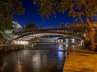
Trikala is a city in northwestern Thessaly, Greece, and the capital of the Trikala regional unit. The city straddles the Lithaios river, which is a tributary of Pineios. According to the Greek National Statistical Service, Trikala is populated by 81,355 inhabitants (2011), while in total the Trikala regional unit is populated by 131,085 inhabitants (2011).

Andravida is a town and a former municipality in Elis, in the northwest of the Peloponnese peninsula of Greece. Since the 2011 local government reform it is part of the municipality Andravida-Kyllini, of which it is a municipal unit. The municipal unit has an area of 40.728 km2. Its population is about 3,700. The town was the capital of the Frankish Principality of Achaea in the late Middle Ages.

Rhodope is one of the regional units of Greece. It is part of the region of East Macedonia and Thrace. Its name is derived from the Rhodope Mountains, which cover the northern part of its territory. Together with the regional units Evros and Xanthi, it forms the geographical region of Western Thrace. The capital of the prefecture is the city of Komotini. The second largest town is Sapes. Most of the Muslims of Thrace, the only officially recognized minority in Greece, are settled in this area, where they form around half of the regional unit's population.
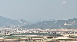
Almyros or Halmyros is a town and a municipality of the regional unit of Magnesia, region of Thessaly, Greece. It lies in the center of prosperous fertile plain known as 'Krokio Pedio', which is crossed by torrents. Almyros is an important agricultural and commercial center of Magnesia, and is also developing as a tourist center for the area. The main agricultural products are tomatoes, cotton, wheat, almonds, peanuts and pistachio nuts.

Lampeia is a mountain village, a community and a former municipality in Elis, West Greece, Greece. Since the 2011 local government reform it is part of the municipality Archaia Olympia, of which it is a municipal unit. The municipal unit has an area of 72.447 km2. The community includes the village Amygdali.

Levidi is a small town and a former municipality in Arcadia, Peloponnese, Greece. Since the 2011 local government reform it is part of the municipality Tripoli, of which it is a municipal unit. The municipal unit has an area of 312.641 km2. The town is situated on the northeastern slope of the Mainalo mountains, at about 850 m elevation. Levidi is 9 km northwest of Kapsas, 10 km east of Vytina, 12 km southwest of Kandila and 20 km northwest of Tripoli. It is at the junction of the Greek National Road 74 (Tripoli–Pyrgos) and the Greek National Road 66.
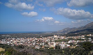
Zacharo is a town and municipality in western Peloponnese, Greece. Administratively, it belongs to the regional unit of Elis in West Greece. Zacharo is situated on the coast of the Gulf of Kyparissia, a part of the Ionian Sea. The mountain Lapithas is to the north, and the Minthi is to the east. Northwest of the town, between mount Lapithas and the sea, is the Kaiafas Lake. Zacharo is 18 km south of Olympia, 28 km southeast of Pyrgos, 65 km northwest of Kalamata and 65 km west of Tripoli. The town is crossed by the Greek National Road 9/E55, that links Patras with Kalamata.

Akrata, is a town and a former municipality in Achaea, West Greece, Greece. Since the 2011 local government reform it is part of the municipality Aigialeia, of which it is a municipal unit. The municipal unit has an area of 180.169 km2. Akrata is located on the right bank of the river Krathis, 3 km from its outflow into the Gulf of Corinth. The Greek National Road 8A/E65 and the railway from Patras to Corinth pass through the municipal unit, northeast of the town. The nearest town is Aigeira, 4 km to the east. It is 23 km southeast of Aigio, 52 km east of Patras and 23 km northeast of Kalavryta.
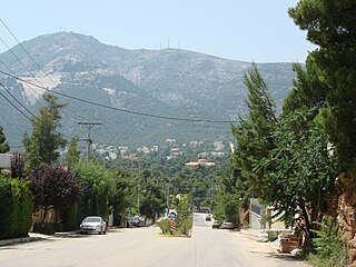
Dionysos is a northern suburb of the Athens agglomeration and a municipality in northeastern Attica, Greece. The seat of the municipality is the town Agios Stefanos.

Mesolouri is a mountain village and a former community in Grevena regional unit, Western Macedonia, Greece. Since the 2011 local government reform it is part of the municipality Grevena, of which it is a municipal unit. Mesolouri had 24 inhabitants as of 2021. The municipal unit has an area of 17.744 km2.

Perivoli is a mountain village and a former community in Grevena regional unit, West Macedonia, Greece. Since the 2011 local government reform it is part of the municipality Grevena, of which it is a municipal unit. Its population was 93 inhabitants as of 2021. The municipal unit has an area of 137.210 km2. The village is inhabited during winter by only 10-20 people due to extreme snow. However, the population rises to 4,000 people during the summer. There are many restored houses, inns, restaurants and cafes in the village. The inhabitants are mainly native Aromanians.

Pramanta is a village and a former municipality in the Ioannina regional unit, Epirus, in northwestern Greece. Since the 2011 local government reform, it is part of the municipality North Tzoumerka, of which it is a municipal unit. In 2021 its population was 1,514 for the community and 1,759 for the municipal unit. The municipal unit has an area of 69.058 km2 and the community 39.435 km2. Pramanta is situated in the Athamanika mountains, at about 840m elevation. It is 4 km west of Melissourgoi, 6 km north of Agnanta, 6 km south of Prosilio, 65 km southeast of Ioannina, 70 km northeast of Arta and 28 km south of Metsovo.
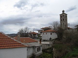
Ano Vrontou is a remote mountain village and a former community in the northern Serres regional unit, Greece. Since the 2011 local government reform it is part of the municipality Serres, of which it is a municipal unit. Each year on August astrophotography hobbyists gather there due to the clear view of the night sky, a result of the villages high elevation. The municipal unit has an area of 47.306 km2. Ano Vrontou is situated in the northeastern part of the Vrontous mountains, at about 1060 m elevation. It borders on the Drama regional unit to the north and east. Ano Vrontou is 6 km northwest of Kato Vrontou, 12 km east of Achladochori, 13 km northeast of Oreini, 16 km southwest of Kato Nevrokopi and 26 km northeast of Serres.

Nymfaio and in Ancient Greece: Νυμφαῖον or Νύμφαιον, is a village and a former community in Florina regional unit, Western Macedonia, Greece. After the 2011 local government reform it became a member of the municipality Amyntaio. The municipal unit has an area of 28.209 km2. As of 2021 the village had a population of 63 residents. The village is protected by the Hellenic Ministry of Culture in order to preserve its architectural integrity.
Pertouli is a small mountain village within the province of Trikala in Greece and is situated at an altitude of 1,150 metres on the central part of the Pindos mountain range.
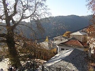
Pinakates is a mountain village in the Magnesia regional unit, Greece. It is part of the municipal unit of Milies.
Dyrrachio is a mountain dota village in the municipal unit of Falaisia, southwestern Arcadia, Greece. It is considered a traditional settlement and is situated at an altitude of 800 metres (2,600 ft) in the Taygetos mountains of the Peloponnese. It is 3 km west of Neochori, 4 km east of Akovos, 7 km southwest of Longanikos and 25 km south of Megalopoli. Dyrrachio suffered damage from the 2007 Greek forest fires.
Neochori Falaisias is a mountain village in the municipal unit of Falaisia, Arcadia, Greece. It is situated in the northern part of the Taygetus mountains, at about 1200 m elevation. It is 3 km east of Dyrrachio, 4 km west of Georgitsi, 17 km southeast of Leontari and 26 km southeast of Megalopoli. It suffered damage from the 2007 Greek forest fires.

Elati, formerly known as Tyrna (Τύρνα), is a village in the regional unit of Trikala, Greece. It lies at the south part of the Pindos mountain chain, 32 km (20 mi) from Trikala city.
Kryovrysi is a village in the municipal unit of Perama, Ioannina regional unit, Greece. It is in the southeastern part of the Mitsikeli mountains, at the southeastern edge of the Zagori region. Kryovrysi is 2.5 km north of Spothoi, 9 km east of Perama and 8 km northeast of Ioannina.


