Gallery
- Site of New Burlington (1803–1971) located on Ohio State Route 380
- Headstone of Lawrence E. & Ethel Compton Mitchner located in New Burlington Cemetery
- Grave of Lawrence E. Mitchner, the last remaining resident of New Burlington
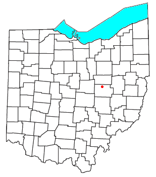
New Burlington is a former town located in Chester Township in the northwestern corner of Clinton County, Ohio, off Ohio State Route 380. The GNIS classifies it as a populated place. [1] It was acquired by the United States federal government when Caesar Creek was dammed and a reservoir created in the 1970s.[ citation needed ]
New Burlington was laid out in 1833, and named after Burlington, North Carolina, the native home of a share of the first settlers. [2] A post office called New Burlington was established in 1837, and remained in operation until 1971. [3] New Burlington was a "station" on the Underground Railroad. [4]

Clinton County is a county located in the U.S. state of Ohio. As of the 2020 census, the population was 42,018. Its county seat and largest city is Wilmington. The county is named for former U.S. Vice President George Clinton. Clinton County comprises the Wilmington, Ohio Micropolitan Statistical Area, which is also included in the Cincinnati-Wilmington-Maysville, OH-KY-IN Combined Statistical Area.

Plattsburgh is an unincorporated community in central Harmony Township, Clark County, Ohio, United States. It is located along State Route 54 near the headwaters of the North Fork Little Miami River.

Chester Township is one of the thirteen townships of Clinton County, Ohio, United States. As of the 2020 census the population was 2,027.

Lees Creek, also known as Centerville, is an unincorporated community in central Wayne Township, Clinton County, Ohio, United States. It lies at the intersection of State Route 729 with Cox Road, 6 miles south of Sabina and 12 miles (19 km) southeast of Wilmington, the county seat of Clinton County. It lies between the headwaters of the Middle Fork of Lees Creek, to the southeast, and the Anderson Fork of Caesar Creek. it had a post office, with the ZIP code 45138. The Post Office closed in 2012 and the town, including East Clinton High School, now carries a Sabina mailing address.

Reesville is an unincorporated community in northwestern Richland Township, Clinton County, Ohio, United States. It has a post office with the ZIP code 45166. It is located along State Route 72.

Blissfield is an unincorporated community in southwestern Clark Township, Coshocton County, Ohio, United States. It has a post office with the ZIP code 43805. It lies along State Route 60 between Warsaw and Killbuck.
Oakland is an unincorporated community in Clinton County, Ohio, United States.
New Antioch is an unincorporated community in Green Township, Clinton County, Ohio, United States.
Westboro is an unincorporated community in Jefferson Township, Clinton County, Ohio, United States.
Lumberton is an unincorporated community in Clinton County, Ohio, United States.
Morrisville is an unincorporated community located in Clinton County, Ohio, United States.
Bloomington is an unincorporated community in Clinton County, Ohio, United States.
Louden is an unincorporated community in Bratton Township, Adams County, in the U.S. state of Ohio. Its elevation is 784 feet above sea level. Serpent Mound Historical Site is located just east within sight of Louden on State Route 73, formerly known as the Hillsboro-Portsmouth road. Louden Road runs south from State Route 73 within the hamlet.
Burtonville is an unincorporated community in Clinton County, in the U.S. state of Ohio.
Farmers is an unincorporated community in Clinton County, in the U.S. state of Ohio.
Jonesboro is an unincorporated community in Clinton County, in the U.S. state of Ohio.
Kingman is an unincorporated community in Clinton County, in the U.S. state of Ohio. Nearby North Kingman is also listed by the GNIS as a populated place.
Memphis is an unincorporated community in Clinton County, in the U.S. state of Ohio.
Pansy is an unincorporated community in Clinton County, in the U.S. state of Ohio.
Snow Hill is an unincorporated community in Clinton County, in the U.S. state of Ohio.
39°33′43″N83°57′56″W / 39.56194°N 83.96556°W