New Vienna, Ohio

Last updated

New Vienna, Ohio
New-Vienna-West-Main-oh.jpg
Intersection of Main and West (SR 28)
OHMap-doton-New Vienna.png
Location of New Vienna, Ohio
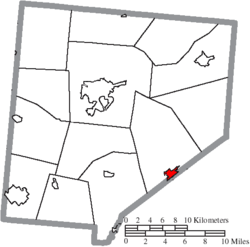
Map of Clinton County Ohio Highlighting New Vienna Village.png
Location of New Vienna in Clinton County
Coordinates: 39°19′27″N83°41′31″W / 39.32417°N 83.69194°W / 39.32417; -83.69194
Country United States
State Ohio
County Clinton
Government
   Mayor Kathy Stone
Area
[1]
  Total0.82 sq mi (2.13 km2)
  Land0.80 sq mi (2.08 km2)
  Water0.02 sq mi (0.05 km2)
Elevation
[2]
1,122 ft (342 m)
Population
 (2020)
  Total1,108
  Density1,381.55/sq mi (533.34/km2)
Time zone UTC-5 (Eastern (EST))
  Summer (DST) UTC-4 (EDT)
ZIP code
45159
Area code(s) 937, 326
FIPS code 39-55748 [3]
GNIS feature ID1065138 [2]
Website http://newvienna.net/
Historical population
CensusPop.Note
1860 580
1870 573−1.2%
1880 79739.1%
1890 8719.3%
1900 805−7.6%
1910 793−1.5%
1920 704−11.2%
1930 628−10.8%
1940 75219.7%
1950 8077.3%
1960 8586.3%
1970 849−1.0%
1980 1,13333.5%
1990 922−18.6%
2000 1,29440.3%
2010 1,224−5.4%
2020 1,108−9.5%
U.S. Decennial Census [4]

New Vienna is a village in Clinton County, Ohio, United States. The population was 1,108 at the 2020 census.

Contents

History

New Vienna was originally called Buzzard's Glory, and under the latter name was laid out in 1835. [5]

Geography

New Vienna is located at 39°19′27″N83°41′31″W / 39.32417°N 83.69194°W / 39.32417; -83.69194 (39.324126, -83.691848). [6]

According to the United States Census Bureau, the village has a total area of 0.87 square miles (2.25 km2), of which 0.85 square miles (2.20 km2) is land and 0.02 square miles (0.05 km2) is water. [7]

Demographics

2010 census

As of the census [8] of 2010, there were 1,224 people, 478 households, and 322 families living in the village. The population density was 1,440.0 inhabitants per square mile (556.0/km2). There were 557 housing units at an average density of 655.3 per square mile (253.0/km2). The racial makeup of the village was 96.7% White, 0.8% African American, 0.4% Native American, 0.3% Asian, 0.5% from other races, and 1.2% from two or more races. Hispanic or Latino of any race were 0.7% of the population.

There were 478 households, of which 35.8% had children under the age of 18 living with them, 45.4% were married couples living together, 15.7% had a female householder with no husband present, 6.3% had a male householder with no wife present, and 32.6% were non-families. 27.0% of all households were made up of individuals, and 11.3% had someone living alone who was 65 years of age or older. The average household size was 2.56 and the average family size was 3.03.

The median age in the village was 35.7 years. 26.5% of residents were under the age of 18; 7.3% were between the ages of 18 and 24; 29.2% were from 25 to 44; 26.3% were from 45 to 64; and 10.8% were 65 years of age or older. The gender makeup of the village was 47.9% male and 52.1% female.

2000 census

As of the census [3] of 2000, there were 1,294 people, 497 households, and 330 families living in the village. The population density was 1,619.0 inhabitants per square mile (625.1/km2). There were 555 housing units at an average density of 694.4 per square mile (268.1/km2). The racial makeup of the village was 97.76% White, 0.31% African American, 1.08% Native American, 0.08% Asian, 0.31% from other races, and 0.46% from two or more races. Hispanic or Latino of any race were 0.77% of the population.

There were 497 households, out of which 38.6% had children under the age of 18 living with them, 46.9% were married couples living together, 13.7% had a female householder with no husband present, and 33.6% were non-families. 27.8% of all households were made up of individuals, and 10.9% had someone living alone who was 65 years of age or older. The average household size was 2.60 and the average family size was 3.16.

In the village, the population was spread out, with 31.0% under the age of 18, 9.7% from 18 to 24, 30.4% from 25 to 44, 19.6% from 45 to 64, and 9.4% who were 65 years of age or older. The median age was 32 years. For every 100 females there were 83.5 males. For every 100 females age 18 and over, there were 84.1 males.

The median income for a household in the village was $31,750, and the median income for a family was $36,339. Males had a median income of $31,471 versus $21,042 for females. The per capita income for the village was $13,966. About 9.1% of families and 10.8% of the population were below the poverty line, including 13.8% of those under age 18 and 6.7% of those age 65 or over.

Notable people

Related Research Articles

<span class="mw-page-title-main">Minden City, Michigan</span> Village in Michigan, United States

Minden City is a village in Sanilac County of the U.S. state of Michigan. The population was 197 at the 2010 census. The village is located within Minden Township. It has possessed a post office since 1862.

<span class="mw-page-title-main">Lafayette, Ohio</span> Village in Ohio, United States

Lafayette is a village in Allen County, Ohio, United States. The population was 406 at the 2020 census. It is included in the Lima, Ohio Metropolitan Statistical Area.

<span class="mw-page-title-main">Aberdeen, Ohio</span> Village in Ohio, United States

Aberdeen is a village in Huntington Township, Brown County, Ohio, United States, along the Ohio River 50 miles (80 km) southeast of Cincinnati. The population was 1,515 at the 2020 census.

<span class="mw-page-title-main">South Vienna, Ohio</span> Village in Ohio, United States

South Vienna is a village in Clark County, Ohio, United States. The population was 402 at the 2020 census. It is part of the Springfield, Ohio Metropolitan Statistical Area.

<span class="mw-page-title-main">Riverlea, Ohio</span> Village in Ohio, United States

Riverlea is a village in Franklin County, Ohio, United States, surrounded by Worthington on its north, south, and east sides, and bordered on the west by the Olentangy River, across which is Columbus. Riverlea was incorporated in 1939, a small community that formed on former farmland. The population was 599 at the 2020 census.

<span class="mw-page-title-main">Metamora, Ohio</span> Village in Ohio, United States

Metamora is a village in Fulton County, Ohio, United States. The population was 566 at the 2020 census.

<span class="mw-page-title-main">Mount Blanchard, Ohio</span> Village in Ohio, United States

Mount Blanchard is a village in Hancock County, Ohio, United States. The population was 471 at the 2020 census.

<span class="mw-page-title-main">McGuffey, Ohio</span> Village in Ohio, United States

McGuffey is a village in Hardin County, Ohio, United States. The population was 466 at the 2020 census.

<span class="mw-page-title-main">Leesburg, Ohio</span> Village in Ohio, United States

Leesburg is a village in Highland County, Ohio, United States. The population was 1,273 at the 2020 census.

<span class="mw-page-title-main">Berkey, Ohio</span> Village in Ohio, United States

Berkey is a village in Lucas County, Ohio, United States. The population was 275 at the 2020 census.

<span class="mw-page-title-main">Prospect, Ohio</span> Village in Ohio, United States

Prospect is a village in Marion County, Ohio, United States. The population was 1,067 at the 2020 census. The village is served by Elgin Local School District. Prospect has a public library, a branch of Marion Public Library.

<span class="mw-page-title-main">Rocky Ridge, Ohio</span> Village in Ohio, United States

Rocky Ridge is a village in Ottawa County, Ohio, United States. The population was 417 at the 2010 census.

<span class="mw-page-title-main">Darbyville, Ohio</span> Village in Ohio, United States

Darbyville is a village in Pickaway County, Ohio, United States. The population was 222 at the 2010 census.

<span class="mw-page-title-main">Helena, Ohio</span> Village in Ohio, United States

Helena is a village in Sandusky County, Ohio, United States. The population was 224 at the 2010 census.

<span class="mw-page-title-main">Bradner, Ohio</span> Village in Ohio, United States

Bradner is a village in Wood County, Ohio, United States. The population was 985 at the 2010 census.

<span class="mw-page-title-main">Jerry City, Ohio</span> Village in Ohio, United States

Jerry City is a village in Wood County, Ohio, United States. The population was 427 at the 2010 census.

<span class="mw-page-title-main">Walbridge, Ohio</span> Village in Ohio, United States

Walbridge is a village in Wood County, Ohio, United States, within the Toledo metropolitan area. The population was 3,019 at the 2010 census.

<span class="mw-page-title-main">Buck Run, Pennsylvania</span> CDP in Pennsylvania, United States

Buck Run is a census-designated place (CDP) in Schuylkill County, Pennsylvania, United States. The population was 176 at the 2010 census.

<span class="mw-page-title-main">Vienna, West Virginia</span> City in West Virginia, United States

Vienna is a city in Wood County, West Virginia, United States, situated along the Ohio River. The population was 10,676 at the 2020 census. It is the second-largest city in the Parkersburg–Vienna metropolitan area.

<span class="mw-page-title-main">New Holland, Ohio</span> Village in Ohio, United States

New Holland is a village in Fayette and Pickaway counties in Ohio, United States. The population was 804 at the 2020 census.

References

  1. "ArcGIS REST Services Directory". United States Census Bureau. Retrieved September 20, 2022.
  2. 1 2 "US Board on Geographic Names". United States Geological Survey. October 25, 2007. Retrieved January 31, 2008.
  3. 1 2 "U.S. Census website". United States Census Bureau . Retrieved January 31, 2008.
  4. "Census of Population and Housing". Census.gov. Retrieved June 4, 2015.
  5. Brown, Albert J. (1915). History of Clinton County, Ohio: Its People, Industries, and Institutions. B.F. Bowen. pp.  271.
  6. "US Gazetteer files: 2010, 2000, and 1990". United States Census Bureau. February 12, 2011. Retrieved April 23, 2011.
  7. "US Gazetteer files 2010". United States Census Bureau. Archived from the original on January 25, 2012. Retrieved January 6, 2013.
  8. "U.S. Census website". United States Census Bureau . Retrieved January 6, 2013.