Portage County is a county in the U.S. state of Wisconsin. As of the 2020 census, the population was 70,377. Its county seat is Stevens Point.

Pembina County is a county in the U.S. state of North Dakota. At the 2020 census its population was 6,844. The county seat is Cavalier.

Wabasha County is a county in the U.S. state of Minnesota. As of the 2020 census, the population was 21,387. Its county seat is Wabasha.

Pope County is a county in the U.S. state of Minnesota. As of the 2020 census, the population was 11,308. Its county seat is Glenwood. The county was formed in 1862 and organized in 1866.

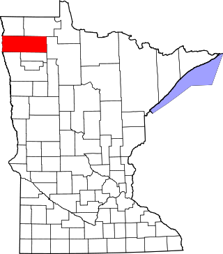
Marshall County is a county in the northwestern part of the U.S. state of Minnesota. As of the 2020 census, the population was 9,040. Its county seat is Warren.

Lac qui Parle County is a county in the southwestern part of the U.S. state of Minnesota. As of the 2020 census, the population was 6,719. Its county seat is Madison. The largest city in the county is Dawson.

Carlton County is a county in the State of Minnesota, formed in 1857. As of the 2020 census, the population was 36,207. Its county seat is Carlton. Part of the Fond du Lac Indian Reservation lies in northeastern Carlton County.

See Cleveland (disambiguation)

Tomahawk is a city in Lincoln County, Wisconsin, United States. The population was 3,441 at the 2020 census. The city is located to the northeast of the Town of Tomahawk and is not contiguous with it.

The Town of Grafton is a town located in Ozaukee County, Wisconsin, United States, and is in the Milwaukee metropolitan area. The town was created in 1846 and at the time of the 2020 Census had a population of 4,157.

The Feather River is the principal tributary of the Sacramento River, in the Sacramento Valley of Northern California. The river's main stem is about 73 miles (117 km) long. Its length to its most distant headwater tributary is just over 210 miles (340 km). The main stem Feather River begins in Lake Oroville, where its four long tributary forks join—the South Fork, Middle Fork, North Fork, and West Branch Feather Rivers. These and other tributaries drain part of the northern Sierra Nevada, and the extreme southern Cascades, as well as a small portion of the Sacramento Valley. The total drainage basin is about 6,200 square miles (16,000 km2), with approximately 3,604 square miles (9,330 km2) above Lake Oroville.

The Jump River is a small rocky river in north-central Wisconsin. In the late 19th century it was used to drive logs down to the Chippewa River. Today it is recreational, rambling through woods and farmlands, used mostly by fishermen and paddlers.

The Door Peninsula is a peninsula in eastern Wisconsin, separating the southern part of the Green Bay from Lake Michigan. The peninsula includes northern Kewaunee County, northeastern Brown County, and the mainland portion of Door County. It is on the western side of the Niagara Escarpment. Well known for its cherry and apple orchards, the Door Peninsula is a popular tourism destination. With the 1881 completion of the Sturgeon Bay Ship Canal, the northern half of the peninsula became an island.

The Black River is a river in west-central Wisconsin and a tributary of the Mississippi River. The river is approximately 190 miles (310 km) long. During the 19th century, pine logs were rafted down the Black, heading for sawmills at La Crosse and points beyond.

The Deep Fork River is an Oklahoma tributary of the North Canadian River. The headwaters flow from northern Oklahoma City and the river empties into the North Canadian River, now impounded by Lake Eufaula.
The Dauphin River is a river of Manitoba, Canada. The Dauphin is part of the connection from Lake Manitoba to Lake Winnipeg. The Fairford River flows from Portage Bay in Lake Manitoba through to Lake St. Martin then the Dauphin River continues north-eastward from Lake St. Martin into Lake Winnipeg. The two streams parallel Manitoba Provincial Road 513 much of the way. The Fairford River passes through the Rural Municipality of Grahamdale in its flow eastward.

The Tomahawk River is a river in Wisconsin.

The American River is a 30-mile-long (50 km) river in California that runs from the Sierra Nevada mountain range to its confluence with the Sacramento River in downtown Sacramento. Via the Sacramento River, it is part of the San Francisco Bay watershed. This river is fed by the melting snowpack of the Sierra Nevada and its many headwaters and tributaries, including its North, Middle, and South Forks.

Baldwins Creek is a tributary of the Stony Brook in Mercer County, New Jersey in the United States.
The Trade River is a 50.8-mile-long (81.8 km) tributary of the St. Croix River in northwestern Wisconsin in the United States. In its history, it has been known by the names "Atanwa" or "Ottoway" River, both of which are Anglicized versions of an Ojibwe language word meaning "trade". Beneath the mouth of the Trade River, the St. Croix River was once known as the Grave-marker River.


