Related Research Articles

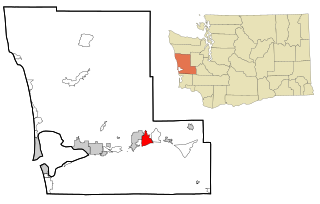
Brady is a census-designated place (CDP) in Grays Harbor County, Washington, United States. The population was 692 at the 2020 census.

Junction City is a census-designated place (CDP) in Grays Harbor County, Washington, United States. The population was 18 at the 2010 census.

Neilton is an unincorporated community and census-designated place (CDP) in Grays Harbor County, Washington, United States. The population was 299 at the 2020 census, down from 315 at the 2010 census.

The Wishkah River is a tributary of the Chehalis River in the U.S. state of Washington. Approximately 40 miles (64 km) long, the river drains a remote rural area of approximately 102 square miles (260 km2) in Grays Harbor County along the Washington coast north of Aberdeen. It flows south through the county and empties into the Chehalis at Aberdeen.

Marys River is a 40-mile (64 km) tributary of the Willamette River in the U.S. state of Oregon. From its source at the confluence of its east and west forks near Summit, it flows generally southeast from the Central Oregon Coast Range to Corvallis.

The Capitol State Forest is a 110,000-acre (450 km2) state forest in Thurston and Grays Harbor counties of the U.S. state of Washington. It includes part of the unusual Mima Mounds geologic feature.
The North River is a river, approximately 30 miles (48 km) long, in western Washington, in the United States. It empties into Willapa Bay, the first large estuary on the Washington coast north of the Columbia River.

Famoso is an unincorporated community in Kern County, California. It is located on Poso Creek 5.5 miles (8.9 km) south-southeast of McFarland, at an elevation of 427 feet (130 m). Famoso is located at the junction of State Route 99 and the eastern terminus of State Route 46. The town is famous for its nut groves and especially the race track - Auto Club Famoso Raceway.

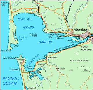
Grays Harbor is an estuarine bay located 45 miles (72 km) north of the mouth of the Columbia River, on the southwest Pacific coast of Washington state, in the United States. It is a ria, which formed at the end of the last ice age, when sea levels flooded the Chehalis River. The bay is 17 miles (27 km) long and 12 miles (19 km) wide. The Chehalis River flows into its eastern end, where the city of Aberdeen stands at that river's mouth, on its north bank, with the somewhat smaller city of Hoquiam immediately to its northwest, along the bayshore. Besides the Chehalis, many lesser rivers and streams flow into Grays Harbor, such as the Hoquiam River and Humptulips River. A pair of low peninsulas separate it from the Pacific Ocean, except for an opening about two miles (3 km) in width. The northern peninsula, which is largely covered by the community of Ocean Shores, ends in Point Brown. Facing that across the bay-mouth is Point Chehalis, at the end of the southern peninsula upon which stands the town of Westport.

The Sol Duc River is a river in the U.S. state of Washington. About 78 miles (126 km) long, it flows west through the northwest part of the Olympic Peninsula, from the Olympic Mountains of Olympic National Park and Olympic National Forest, then through the broad Sol Duc Valley. Near the Pacific Ocean the Sol Duc River joins the Bogachiel River, forming the Quillayute River, which flows about 4 miles (6.4 km) to the Pacific Ocean at La Push. Although the Quillayute River is short, its large tributary rivers—the Sol Duc, Bogachiel, Calawah, and Dickey Rivers—drain the largest watershed of the northern Olympic Peninsula, 629 square miles (1,630 km2). The Sol Duc's watershed is the largest of the Quillayute's tributaries, at 219 square miles (570 km2).

Dairy Creek is a 10.55-mile (16.98 km) tributary of the Tualatin River in the U.S. state of Oregon. It begins at the confluence of its east and west forks near the unincorporated community of Schefflin and meanders southeast across the Tualatin Valley to the Tualatin River near Hillsboro, in Washington County. East Fork Dairy Creek begins at 45.788446°N 123.041498°W in Columbia County, slightly north of its border with Washington County, and flows generally south for 22 miles (35 km). West Fork Dairy Creek, also about 22 miles (35 km) long, forms at 45.7553899°N 123.178168°W, near the unincorporated community of Tophill, and flows generally southeast. Before railroads displaced river boats on the Tualatin, some steamships also worked the lower section of Dairy Creek, with plans to go as far up stream as Centerville.

The Satsop River is a stream in the U.S. state of Washington. It has three main tributary forks, the East Fork, West Fork, and Middle Fork Satsop Rivers. The main stem Satsop River is formed by the confluence of the West and East Forks. The Middle Fork is a tributary of the East Fork. The three forks are much longer than the main stem Satsop itself, which flows south from the confluence only a few miles to join the Chehalis River near Satsop, Washington. Other significant tributaries include the Canyon River and Little River, both tributaries of the West Fork Satsop, and Decker Creek, a tributary of the East Fork Satsop River. The Satsop River's major tributaries originate in the Olympic Mountains and its southern foothills, the Satsop Hills, within Grays Harbor and Mason counties. Most of the Satsop River's watershed consists of heavily wooded hill lands. The upper tributaries extend into Olympic National Forest, approaching but not quite reaching Olympic National Park.

The Satsop Hills are foothills of the Olympic Mountains in Mason County, Washington north of Matlock, Washington, between Wynoochee Lake to the west and Lake Cushman to the east.

Aloha is an unincorporated community in Grays Harbor County, in the U.S. state of Washington. It is located two miles east of the Pacific Ocean at Beaver Creek in west central Grays Harbor County.
Artic is an unincorporated community in Grays Harbor County, in the U.S. state of Washington.
Bruceport is an extinct settlement in Pacific County, in the U.S. state of Washington.

Harlows Creek is a stream in Wahkiakum County in the U.S. state of Washington. The name of the stream used to be Jim Crow Creek until it was changed by the U.S. Board of Geographic Names effective May 10, 2017 as part of an nationwide effort to remove offensive and/or derogatory names from geographic features. The new name commemorates John (1872-1953) and Mary (1888-1963) Harlow, who lived in the area during the 1870s.
Vesta is an unincorporated community in Grays Harbor County, in the U.S. state of Washington.
Wood is an unincorporated community in DeKalb County, in the U.S. state of Missouri.
Fifteenmile Creek is a tributary stream of East Deep Creek, in Juab County, Utah and Tooele County, Utah.
References
- ↑ U.S. Geological Survey Geographic Names Information System: Newskah Creek
- ↑ Meany, Edmond S. (1923). Origin of Washington geographic names. Seattle: University of Washington Press. p. 186.
46°57′06″N123°51′02″W / 46.95167°N 123.85056°W