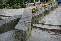
Newtown, Cardiff

Last updated

Newtown
Newtown Memorial Cardiff.jpg
Newtown Memorial Garden, Tyndall Street
Cardiff UK location map.svg
Red pog.svg
Newtown
Newtown location within Cardiff
Coordinates: 51°28′38″N3°10′08″W / 51.4772°N 3.1690°W / 51.4772; -3.1690 Coordinates: 51°28′38″N3°10′08″W / 51.4772°N 3.1690°W / 51.4772; -3.1690
CountryWales
CityCardiff
Established1840s

Newtown was a residential area of Cardiff, Wales that was also known as 'Little Ireland' because of its population of Irish families. Its six streets and 200 houses existed from the mid-nineteenth century until they were demolished in 1970. It was known as one of the "5 towns of Cardiff", the others being Butetown, Crockherbtown, Grangetown and Temperance Town.

Contents

History

The areas later known as Newtown and Adamsdown were the first significant areas of housing that developed outside of Cardiff's old town boundaries in the early nineteenth century, clearly evident by the 1830s. [1] In the years following the Great Famine of Ireland of 1845 hundreds of Irish families began to arrive in Cardiff, often travelling as 'ballast' in ships from Cork and Waterford. [2] They were generally housed in Newtown, which had been purposely expanded by the Marquess of Bute to house construction workers for Cardiff's new docks. [3] In 1850 the South Wales Railway (from Swansea to Chepstow) had been opened, [4] separating Adamsdown from Newtown. Newtown came to consist of six streets – Ellen Street, North Williams Street, Pendoylan Street and Pendoylan Place, Roland Street, Rosemary Street – immediately south of the railway and north of Tyndall Street. A footbridge gave access over the railway. [5]

Newtown became known as 'Little Ireland'. [2]

Cardiff's first race riot occurred in Newtown in 1848. A Welshman, Thomas Lewis, had been stabbed to death by an Irishman, John Connors. Welsh mobs took the law into their own hands and headed to Newtown to find the culprit. At Lewis's funeral Irishmen with pick axes had to stand guard to ward off any further trouble. [6]

By the 1930s, Newtown had already deteriorated to slum conditions. [7]

Eventually, in 1966 the houses were compulsorily purchased in anticipation of the redevelopment of the old dock areas. In 1970 the houses were demolished. [3]

The site became a trading estate. In 2010 this in turn had been demolished. It was anticipated the area would be redeveloped for mixed-use, with new housing and offices. [7]

One of the last original remnants of Newtown, The Vulcan public house on Adam Street (originally Whitmore Lane, Newtown), [8] was demolished in 2012 with plans to rebuild it at St Fagans National History Museum. [9]

Notable people

Memorial garden

In 1999 Cardiff Bay Development Corporation gave £10,000 toward the cost of a memorial to commemorate the Newtown community. The Newtown Memorial Garden was created, opened on 20 March 2005. It contains a large stone 'knotwork' sculpture by local artist David Mackie. [10]

Related Research Articles

<span class="mw-page-title-main">Cardiff</span> Capital of Wales

Cardiff is the capital and largest city of Wales. Cardiff had a population of 362,310 in 2021, forms a principal area officially known as the City and County of Cardiff, and the city is the eleventh-largest in the United Kingdom. Located in the south-east of Wales and in the Cardiff Capital Region, Cardiff is the county town of the historic county of Glamorgan and in 1974–1996 of South Glamorgan. It belongs to the Eurocities network of the largest European cities. A small town until the early 19th century, its prominence as a port for coal when mining began in the region helped its expansion. In 1905, it was ranked as a city and in 1955 proclaimed capital of Wales. Cardiff Built-up Area covers a larger area outside the county boundary, including the towns of Dinas Powys and Penarth.

<span class="mw-page-title-main">Tonypandy</span> Human settlement in Wales

Tonypandy is a town, community and electoral ward located in the county borough of Rhondda Cynon Taf, within the historic county boundaries of Glamorgan, Wales, lying in the Rhondda Fawr Valley. A former industrial coal mining town, the town was the scene of the 1910 Tonypandy riots.

<span class="mw-page-title-main">Roath</span> District and community in Cardiff, Wales

Roath is a district and community to the north-east of the city centre of Cardiff, capital of Wales. The area is mostly covered by the Plasnewydd electoral ward, and stretches from Adamsdown in the south to Roath Park in the north.

<span class="mw-page-title-main">Splott</span> Area of Cardiff, Wales

Splott is a district and community in the south of the city of Cardiff, capital of Wales, just east of the city centre. It was built up in the late 19th century on the land of two farms of the same name: Upper Splott and Lower Splott Farms. Splott is characterised by its once vast steelworks and rows of tightly knit terraced houses. The suburb of Splott falls into the Splott electoral ward.

<span class="mw-page-title-main">Cathays</span> District and community in Cardiff, Wales

Cathays is a district and community in the centre of Cardiff, capital of Wales. It is an old suburb of Cardiff established in 1875. It is densely populated and contains many Victorian terraced houses. The area falls into the Cathays ward. It is the third most populous community in Cardiff, having a population of 18,002 in 2011.

<span class="mw-page-title-main">Butetown</span> District and community in Cardiff, Wales

Butetown is a district and community in the south of the city of Cardiff, the capital of Wales. It was originally a model housing estate built in the early 19th century by the 2nd Marquess of Bute, for whose title the area was named. Commonly known as "Tiger Bay", this area became one of the UK's first multicultural communities with people from over 50 countries settled here by the outbreak of the First World War, working in the docks and allied industries. Some of the largest communities included the Somalis, Yemenis and Greeks, whose influence still lives on today. A Greek Orthodox church still stands at the top of Bute Street. It is known as one of the "five towns of Cardiff", the others being Crockherbtown, Grangetown, Newtown and Temperance Town. The population of the ward and community taken at the 2011 census was 10,125. It is estimated that the Butetown's population increased to 14,094 by 2019.

<span class="mw-page-title-main">Adamsdown</span> Area and community in Cardiff, Wales

Adamsdown is an inner city area and community in the south of Cardiff, the capital city of Wales. Adamsdown is generally located between Newport Road, to the north and the mainline railway to the south. The area includes Cardiff Prison, Cardiff Magistrates' Court, Cardiff Royal Infirmary, a University of South Wales campus, and many streets of residential housing.

<span class="mw-page-title-main">Atlantic Wharf</span> Area of south Cardiff, Wales

Atlantic Wharf is a southern area of the city of Cardiff, Wales. It is primarily an area of new houses and apartments located on the west side of the disused Bute East Dock and to the east of Lloyd George Avenue. It also includes a number of refurbished dock warehouses, modern hotels, the Red Dragon Centre and Cardiff Council's County Hall. Atlantic Wharf lies in the Butetown electoral division of Cardiff and the Cardiff South and Penarth constituency for the UK Parliament and the Senedd.

<span class="mw-page-title-main">St Fagans National Museum of History</span> Open-air museum in St Fagans, Cardiff, Wales

St Fagans National Museum of History, commonly referred to as St Fagans after the village where it is located, is an open-air museum in Cardiff chronicling the historical lifestyle, culture, and architecture of the Welsh people. The museum is part of the wider network of Amgueddfa Cymru – Museum Wales.

<span class="mw-page-title-main">Grangetown, Cardiff</span> District and community in Cardiff, Wales

Grangetown is a district and community in the south of Cardiff, capital of Wales. It is one of the largest districts in the south of the city and is bordered by Riverside, Canton and Butetown. The River Taff winds its way through the area. Adjacent to the city's Cardiff Bay area, Grangetown is experiencing a period of gentrification and improvements in its infrastructure. Its population as of 2011 was 19,385 in 8,261 households. One of the "five towns of Cardiff", the others are Butetown, Crockherbtown, Newtown and Temperance Town.

<span class="mw-page-title-main">Trealaw</span> Human settlement in Wales

Trealaw is a long village, also a community and electoral ward in the Rhondda Valley, Rhondda Cynon Taf, Wales. It stretches over two miles from the junction of Cemetery Road and Brithweunydd Road in the east, to the junction of Ynyscynon Road and Partridge Road to the northwest.

<span class="mw-page-title-main">River Ely</span> River in South Wales flowing from Tonyrefail to Cardiff

The River Ely is in South Wales flowing generally southeast, from Tonyrefail to Cardiff.

Politics of Cardiff refers to the political representation of the city of Cardiff, capital of Wales. Cardiff is represented politically at a local, Wales and United Kingdom level and previously at the European level.

<span class="mw-page-title-main">Architecture of Cardiff</span> Overview of the architecture in the capital city of Wales

Architecture in Cardiff, the capital city of Wales, dates from Norman times to the present day. Its urban fabric is largely Victorian and later, reflecting Cardiff's rise to prosperity as a major coal port in the 19th century. No single building style is associated with Cardiff, but the city centre retains several 19th and early 20th century shopping arcades.

Rail transport in Cardiff has developed to provide connections to many other major cities in the United Kingdom, and to provide an urban rail network for the city and its commuter towns in southeast Wales. Today, there are three train operating companies in Cardiff: Great Western Railway, CrossCountry and Transport for Wales.

<span class="mw-page-title-main">The Vulcan, Cardiff</span> Public house in Cardiff, Wales

The Vulcan Hotel is a historic hotel and public house, that was located in Adamsdown suburb of Cardiff, South Wales. Scheduled for demolition in 2009, after a long public campaign to preserve what had become one of Cardiff's oldest working public houses, in 2012 it was donated to the National History Museum at St Fagans, where it is being reconstructed.

<span class="mw-page-title-main">Cardiff Rural District</span>

Cardiff Rural District was a second tier local government district of Glamorgan, Wales until 1974. It covered the more rural areas to the west and north of the city of Cardiff.

References

  1. William Rees, Cardiff: A History of the City, The Corporation of the City of Cardiff, 2nd edition (1969), pp. 298–299 (also maps and commentary facing p. 277)
  2. 1 2 David Morgan, The Cardiff Story: A History of the City from the Earliest Times to the Present, Hackman Ltd, Tonypandy (1991), p.164
  3. 1 2 History, Newtown Association webpages. Retrieved 17 January 2012.
  4. William Rees, Cardiff: A History of the City, The Corporation of the City of Cardiff, 2nd edition (1969), pp. 268–269
  5. Streets, Newtown Association webpages. Retrieved 17 January 2012.
  6. David Morgan, The Cardiff Story: A History of the City from the Earliest Times to the Present, Hackman Ltd, Tonypandy (1991), p.179
  7. 1 2 Stephen Fisk, Cardiff's Lost Communities, WalesOnline, 1 April 2010. Retrieved 19 January 2012.
  8. James Preston, "Cardiff's oldest pub looks set to close" Archived 23 October 2013 at the Wayback Machine , The Cardiffian, 20 March 2012. Retrieved 22 October 2013.
  9. "Plans to rebuild Cardiff's Vulcan pub at St Fagans submitted", BBC News, 28 July 2013. Retrieved 22 October 2013.
  10. Memorial Garden, Newtown Association webpages. Retrieved 17 January 2012.