Related Research Articles
Glamis is a small village in Angus, Scotland, located 4 miles (6.4 km) south of Kirriemuir and 5 miles (8.0 km) southwest of Forfar. It is the location of Glamis Castle, the childhood home of Queen Elizabeth the Queen Mother.
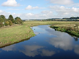
Strathmore is a strath in east central Scotland running from northeast to southwest between the Grampian mountains and the Sidlaws. It is approximately 50 miles (80 km) long and 10 miles (16 km) wide. Strathmore is underlain by Old Red Sandstone but this is largely obscured by glacial till, sands and gravels deposited during the ice age. Its northeast to southwest alignment is influenced by the underlying geological structure of the area which reflects the dominant Caledonian trend of both the central lowlands and the Highlands of Scotland; its northern margin reflects the presence of the Highland Boundary Fault. Strathmore is fertile and has some of Scotland's best arable farmland, producing soft fruits and cereals.
Newbigging is a village in Angus, Scotland, two miles northeast of Dundee. The name "Newbigging" originally referred to a "new bigging" or "new cottar town" (hamlet). The village is roughly two miles north of Monifieth.

The Stone of Morphie is a standing stone about 700 metres west of the Coast Highway bridge of the River North Esk and 400 metres east of the historic Mill of Morphie in Aberdeenshire, Scotland. The stone is approximately 3.5 metres high and is unshaped and uninscripted; the base of this stone measures approximately 70 by 100 centimetres.

Kempstone Hill is a landform in Aberdeenshire, Scotland within the Mounth Range of the Grampian Mountains. The peak elevation of this mountain is 132 metres above mean sea level. This hill has been posited by Gabriel Jacques Surenne, Archibald Watt and C.Michael Hogan as the location for the noted Battle of Mons Graupius between the Romans and the indigenous Caledonians. The major Roman Camp of Raedykes is situated about three kilometres to the west. From Kempstone Hill there are fine views to the North Sea facing east and slightly to the north of Muchalls Castle. There is a UK trigpoint installation on Kempstone Hill.
Megray Hill is a low-lying coastal mountainous landform in Aberdeenshire, Scotland within the Mounth Range of the Grampian Mountains. The peak elevation of this mountain is 120 metres above mean sea level. This hill has been posited as a likely location for the noted Battle of Mons Graupius between the Romans and the indigenous Caledonians. The major Roman Camp of Raedykes is situated about three kilometres to the west. From Megray Hill there are expansive views to the North Sea facing east. The summit affords scenic views of the historic harbour of Stonehaven.

Bowdun Head is a headland landform on the North Sea coast approximately one kilometre south of Stonehaven, Scotland.(Ordnance Survey, 2004) Slightly to the north is another headland, Downie Point. Somewhat to the south along the coast is Dunnottar Castle on the far side of the bay of Castle Haven. Other historic structures in the general vicinity include the Stonehaven Tolbooth, Fetteresso Castle, the Chapel of St. Mary and St. Nathalan and Muchalls Castle. There is considerable prehistory associated with the local area including a Pictish hill fort on the sea stack of Dunnicaer immediately to the north, and Bronze Age archaeological sites at Fetteresso and Spurryhillock, both somewhat inland of Bowdun Head.

The Eassie Stone is a Class II Pictish stone of about the mid 8th century AD in the village of Eassie, Angus, Scotland. The stone was found in Eassie burn in the late 18th century and now resides in a purpose-built perspex building in the ruined Eassie church.

Eassie is a village located along the A94 road in Angus, Scotland. The church in Eassie is dedicated to Saint Fergus, a monk who worked at nearby Glamis. Eassie is noted for the presence of the Eassie Stone, a carved Pictish stone.

Castle Bloody is a prehistoric feature on the island of Shapinsay, Orkney, Scotland. Hogan observes that while the feature is marked as a chambered mound on the UK Ordnance Survey map, the structure is more properly and specifically classified as a souterrain or earth house. Slightly to the north is located the ruined historic Linton Chapel.
Milton Ness is a coastal landform along the coast of the North Sea approximately two miles south of the village of Johnshaven, Scotland. This headland feature includes a red sandstone cliff formation. Certain prehistoric features are found in the vicinity of Milton Ness, including the Stone of Morphie located somewhat to the west.
Castleton, officially Castleton Of Eassie, is a village in Angus, Scotland. This settlement is situated along the A94 road between Glamis and Meigle. One mile to the south is the village of Eassie noted for the presence of the Eassie Stone; this carved Pictish stone is dated prior to the Early Middle Ages. Slightly further to the south lies Ark Hill within the Sidlaw Hills.

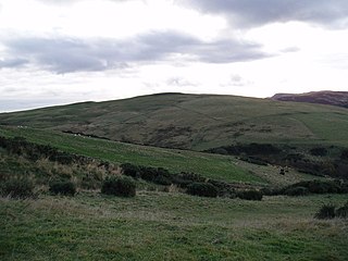
Ark Hill is a mountainous landform within the Sidlaw Hills in Angus, Scotland. This location has been proposed as a windfarm for generating renewable electrical power. Approximately two kilometres to the north is the village of Eassie noted for the presence of the Eassie Stone; this carved Pictish stone is dated prior to the Early Middle Ages.

Wester Denoon is a small settlement in Angus, Scotland. Approximately one mile to the north of Wester Denoon is the village of Eassie, where the Eassie Stone is displayed in a ruined church; this carved Pictish stone is dated prior to the Early Middle Ages. Other nearby settlements are Charleston, Balkeerie and Kirkinch. Two fragments of small Pictish cross-slabs have also been found at Wester Denoon itself. One shows the stylised figure of a woman wearing a long dress or mantle fastened on the breast by a large brooch.
Balkeerie is a village in Angus, Scotland north of Dundee. It has an elevation of 222 feet (68 m) above sea level. It is one mile (1.6 km) to the north east of kirkinch and two-thirds of a mile (1.1 km) to the west of the village of Eassie. Eassie is noted for the presence of the Eassie Stone, a carved Pictish stone.

Kirkinch, meaning 'kirk (church) on the island' in Scots and Gaelic, is a small village in Angus, Scotland. The 'island' is the knoll on which remains of the medieval church of the parish of Nevay, now united with Eassie, stand. Originally it was an 'island' of slightly higher land surrounded by boggy country. The village houses are adjacent to the knoll, which is encompassed by the wall of the old churchyard. Some of the earliest history of the local area is represented approximately two kilometres northwest at the village of Eassie, where the Eassie Stone is displayed in a modern transparent shelter in the ruined former parish church; this finely carved Pictish cross-slab probably dates to the first half of the 8th century. The church site at Kirkinch is itself probably of early Christian origin. A simple disc-headed cross-slab found here is on display at the Meffan Institute in Forfar.
Milton is a hamlet in Angus, Scotland situated near Glamis. Considerable early history is in the general area including Glamis Castle and the Eassie Stone, a carved Pictish stone dating prior to the Early Middle Ages.
Hatton Hill is a mountain landform in Angus, Scotland in the Sidlaw Hills. Hatton Castle stands on the flanks of Hatton Hill above the village of Newtyle. The general vicinity has elements of prehistory including presence of the Eassie Stone, a Pictish stone dating back to the Dark Ages.

The Hunter's Hill Stone, otherwise known as the Glamis 1 Stone, is a Class II Pictish standing stone at Hunter's Hill to the south east of Glamis village, Angus, Scotland.

Collace is a parish in Perthshire, Scotland, 8 miles northeast of Perth, in the Carse of Gowrie district. The parish boundary includes the neighbouring villages of Kinrossie and Saucher.
References
- United Kingdom Ordnance Survey Mapy, Sheet 53, Blairgowrie
- C.Michael Hogan, Eassie Stone, The Megalithic Portal, ed. A. Burnham, 7 October 2007
Coordinates: 56°32′47″N3°08′41″W / 56.5463°N 3.1447°W
| | This Angus location article is a stub. You can help Wikipedia by expanding it. |