
Malanje is a province of Angola. It has an area of 97,602 km2 and a 2014 census population of 986,363. Malanje is the provincial capital.

The Cabo Blanco Absolute Natural Reserve is a Nature Reserve of Costa Rica, part of the Tempisque Conservation Area in the province of Puntarenas, covering an area of 3,140 acres (12.7 km2) terrestrial and 4,420 acres (17.9 km2) marine on the southern tip of the Nicoya Peninsula near Montezuma-Cabuya and Mal Pais.
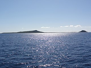
Caja de Muertos is an uninhabited island off the southern coast of Puerto Rico, in the municipality of Ponce. The island and its surrounding waters are protected by the Caja de Muertos Nature Reserve, because of its native turtle traffic and ecological value of its dry forests and reefs. Hikers and beachgoers are often seen in the island, which can be reached by ferry from the La Guancha Boardwalk sector of Ponce Playa. Together with Cardona, Ratones, Morrillito, Isla del Frio, Gatas, and Isla de Jueyes, Caja de Muertos is one of seven islands ascribed to the municipality of Ponce.

Protected areas of Brazil included various classes of area according to the National System of Nature Conservation Units (SNUC), a formal, unified system for federal, state and municipal parks created in 2000.
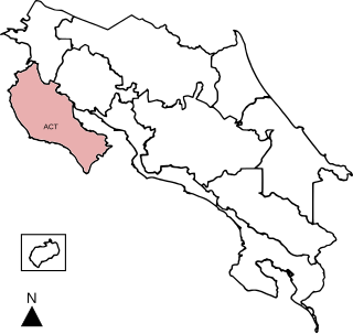
Tempisque Conservation Area is an administrative area which is managed by SINAC for the purposes of conservation in the western part of Costa Rica, including the Tempisque River valley and the Nicoya Peninsula. It contains a number of National Parks, Wildlife refuges and Forest Reserves.

Águas Mornas is a Brazilian municipality in the state of Santa Catarina.
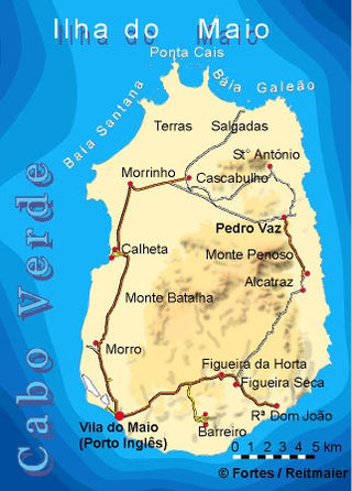
Terras Salgadas is a vast natural area covering the northwestern part of the island of Maio, Cape Verde. It is part of the protected area Parque Natural do Norte da Ilha do Maio. It is the largest saline ecosystem of the whole archipelago, characterized by imposing sand dunes. The area is rich in endemic species of sea birds, fish and sea turtles. The nearest settlements are Morrinho, Cascabulho and Santo António. As "saline" (French) and "zoutpan" (Dutch) it was mentioned in the 1747 map by Jacques-Nicolas Bellin.

Rio Trombetas Biological Reserve is a federally-administered biological reserve in the municipality of Oriximiná, Pará, Brazil. It covers a large area of Amazon biome including rainforest, wetlands and water.
Serra Negra Biological Reserve is a Biological reserve in the state of Pernambuco, Brazil.
The Protected areas of Portugal are classified under a legal protection statute that allows for the adequate protection and maintenance of biodiversity, while providing services for ecosystem that maintains the natural and geological patrimony.

Guaraqueçaba is the easternmost municipality in the Brazilian state of Paraná, and one of the few coastal municipalities of the state. The short Ararapira River marks the border with São Paulo.

Morrillito is a small uninhabited island off the southern coast of Puerto Rico. The island is protected by the Reserva Natural Caja de Muertos natural reserve because of its native turtle traffic. Together with Caja de Muertos, Gatas, Ratones, Cardona, Isla del Frio, and Isla de Jueyes, Morrillito is one of seven islands ascribed to the municipality of Ponce.
Puinawai Natural Reserve is the second-largest national park in Colombia. This protected area occupies 10,925 square kilometres (4,218 sq mi) of the Amazon Region of Colombia, roughly 15% of the Guainía Department. The Reserve was created in September 1989 and coincides with three important indigenous territories that were also formed at the same time. Several rivers cross the Natural Reserve belonging to the Amazon River basin: The Cuyari, Isana and Guainía River. And belonging to the Orinoco River basin, the Inírida River. The Natural Reserve lies between altitude of 200 to 380 metres above sea level and its climate is hot and humid with little seasonal variations throughout the year.
A sustainable development reserve in Brazil is a type of protected area inhabited by a traditional population that seeks to preserve nature while maintaining and improving the life of the population through sustainable development.
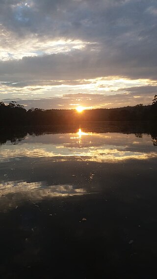
The Maicuru Biological Reserve, is a strictly protected biological reserve in the state of Pará, Brazil. It covers 11,518 square kilometres (4,447 sq mi) of Amazon rainforest.
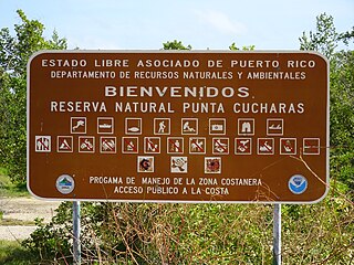
Reserva Natural Punta Cucharas is a nature reserve in Barrio Canas, Ponce, Puerto Rico. It consists of both a land area component as well as an offshore marine area. The land component has an area of 698 cuerdas while the marine component has an expanse of 3,516 cuerdas, for a total area of 4,214 cuerdas. The Reserve consists of mangrove ecosystems, coastal sand dunes, a saline lagoon known as Laguna Las Salinas, open water, and a century-old local community. The lagoon occupies and area of 347,898 m2 Ecological protection is managed and enforced by the Puerto Rico Department of Natural and Environmental Resources. Eight activities are allowed at the Reserve: scuba diving, boating, fishing, hiking, sun bathing, photography, bird watching and canoeing. Activities prohibited are: Camping, crabbing/trapping, horseback riding, water crafting, and hunting. Pets, ATVs, and fireplaces are also prohibited.

The Thomas van der Hammen Natural Reserve or Thomas van der Hammen Forest Reserve is an area of the Bogotá savanna that is under environmental protection. The natural reserve was declared as such in year 2000 by the Ministry of Environment and Sustainable development. It takes its name from the Dutch-Colombian geologist Thomas van der Hammen who devoted his life to the research of the region. The surface area of the protected reserve is approximately 1,395 hectares and it is located in the north of Bogotá.
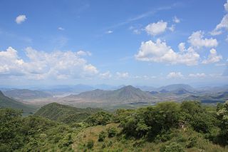
Zicuirán-Infiernillo Biosphere Reserve is a biosphere reserve in western Mexico. It covers 2,651.18 km2 (1,023.63 sq mi) of the Sierra Madre del Sur range in the state of Michoacán, west of the Balsas River.

Humacao Nature Reserve, or the Punta Santiago Nature Reserve, is a nature reserve located in the southeastern coast of Puerto Rico, between the municipalities of Humacao and Naguabo (Río). The 3,000-acre nature reserve was established in 1986 to protect and preserve the remaining Pterocarpus forest ecosystem in the area, along with its surrounding wetlands and mangrove forests.
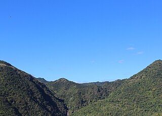
The Planadas-Yeyesa Nature Reserve is a protected nature reserve located in the Sierra de Cayey, in the municipality of Salinas in central Puerto Rico. The reserve is located close to the famous Cerro Las Tetas. Two of the most prominent features of the reserve are Cerro Planada, a 2,480 feet high mountain peak, and La Yeyesa, a heavily forested canyon formed by the Lapa River and other streams which feed into the Nigua River. La Yeyesa can be accessed through a lightly trafficked yet moderate trail.


