Nicoya Airport

Last updated
Nicoya Airport
Summary
Airport type Public
Operator Dirección General de Aviación Civil
Serves Nicoya
Elevation  AMSL 120 m / 394 ft
Coordinates 10°08′22″N085°26′44″W / 10.13944°N 85.44556°W / 10.13944; -85.44556 Coordinates: 10°08′22″N085°26′44″W / 10.13944°N 85.44556°W / 10.13944; -85.44556
Map
Costa Rica location map.svg
Airplane silhouette.svg
MRNC
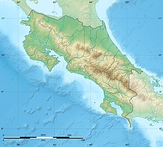
Location in Costa Rica
Runways
Direction Length Surface
m ft
10/28 963 3,159 asphalt
Statistics (2014)
Passengers 96
Passenger change 13–14Decrease2.svg2.0%

Nicoya Airport( IATA : NCT, ICAO : MRNC) is an airport in Costa Rica, serving the city of Nicoya in Guanacaste Province. The airport is owned and managed by the country's Directorate General of Civil Aviation and it has a 963 meters long airstrip plus very basic infrastructure to receive small airplanes and passengers.

An IATA airport code, also known as an IATA location identifier, IATA station code or simply a location identifier, is a three-letter code designating many airports around the world, defined by the International Air Transport Association (IATA). The characters prominently displayed on baggage tags attached at airport check-in desks are an example of a way these codes are used.

ICAO airport code four-letter code designating many airports around the world

The ICAOairport code or location indicator is a four-letter code designating aerodromes around the world. These codes, as defined by the International Civil Aviation Organization and published in ICAO Document 7910: Location Indicators, are used by air traffic control and airline operations such as flight planning.

Airport location where aircraft take off and land

An airport is an aerodrome with extended facilities, mostly for commercial air transport. Airports often have facilities to store and maintain aircraft, and a control tower. An airport consists of a landing area, which comprises an aerially accessible open space including at least one operationally active surface such as a runway for a plane to take off or a helipad, and often includes adjacent utility buildings such as control towers, hangars and terminals. Larger airports may have airport aprons, taxiway bridges, air traffic control centres, passenger facilities such as restaurants and lounges, and emergency services. In some countries, the US in particular, they also typically have one or more fixed-base operators, serving general aviation.

Although Nicoya Airport serves the main city in Nicoya Peninsula, there are no scheduled domestic nor international services to the airport.

Nicoya Peninsula peninsula

The Nicoya Peninsula is a peninsula on the Pacific coast of Costa Rica. It is divided into two provinces: Guanacaste Province in the north, and the Puntarenas Province in the south. It is located at 10°N 85.4166667°W. It varies from 19 to 37 miles (60 km) wide and is approximately 75 miles (121 km) long, forming the largest peninsula in the country. It is known for its beaches and is a popular tourist destination.

Passenger Statistics

These data show number of passengers movements into the airport, according to the Directorate General of Civil Aviation of Costa Rica's Statistical Yearbooks.

Year 2008 2009 2010 2011 2012 2013 2014 2015
Passengers 129 112 110 106 131 98 96 T.B.A.
Growth (%) Decrease2.svg 56.86% Decrease2.svg 13.18% Decrease2.svg 1.79% Decrease2.svg 3.64% Increase2.svg 23.58% Decrease2.svg 25.19% Decrease2.svg 2.04% T.B.A.
Source: Costa Rica's Directorate General of Civil Aviation (DGAC). Statistical Yearbooks
(Years 2008, [3] 2009, [4] 2010, [5] 2011, [6] 2012, [7] 2013, [8] and 2014 [2] )
Year 2000 2001 2002 2003 2004 2005 2006 2007
Passengers N.D. N.D. 30 172 190 144 348 299
Growth (%) N.D. N.D. N.D. Increase2.svg473.33% Increase2.svg 10.47% Decrease2.svg 24.21% Increase2.svg141.67% Decrease2.svg 14.08%
Source: Costa Rica's Directorate General of Civil Aviation (DGAC). Statistical Yearbooks
(Years 2000-2005, [9] 2006, [10] and 2007, [11] )

Related Research Articles

Daniel Oduber Quirós International Airport airport in Costa Rica

Daniel Oduber Quirós International Airport, also known as Liberia International Airport, is one of four international airports in Costa Rica. It serves especially as a tourism hub for those who visit the Pacific coast and western Costa Rica. The airport is named for Daniel Oduber Quirós, who served as president of Costa Rica from 1974 to 1978.

Tobías Bolaños International Airport airport in Costa Rica

Tobías Bolaños International Airport is one of four international airports in Costa Rica, and the secondary airport serving the city of San José, after Juan Santamaría International Airport. It is located in downtown San José, in Pavas District, San José Canton.

Quepos La Managua Airport airport in Costa Rica

La Managua Airport is an airport approximately 3 kilometres (2 mi) east of the Pacific coastal city of Quepos, Costa Rica, serving this city as well as the Manuel Antonio National Park and other tourist attractions in the central part of Puntarenas Province. The airport is named for the La Managua barrio where the it is located. The airport is owned and managed by the country's Directorate General of Civil Aviation (DGAC).

Tortuguero Airport airport in Costa Rica

Barra de Tortuguero Airport, is an airport serving Tortuguero village and Tortuguero National Park in Pococí Canton, Limón Province, Costa Rica.

Golfito Airport airport in Costa Rica

Golfito Airport is an airport serving Golfito, a port town on the northwest end of Golfito Bay, an inlet off the Gulf of Dulce in the Puntarenas Province of Costa Rica. The airport is owned and managed by the country's Directorate General of Civil Aviation (DGAC).

Palmar Sur Airport airport in Costa Rica

Palmar Sur Airport is an airport serving the adjacent towns of Palmar Norte and Palmar Sur in Osa Canton, Puntarenas Province, Costa Rica.

Puerto Jiménez Airport airport in Costa Rica

Puerto Jiménez Airport is an airport serving Puerto Jiménez, a Gulf of Dulce coastal town in Puntarenas Province, Costa Rica. The airport is just east of the town. It is owned and managed by the country's Directorate General of Civil Aviation (DGAC).

Punta Islita Airport Airport in Costa Rica

Islita Airport is an airport that serves the communities of Punta Islita in the Nandayure Canton of Costa Rica. The airport is at the village of Corozalito, 3 kilometres (1.9 mi) east of Punta Islita. It is the main access to a series of secluded beaches in southern Nicoya Peninsula.

Tambor Airport airport in Costa Rica

Tambor Airport is an airport serving Tambor, Costa Rica. The airport also serves tourist destinations like Mal Pais, Santa Teresa, Montezuma, and the Cabo Blanco Absolute Natural Reserve.

Carrillo Airport airport in Costa Rica

Carrillo Airport is an airport serving Puerto Carrillo, a Pacific coastal village in Guanacaste Province, Costa Rica. The airport and village are 5 kilometres (3 mi) east of Sámara village.

Nosara Airport airport in Costa Rica

Nosara Airport is an airport serving Nosara, a village in the Guanacaste Province of Costa Rica. The airport is approximately 15 minutes from the beaches of Nosara, the main tourist attraction in the area. The airport is owned and administrated by the country's Directorate General of Civil Aviation (DGAC).

Tamarindo Airport airport in Costa Rica

Tamarindo Airport is a private airport that serves Tamarindo, a coastal resort in Guanacaste province, Costa Rica. It receives daily scheduled flights from San José and Liberia, and private charter services are available. During the rainy season, the airport is frequently closed due to the weather.

Bahía Drake Airport airport in Costa Rica

Bahía Drake Airport is an airport serving Bahía Drake, a Pacific coastal district with a long tradition as a tourist destination in Osa Canton, Puntarenas Province, Costa Rica. The airport is also known as Drake Bay Airport.

San Isidro de El General Airport airport

San Isidro de El General Airport is an airport serving the city of San Isidro de El General and Pérez Zeledón county, Costa Rica. The airport is 3 kilometres (2 mi) south of downtown San Isidro.

La Fortuna Arenal Airport airport in Costa Rica

Arenal Airport is an airport serving La Fortuna, a district in San Carlos Canton, Alajuela Province, Costa Rica. The airport is named after the Arenal Volcano, one of the major tourist attractions in the country.

Sirena Aerodrome

Sirena Aerodrome is a grass airstrip located in the middle of Corcovado National Park, Osa Peninsula, Costa Rica.

Carate Airport airport in Costa Rica

Carate Airport is a concrete airstrip serving the coastal destination of Sirena, in Osa Peninsula, Costa Rica. The airport in mainly used by charter services with tourists visiting the beaches near Sirena town and the Corcovado National Park. The airport currently does not have scheduled services from any other airport.

Parismina Airport airport that serves Parismina in Costa Rica

Parismina Airport is an airport that serves Parismina, a coastal town in Siquirres Canton, Limón Province, Costa Rica. In some cases the airport is also referred as Barra de Parismina Airport.

Hacienda Jacó Airport airport in Costa Rica

Hacienda Jacó Airport is a grass airstrip in Playa Hermosa, Garabito Canton, Puntarenas Province, Costa Rica.

La Flor Airport airport in Costa Rica

La Flor Airport is an airport serving the La Flor hacienda in Guanacaste Province, Costa Rica. The runway is 6 kilometres (4 mi) north of Daniel Oduber Quirós International Airport.

References