Dąbrowa is a village in the administrative district of Gmina Damasławek, within Wągrowiec County, Greater Poland Voivodeship, in west-central Poland. It lies approximately 3 kilometres (2 mi) south-west of Damasławek, 21 km (13 mi) east of Wągrowiec, and 61 km (38 mi) north-east of the regional capital Poznań.
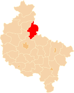
Damasławek is a village in Wągrowiec County, Greater Poland Voivodeship, in west-central Poland. It is the seat of the gmina called Gmina Damasławek. It lies approximately 22 kilometres (14 mi) east of Wągrowiec and 63 km (39 mi) north-east of the regional capital Poznań.
Gruntowice is a village in the administrative district of Gmina Damasławek, within Wągrowiec County, Greater Poland Voivodeship, in west-central Poland. It lies approximately 9 kilometres (6 mi) south-west of Damasławek, 15 km (9 mi) east of Wągrowiec, and 55 km (34 mi) north-east of the regional capital Poznań.
Kołybki is a village in the administrative district of Gmina Damasławek, within Wągrowiec County, Greater Poland Voivodeship, in west-central Poland. It lies approximately 10 kilometres (6 mi) west of Damasławek, 15 km (9 mi) north-east of Wągrowiec, and 61 km (38 mi) north-east of the regional capital Poznań.
Kopanina is a village in the administrative district of Gmina Damasławek, within Wągrowiec County, Greater Poland Voivodeship, in west-central Poland. It lies approximately 6 kilometres (4 mi) west of Damasławek, 17 km (11 mi) east of Wągrowiec, and 61 km (38 mi) north-east of the regional capital Poznań.
Kozielsko is a village in the administrative district of Gmina Damasławek, within Wągrowiec County, Greater Poland Voivodeship, in west-central Poland. It lies approximately 7 kilometres (4 mi) west of Damasławek, 15 km (9 mi) east of Wągrowiec, and 58 km (36 mi) north-east of the regional capital Poznań.
Miąża is a village in the administrative district of Gmina Damasławek, within Wągrowiec County, Greater Poland Voivodeship, in west-central Poland. It lies approximately 4 kilometres (2 mi) west of Damasławek, 18 km (11 mi) east of Wągrowiec, and 60 km (37 mi) north-east of the regional capital Poznań.
Mokronosy is a village in the administrative district of Gmina Damasławek, within Wągrowiec County, Greater Poland Voivodeship, in west-central Poland. It lies approximately 8 kilometres (5 mi) north-west of Damasławek, 20 km (12 mi) north-east of Wągrowiec, and 65 km (40 mi) north-east of the regional capital Poznań.
Piotrkowice is a village in the administrative district of Gmina Damasławek, within Wągrowiec County, Greater Poland Voivodeship, in west-central Poland. It lies approximately 4 kilometres (2 mi) north of Damasławek, 23 km (14 mi) east of Wągrowiec, and 66 km (41 mi) north-east of the regional capital Poznań.
Smuszewo is a village in the administrative district of Gmina Damasławek, within Wągrowiec County, Greater Poland Voivodeship, in west-central Poland. It lies approximately 9 kilometres (6 mi) north-west of Damasławek, 18 km (11 mi) north-east of Wągrowiec, and 64 km (40 mi) north-east of the regional capital Poznań.
Starężynek is a village in the administrative district of Gmina Damasławek, within Wągrowiec County, Greater Poland Voivodeship, in west-central Poland. It lies approximately 5 kilometres (3 mi) west of Damasławek, 18 km (11 mi) east of Wągrowiec, and 62 km (39 mi) north-east of the regional capital Poznań.
Stępuchowo is a village in the administrative district of Gmina Damasławek, within Wągrowiec County, Greater Poland Voivodeship, in west-central Poland. It lies approximately 9 kilometres (6 mi) south-west of Damasławek, 14 km (9 mi) east of Wągrowiec, and 56 km (35 mi) north-east of the regional capital Poznań.
Turza is a village in the administrative district of Gmina Damasławek, within Wągrowiec County, Greater Poland Voivodeship, in west-central Poland. It lies approximately 3 kilometres (2 mi) north-west of Damasławek, 20 km (12 mi) east of Wągrowiec, and 63 km (39 mi) north-east of the regional capital Poznań.
Wiśniewko is a village in the administrative district of Gmina Damasławek, within Wągrowiec County, Greater Poland Voivodeship, in west-central Poland. It lies approximately 10 kilometres (6 mi) west of Damasławek, 15 km (9 mi) north-east of Wągrowiec, and 61 km (38 mi) north-east of the regional capital Poznań.
Mirkowice is a village in the administrative district of Gmina Mieścisko, within Wągrowiec County, Greater Poland Voivodeship, in west-central Poland. It lies approximately 8 kilometres (5 mi) north-east of Mieścisko, 14 km (9 mi) east of Wągrowiec, and 56 km (35 mi) north-east of the regional capital Poznań.
Piastowice is a village in the administrative district of Gmina Mieścisko, within Wągrowiec County, Greater Poland Voivodeship, in west-central Poland. It lies approximately 5 kilometres (3 mi) east of Mieścisko, 16 km (10 mi) south-east of Wągrowiec, and 50 km (31 mi) north-east of the regional capital Poznań.
Bukowiec is a village in the administrative district of Gmina Wągrowiec, within Wągrowiec County, Greater Poland Voivodeship, in west-central Poland. It lies approximately 9 kilometres (6 mi) north-east of Wągrowiec and 57 km (35 mi) north-east of the regional capital Poznań.
Kobylec is a village in the administrative district of Gmina Wągrowiec, within Wągrowiec County, Greater Poland Voivodeship, in west-central Poland. It lies approximately 6 kilometres (4 mi) north of Wągrowiec and 54 km (34 mi) north of the regional capital Poznań.
Krosno is a village in the administrative district of Gmina Wągrowiec, within Wągrowiec County, Greater Poland Voivodeship, in west-central Poland. It lies approximately 8 kilometres (5 mi) north-east of Wągrowiec and 56 km (35 mi) north-east of the regional capital Poznań.
Rąbczyn is a village in the administrative district of Gmina Wągrowiec, within Wągrowiec County, Greater Poland Voivodeship, in west-central Poland. It lies approximately 9 kilometres (6 mi) east of Wągrowiec and 51 km (32 mi) north-east of the regional capital Poznań.