Papua New Guinea has 326 local-level governments (LLGs) comprising 6,112 wards as of 2018.
The Kavieng Urban LLG is a local government area in New Ireland Province, Papua New Guinea. The LLG is located in Kavieng District and the LLG headquarters is Kavieng. This LLG has six wards. The population is 16,725 and the Lord Mayor is Hon. Stanley Mansini MPA.

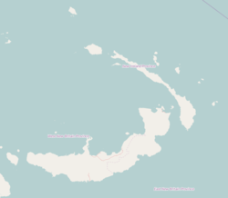
Lovongai Rural LLG is a local government area in New Ireland Province, Papua New Guinea. The LLG administers the island of New Hanover and a few surrounding islands. The LLG is located in Kavieng District and the LLG headquarters is Taskul. Some population centres in the LLG are: Taskul, Patiagaga, Patipai, Ungakum, Tsoi, Tukulisava, and Ungalik. This LLG has 19 wards, comprising a population of 29,005. Current LLG President is John Aini.

Murat Rural LLG is a local government area in New Ireland Province, Papua New Guinea. The LLG president is Herman Sole. The LLG administers the St. Matthias Group of islands and is located in Kavieng District. Population is 4,210(Census 2011).
Palabong is a village on the south-west coast of New Ireland, Papua New Guinea. It is located to the southeast of Umudu. It is located in Namatanai Rural LLG.
Rabaul Urban LLG is a local-level government (LLG) of East New Britain Province, Papua New Guinea.
Wewak Urban LLG is a local-level government (LLG) of East Sepik Province, Papua New Guinea.
Ahi Rural LLG is a local-level government (LLG) of Morobe Province, Papua New Guinea.
Lae Urban LLG is a local-level government (LLG) of Morobe Province, Papua New Guinea.
Mosa Rural LLG is a local-level government (LLG) of West New Britain Province, Papua New Guinea.
Talasea Rural LLG is a local-level government (LLG) of West New Britain Province, Papua New Guinea.
Watom Island Rural LLG is a local-level government (LLG) of East New Britain Province, Papua New Guinea.
Wabag Urban LLG is a local-level government (LLG) of Enga Province, Papua New Guinea.
Gumine Rural LLG is a local-level government (LLG) of Chimbu Province, Papua New Guinea.
Mount Digine Rural LLG is a local-level government (LLG) of Chimbu Province, Papua New Guinea.
Nomane Rural LLG is a local-level government (LLG) of Chimbu Province, Papua New Guinea. The Nomane language is spoken in the LLG.
Yonggomugl Rural LLG is a local-level government (LLG) of Chimbu Province, Papua New Guinea.

Mimanalo Rural LLG is a local-level government (LLG) of Eastern Highlands Province, Papua New Guinea.
Dunantina Rural LLG is a local-level government (LLG) of Eastern Highlands Province, Papua New Guinea.
Kamano No. 2 Rural LLG is a local-level government (LLG) of Eastern Highlands Province, Papua New Guinea. The Kamano language is spoken in the LLG.