The North Country Trail is a long-distance hiking trail in the Midwestern and Northeastern United States. The trail extends roughly 4,800 miles (7,700 km) from Lake Sakakawea State Park in North Dakota to the Appalachian Trail in Green Mountain National Forest in Vermont, passing through eight states along its route. As of 2023, most of the trail is in place, though about one-third of the distance consists of road walking; those segments are frequently evaluated for transfer to off-road segments on nearby public or private lands.

The Pan-American Highway is a network of roads stretching across the Americas, measuring about 30,000 kilometres (19,000 mi) in total length. Except for a break of about 100 km (60 mi) across the border between Colombia and Panama known as the Darién Gap, the roads link most of the Pacific coastal countries of North America and South America in a connected highway system. According to Guinness World Records, the Pan-American Highway is the world's longest "motorable road".

Kanjirappally is a taluk and a town in Kottayam district situated about 38 km (24 mi) away from the district capital, in the state of Kerala, in southwestern India.

Balussery is a town located about 25 km northeast of Kozhikode city, situated on State Highway 34. It is one of the 12 block Panchayats in the Kozhikode district and serves as the northeastern entry point to Kozhikode city.

Mattanur, also spelled Mattannur, is a town, municipality, and an aerotropolis in Kannur district, Kerala, India. Mattanur is about 27 km east of Kannur and Thalassery, two major towns of the district.

Uzhavoor is an expanding town in Kottayam district, Kerala in India. It is just 32 km away from the administrative capital Kottayam District. Most of its residents are either wealthy farmers or businessmen. Many of the houses belong to NRIs. The tenth President of India, K. R. Narayanan, was born and brought up in this village. The newly expanded road which connects the city of Pala and other destinations such as Sabarimala to the city of Muvattupuzha passes through Uzhavoor. The town is 177 km from the state capital Thiruvananthapuram.

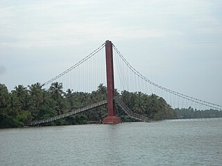
Valiyaparamba is a coastal island in Hosdurg taluk, Kasaragod district, Kerala state, India.
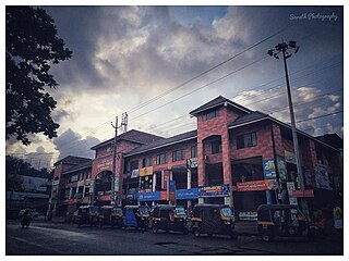
Panoor is a Municipality in the district of Kannur in the state of Kerala, India. The town is the main market place for the farmer communities in the surrounding regions. Panoor is one of the main suburbs of the City of Thalassery. Panoor got municipal status when the Government of Kerala decided to upgrade Panoor Grama Panchayat and added with other Panchayats, as Panoor Municipality in 2015.

Udumalai, also known as Udumalaipettai and Udumalpet, is a town in Tiruppur district in the Indian state of Tamil Nadu. It is located 535 km (332 mi) south west from the state capital, Chennai and 72 km (45 mi) from Coimbatore. It is the headquarters of Udumalaipettai taluk and had a population of 61,133 as per 2011 Census of India. The town comes under the Udumalaipettai Assembly constituency.

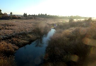
Town Creek is a 41.6-mile-long (66.9 km) tributary stream of the Potomac River in the U.S. states of Maryland and Pennsylvania. The creek is formed from the confluence of Sweet Root Creek and Elk Lick Creek, about 0.5 miles (0.8 km) south of Buchanan State Forest in Bedford County, Pennsylvania. Town Creek flows south along the base of Warrior Mountain into Allegany County, Maryland. The Chesapeake and Ohio Canal crosses it at the Town Creek Aqueduct. It empties into the Potomac about 4 miles (6 km) east of Oldtown, Maryland.

Uppala is a town and Headquarters of Manjeshwaram Taluk in Kasaragod district, Kerala, India. It is geographically located midway from Kasaragod to Mangalore. Easy geographical access and lack of major towns nearby are the key reasons for the town to develop exponentially, especially in the past decade. The population of Manjeshwaram Taluk alone was over 268,642 as of 2011. Uppala is 22 km north of Kasaragod and one of the fastest growing urban settlements in Kasaragod district. It is well known as an important trade hub in the northernmost part of Kerala state.
Harugeri (ಹಾರುಗೇರಿ) is a town in Raybag tehsilin Belguam District of the Indian state of Karnataka.

Beuvry is a commune in the Pas-de-Calais department in the Hauts-de-France region in northern France.

The Batten Kill, Battenkill, or Battenkill River is a 59.4-mile-long (95.6 km) river rising in Vermont that flows into New York and is a tributary of the Hudson River. It is the longest Hudson tributary on that river's east. As "kill" means a creek, the name "Battenkill River" is pleonastic.

Kattakada is a town in Thiruvananthapuram district of Kerala. It is situated 13 km north of Neyyattinkara town, 18 km south of Nedumangad town and 20 km east of the Capital City, Thiruvananthapuram.

Mangasuli is a village located in Northern Karnataka, India. It is located in the Athani taluk of Belgaum district in Karnataka.

The Wilge River (iKuthu) is a river in Mpumalanga and Gauteng provinces, South Africa. It is a tributary of the Olifants River.

Honnihalli is a village in Belagavi district in the southern state of Karnataka, India.

Perinthalmanna is a major town and municipality in Malappuram district, Kerala, India. It serves as the administrative centre for the Perinthalmanna taluk, as well as a revenue division, a community development block, and a police sub-division bearing the same name. It was formerly the headquarters of Valluvanad Taluk, which was one of the two Taluks in the Malappuram Revenue Division of the erstwhile Malabar District during the British Raj. The city is located 23 kilometres (14 mi) southwest of the city of Malappuram at the centre of the Kozhikode–Malappuram–Perinthalmanna–Palakkad National Highway 966.
Cibyra also referred to as Cibyra Minor to distinguish it from Cibyra Magna, was a town in ancient Pamphylia. Strabo, after mentioning Side, says, "...and near it is the coast of the little Cibyratae, and then the river Melas, and a station for ships". The site of Side is well known. The Melas is the Manavgat River, 4 miles (6.4 km) east of Side. But there could have been no city between Side and the Melas, and it is conjectured that in Strabo's text, the coast ("Paralia") of the Cibyratae should come after the Melas. The vestiges of Cibyra are probably those observed by Captain Beaufort upon a height which rises from the right bank of a considerable river about 8 miles (13 km) to the eastward of the Melas, about 4 miles (6.4 km) to the west of Cape Karáburun, and nearly 2 miles (3.2 km) from the shore. Ptolemy mentions this Cibyra among the inland towns of Cilicia Trachea; but Scylax places it on the coast. There is a place, Cyberna (Κυβέρνη), mentioned in the Stadiasmus, which is placed 59 stadia east of the Melas. If the conjecture as to Strabo's text is correct, we may identify Cyberna with this Cibyra of Pamphylia.


