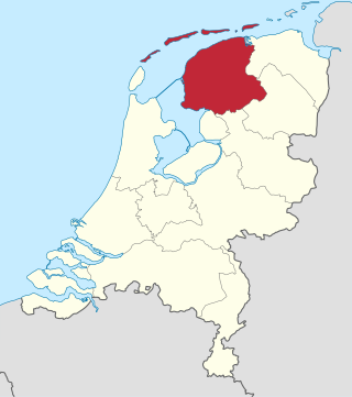
Friesland, historically and traditionally known as Frisia, named after the Frisians, is a province of the Netherlands located in the country's northern part. It is situated west of Groningen, northwest of Drenthe and Overijssel, north of Flevoland, northeast of North Holland, and south of the Wadden Sea. As of January 2020, the province had a population of 649,944 and a total area of 5,749 km2 (2,220 sq mi).
The Frisians are an ethnic group indigenous to the coastal regions of the Netherlands and northwestern Germany. They inhabit an area known as Frisia and are concentrated in the Dutch provinces of Friesland and Groningen and, in Germany, East Frisia and North Frisia. The name is probably derived from frisselje. The Frisian languages are spoken by more than 500,000 people; West Frisian is officially recognised in the Netherlands, and North Frisian and Saterland Frisian are recognised as regional languages in Germany.
Flevoland is the twelfth and youngest province of the Netherlands, established in 1986, when the southern and eastern Flevopolders, together with the Noordoostpolder, were merged into one provincial entity. It is in the centre of the country in the former Zuiderzee, which was turned into the freshwater IJsselmeer by the closure of the Afsluitdijk in 1932. Almost all of the land belonging to Flevoland was reclaimed in the 1950s and 1960s while splitting the Markermeer and Bordering lakes from the IJsselmeer. As to dry land, it is the smallest province of the Netherlands at 1,412 km2 (545 sq mi), but not gross land as that includes much of the waters of the fresh water lakes (meres) mentioned.
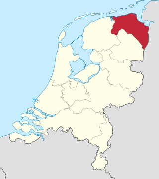
Groningen is the northeasternmost province of the Netherlands. It borders on Friesland to the west, Drenthe to the south, the German state of Lower Saxony to the east, and the Wadden Sea to the north. As of February 2020, Groningen had a population of 586,309 and a total area of 2,960 km2 (1,140 sq mi).
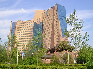
Groningen is the capital city and main municipality of Groningen province in the Netherlands. The capital of the north, Groningen is the largest place as well as the economic and cultural centre of the northern part of the country; as of December 2021, it had 235,287 inhabitants, making it the sixth largest city/municipality in the Netherlands and the second largest outside the Randstad.

The geography of the European Netherlands is unusual in that much of its land has been reclaimed from the sea and is below sea level, protected by dikes. It is a small country with a total area of 41,545 km2 (16,041 sq mi) and ranked 131st. With a population of 17.4 million and density of 521/km2 (1,350/sq mi) makes it the second most densely populated member of the European Union after Malta, and the 12th most densely populated country in the world, behind only three countries with a population over 16 million. Consequently, the Netherlands is highly urbanized.

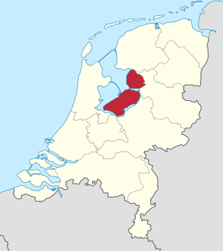
Overijssel is a province of the Netherlands located in the eastern part of the country. The province's name translates to "across the IJssel", from the perspective of the Episcopal principality of Utrecht by which it was held until 1528. The capital city of Overijssel is Zwolle and the largest city is Enschede. The province had a population of 1,162,215 as of November 2019. The land mostly consists of grasslands and some forests ; it also borders a small part of the IJsselmeer to the west.

Delfzijl is a city and former municipality with a population of 25,651 in the province of Groningen in the northeast of the Netherlands. Delfzijl was a sluice between the Delf and the Ems, which became fortified settlement in the 16th century. The fortifications were removed in the late 19th century. Delfzijl is the fifth largest seaport in the Netherlands, and the largest port in the North East of the country.
Eemsmond is a former municipality with a population of 15,864 in the north of the province of Groningen in the northeast of the Netherlands. On 1 January 2019 it merged with the municipalities of Bedum, De Marne and Winsum to form the new municipality Het Hogeland.

Vlieland is a municipality and island in the northern Netherlands. The municipality of Vlieland is the second most sparsely populated municipality in the Netherlands, after Schiermonnikoog.

Football Club Groningen is a Dutch professional association football club based in Groningen, province of Groningen. Founded on 16 June 1971 as the successor of GVAV, the team compete in the Eredivisie, the first tier of Dutch football, but will play in the second tier Eerste Divisie from the 2023–24 season following relegation from the 2022–23 Eredivisie. Groningen played their inaugural season in the Eredivisie, before the side were relegated to the Eerste Divisie in 1973–74 as they got into financial difficulties. Groningen were promoted back to the Eredivisie as champions in 1979–80 and remained in the top flight for almost 20 seasons before they dropped to the second tier in 1997–98. The team won promotion to the Eredivisie in 1999–2000, where they remained for 23 seasons before suffering relegation in 2022–23.
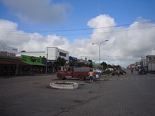
Chuí is a municipality located in the state of Rio Grande do Sul, Brazil. It's the southernmost municipality of Brazil, located in the coordinates 33°41′0″S. A border town, it shares its name with sister city Chuy, Uruguay. The two towns constitute one contiguous urban area, divided by a border street called Avenida Internacional, a situation also seen in a few other Brazilian border points, such as between Santana do Livramento (Brazil) and Rivera (Uruguay).
The Netherlands has several levels of administrative subdivisions. The first level of subdivision consists of 12 provinces. The second level of subdivision consists of 342 municipalities.

Beerta is a village and former municipality with a population of 2,205 in the municipality of Oldambt in the province of Groningen in the Netherlands. In the 20th century, Beerta was a communist stronghold. In 1933, the municipal council was dismissed by the government, and was ruled by a government commissioner until 1935. Between 1982 and 1990, Beerta was the only municipality with a communist mayor.

Pieterburen is a village in the northeastern Netherlands, located in the municipality of Het Hogeland, Groningen.
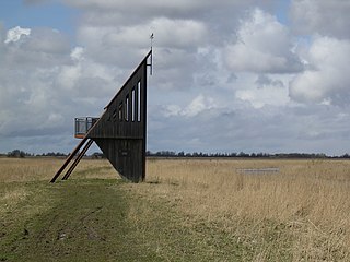
Lauwersmeer National Park is a national park in the provinces of Friesland and Groningen in the Netherlands. It consists of the southern and eastern parts of the Lauwersmeer. As part of the Dutch Wadden Sea Conservation Area, it was inscribed on the UNESCO World Heritage List for its outstanding biodiversity and its large, relatively pristine intertidal ecosystem.

Oldambt is a municipality with a population of 38,277 in the province of Groningen in the Netherlands. It was established in 2010 by merging the municipalities of Reiderland, Scheemda, and Winschoten. It contains the city of Winschoten and these villages:

The 2021–22 Eredivisie was the 66th season of Eredivisie, the premier football competition in the Netherlands. It began on 14 August 2021 and concluded on 15 May 2022.
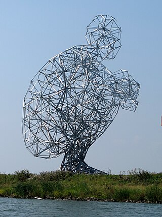
Exposure (Exposure) is a steel frame sculpture on the Markerstrekdam near the Houtribsluizen in Lelystad Netherlands by artist Antony Gormley. The work is also known as Crouching man, or popularly called the Shitting Man.