
Port Augusta is a small coastal city in South Australia about 310 kilometres (190 mi) by road from the state capital, Adelaide. Most of the city is on the eastern shores of Spencer Gulf, immediately south of the gulf's head, comprising the city's centre and surrounding suburbs, Stirling North, and seaside homes at Commissariat Point, Blanche Harbor and Miranda. The suburb of Port Augusta West is on the western side of the gulf on the Eyre Peninsula. Together, these localities had a population of 13,515 people in the 2021 census.

Port Pirie is a small city on the east coast of the Spencer Gulf in South Australia, 223 km (139 mi) north of the state capital, Adelaide. Port Pirie is the largest city and the main retail centre of the Mid North region of South Australia. The city has an expansive history which dates back to 1845. Port Pirie was the first proclaimed regional city in South Australia, and is currently the second most important and second busiest port in SA.

North Terrace is one of the four terraces that bound the central business and residential district of Adelaide, the capital city of South Australia. It runs east–west, along the northern edge of "the square mile". The western end continues on to Port Road, and the eastern end continues across the Adelaide Parklands as Botanic Road.

Melrose is the oldest town in the Flinders Ranges, South Australia. The town was once named "Mount Remarkable".

Port Adelaide is a port-side region of Adelaide, approximately 14 kilometres (8.7 mi) northwest of the Adelaide CBD. It is also the namesake of the City of Port Adelaide Enfield council, a suburb, a federal and state electoral division and is the main port for the city of Adelaide. Port Adelaide played an important role in the formative decades of Adelaide and South Australia, with the port being early Adelaide's main supply and information link to the rest of the world. Its Kaurna name, although not officially adopted as a dual name, is Yertabulti.

Robe is a town and fishing port located in the Limestone Coast of South Australia. The town's distinctive combination of historical buildings, ocean, fishing fleets, lakes and dense bush attracts many tourists. Robe lies on the southern shore of Guichen Bay, just off the Princes Highway. At the 2021 census, Robe had a population of 1252. Robe is the main town in the District Council of Robe local government area. It is in the state electorate of MacKillop and the federal Division of Barker.
Penola is a town in the Australian state of South Australia located about 388 kilometres (241 mi) southeast of the state capital of Adelaide in the wine growing area known as the Coonawarra. At the 2021 Australian Census, the town of Penola had a population of 1,376.

Woodville is a suburb of Adelaide, situated about 8 km (5 mi) north-west of the Adelaide city centre. It lies within the City of Charles Sturt. The postcode of Woodville is 5011. Woodville is bound by Cheltenham Parade to the west, Torrens Road to the north, Port Road to the south and Park Street to the east, excluding the area of Cheltenham Park Racecourse. The population was 2,180 at the 2021 Australian census.

Eagle On The Hill is an unbounded locality in the Australian state of South Australia located in the suburb of Crafers West on the western face of the Adelaide Hills overlooking the Adelaide metropolitan area.

Aldgate is a South Australian village and a suburb of Adelaide, located 21 km (13 mi) south-east of the Adelaide city centre, in the Adelaide Hills.

Port Noarlunga is a suburb in the City of Onkaparinga, South Australia. It is a small sea-side suburb, with a population of 2,918, about 30 kilometres to the south of the Adelaide city centre and was originally created as a sea port. This area is now popular as a holiday destination or for permanent residents wishing to commute to Adelaide or work locally. There is a jetty that connects to a 1.6 kilometres natural reef that is exposed at low tide.

Rundle Street, often referred to as "Rundle Street East" as distinct from Rundle Mall, is a street in the East End of the city centre of Adelaide, the capital of South Australia. It runs from Pulteney Street to East Terrace, where it becomes Rundle Road through the East Park Lands. The street is close to Adelaide Botanic Gardens, Rundle Park, Rymill Park, Hindmarsh Square and North Terrace.

Moonta is a town on the Yorke Peninsula of South Australia, 165 km (103 mi) north-northwest of the state capital of Adelaide. It is one of three towns known as the Copper Coast or "Little Cornwall" for their shared copper mining history.
Australian non-residential architectural styles are a set of Australian architectural styles that apply to buildings used for purposes other than residence and have been around only since the first colonial government buildings of early European settlement of Australia in 1788.

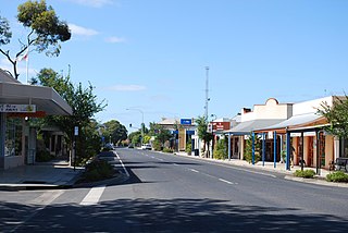
Wilmington is a town and locality in the Yorke and Mid North region of South Australia.The town is located in the District Council of Mount Remarkable local government area, 305 kilometres (190 mi) north of the state capital, Adelaide.

Grenfell Street is a major street in the north-east quarter of the Adelaide city centre, South Australia. The street runs west-east from King William Street to East Terrace. Its intersection with Pulteney Street is formed by Hindmarsh Square. On the west side of King William Street, it continues as Currie Street towards West Terrace.
East Terrace is a road that marks the eastern edge of the Adelaide city centre in Adelaide, South Australia.

Salisbury is a northern suburb of Adelaide, South Australia. It is the seat of the City of Salisbury, and in the South Australian Legislative Assembly electoral district of Ramsay and the Australian House of Representatives division of Spence. The suburb is a service area for the City of Salisbury district, with many parklands, shops, cafés and restaurants.

North Adelaide is a predominantly residential precinct and suburb of the City of Adelaide in South Australia, situated north of the River Torrens and within the Adelaide Park Lands. Laid out in a grid plan in three sections by Colonel William Light in 1837, the suburb contains many grand old mansions.
Kirkala Station is a pastoral lease that operates as a sheep station in South Australia.

