
North Beaverbank in Nova Scotia
North Beaverbank is a community of the Halifax Regional Municipality in the Canadian province of Nova Scotia.
Coordinates: 44°53′13.03″N63°42′15.05″W / 44.8869528°N 63.7041806°W
North Beaverbank is a community of the Halifax Regional Municipality in the Canadian province of Nova Scotia.
Coordinates: 44°53′13.03″N63°42′15.05″W / 44.8869528°N 63.7041806°W

Halifax Chebucto is a provincial electoral district in Nova Scotia, Canada, that elects one member of the Nova Scotia House of Assembly.
Preston is an area in central Nova Scotia, Canada in the Halifax Regional Municipality, located on Trunk 7. Preston includes the subdivisions of East Preston, North Preston, Lake Major, Cherrybrook and Loon Lake. The definition sometimes extends to include Lake Echo. The population in 2016 was 3,223. This is a decline from 2006, when Preston had a population of 3,536.
Richmond was a Canadian urban neighbourhood comprising part of the North End of the Halifax Peninsula in Nova Scotia's Halifax Regional Municipality.

The Musquodoboit River is a Canadian river located in central Nova Scotia in the northeastern part of Halifax Regional Municipality. The river is approximately 97 kilometres (60 mi) in length with roughly 88 kilometres (55 mi) being traversable by paddle. It has a watershed area of 1,409 square kilometres (544 sq mi)
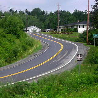
Route 354 is a collector road in the Canadian province of Nova Scotia.
Route 318 is a collector road in the Canadian province of Nova Scotia.

The Halifax Armoury is a military structure in central Halifax, Nova Scotia, Canada. The armoury is the home base of The Princess Louise Fusiliers, and several cadet units.
Burnside Drive is a four-lane divided roadway, with a speed limit of 80 km/h, that serves the Burnside Business Park in the Halifax Regional Municipality (HRM) community of Dartmouth, Nova Scotia. The road parallels Highway 118, running north from exit 3 of Highway 111 to Akerley Boulevard, a western extension of Highway 107. Although some maps produced by the province show Burnside Drive, as well as a portion of Akerley Boulevard, as part of Highway 107, these roads are actually maintained by the HRM, and Highway 107 becomes Akerley Boulevard about halfway between Highway 118 and Burnside Drive.

Robie Street is a north-south artery that runs for 7 km in the Halifax Peninsula area of the Halifax Regional Municipality, from Memorial Drive in the North End Halifax, to Gorsebrook Avenue in the South End.
Halifax was a provincial electoral district in Nova Scotia, Canada, that elected three, and then five members to the Nova Scotia House of Assembly. It existed from 1867 to 1933, at which point Halifax County was divided into five separate electoral districts: Halifax South, Halifax Centre, Halifax North, Halifax East and Halifax West.

The Sackville River is a river in Hants County and Halifax Regional Municipality, Nova Scotia, Canada. It empties into Bedford Basin. The Little Sackville River is a tributary.
Nova Scotia Archives is a governmental archival institution serving the Canadian province of Nova Scotia. The archives acquires, preserves and makes available the province's documentary heritage – recorded information of provincial significance created or accumulated by government and the private sector over the last 300 years.
Sandy Lake could refer to one of the following lakes:
Middle Beaverbank is a rural community of the Halifax Regional Municipality in the Canadian province of Nova Scotia.
Gibraltar is a rural community of the Halifax Regional Municipality in the Canadian province of Nova Scotia on Nova Scotia Route 357, approximately 15 km north of Musquodoboit Harbour.
There are various Black Lakes in Nova Scotia, Canada. They vary widely in size, depth and usability. Many counties, such as Cumberland, Halifax, Inverness, and Pictou Counties have more than one Black Lake so named, while other counties mentioned in this article have only one named Black Lake.

The Prince of Wales Tower is the oldest martello tower in North America and is located in Point Pleasant Park, Halifax Regional Municipality, Nova Scotia, Canada. It was built in 1796 by Captain James Straton and was used as a redoubt and a powder magazine. Restored, it was designated a National Historic Site of Canada in 1943.

The Black-Binney House was a former residence built in 1819 in Halifax, Nova Scotia which is now a National Historic Site of Canada. The house was built by John Black (merchant) and is reflective of the Palladian-inspired residences common during the late 18th and early 19th centuries in Eastern Canada. In 1857, Hibbert Binney subdivided the property to build the St. Matthew's United Church (Halifax). In 1965 Sidney Culverwell Oland purchased and renovated the building to house the Nova Scotia Division of the Canadian Corps of Commissionaires.
Bradley "Brad" Harris Johns is a Canadian politician, who was elected to the Nova Scotia House of Assembly in the 2017 provincial election. A member of the Progressive Conservative Association of Nova Scotia, he represents the electoral district of Sackville-Uniacke.

A township in Nova Scotia, Canada, was an early form of land division and local administration during British colonial settlement in the 18th century. They were created as a means of populating the colony with people loyal to British rule. They were typically rural or wilderness areas of around 100,000 acres (400 km2) that would eventually include several villages or towns. Some townships, but not all, returned a member to the General Assembly of Nova Scotia; others were represented by the members from the county. Townships became obsolete by 1879 by which time towns and counties had become incorporated.
| | This Halifax County, Nova Scotia location article is a stub. You can help Wikipedia by expanding it. |