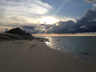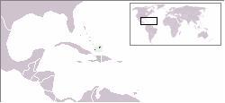
The Turks and Caicos Islands are a British Overseas Territory consisting of the larger Caicos Islands and smaller Turks Islands, two groups of tropical islands in the Lucayan Archipelago of the Atlantic Ocean and northern West Indies. They are known primarily for tourism and as an offshore financial centre. The resident population in 2023 was estimated by The World Factbook at 59,367, making it the third-largest of the British overseas territories by population. However, according to a Department of Statistics estimate in 2022, the population was 47,720.

Parrot Cay is an island in the Turks and Caicos Islands. The island contains about 1,000 acres (405 ha) of land, a mile-long beach and features a high-end beach resort with 61 rooms. Parrot Cay became a private island resort in 1998. It is located about 575 miles (925 km) south east of Miami, and can be reached by a 35-minute boat ride from Providenciales, the main island in Turks and Caicos.

Providenciales is an island in the northwest Caicos Islands, part of the Turks and Caicos Islands, a British Overseas Territory. The island has an area of 98 km2 (38 sq mi) and a 2012 Census population of 23,769. Providenciales is the third largest island in the Turks and Caicos in area, and is home to a large majority of the population of the Turks and Caicos Islands.

South Caicos is the seventh-largest island in the Turks and Caicos archipelago, with a land area of 21.2 square kilometres. South Caicos is known for excellent fishing, both deep-sea and bone fishing, and scuba diving. South Caicos was formerly a salt exporter, the island still hosts a network of salt pans as a reminder of the industry. Today, the island's main income is derived from small-scale commercial fishing.
Clement Howell was a politician from the Turks and Caicos Islands. He served on a four-member interim advisory council beginning in July 1986, after two previous chief ministers were forced to resign and the ministerial government in the territory was suspended.

The Turks and Caicos Islands are divided into five administrative districts, and the Island of Grand Turk; four of these are headed by District Commissioners, and Providenciales District is run by the Permanent Secretary of the Office of the Premier in Providenciales. The Island of Grand Turk is directly administered by the TCI Government.

Middle Caicos is the largest island in the Turks and Caicos Islands. To the west, it is separated from North Caicos by Juniper Hole, and to the east, from East Caicos by Lorimer Creek, both narrow passages that can accommodate only small boats. The island is known for its extensive system of caves and its significant Lucayan Indian archaeological sites. The island is connected to North Caicos via a causeway. Middle Caicos was previously called Grand Caicos, although this name is not used today.

East Caicos is the fourth largest island in the Turks and Caicos Islands. To the west, it is separated from Middle Caicos by Lorimer Creek, a narrow passage that can accommodate only small boats. To the south is South Caicos. East Caicos has no inhabitants.

Salt Cay is the second largest of the Turks Islands, one of the two island groups forming of the British territory of the Turks and Caicos Islands in the Caribbean. Its area is 6.74 square kilometres. The size of the district, which also includes some unpopulated islands like Cotton Cay nearby, is 9.1 square kilometres. The population is 108, all in the district capital Balfour Town, established in 1673, on the west coast.

West Caicos is an island in the Turks and Caicos Islands southwest of Providenciales. West Caicos has an area of 11 square miles (28 km2), and has been uninhabited for over a century.

The following outline is provided as an overview of and topical guide to the Turks and Caicos Islands:

The following is an alphabetical list of topics related to the British Overseas Territory of the Turks and Caicos Islands.

Dellis Cay is a 560-acre (2.3 km2) private island located in the Turks and Caicos Islands archipelago.

The Fish Ponds and Crossing Place Trail Important Bird Area is a 1024 ha tract of land on the island of Middle Caicos in the Turks and Caicos Islands, a British Overseas Territory in the Lucayan Archipelago of the western Atlantic Ocean. It forms one of the territory's Important Bird Areas (IBAs).

Tourism in the Turks and Caicos Islands is an industry that generates more than 1 million tourist arrivals per year, and is "the main source of revenue for the country. The tourism industry began in the 1980s, with the opening of Club Med Turquoise, the country's first main resort." "Tourism has benefited from the proximity to the United States and the stability via being a British Overseas Territory. The opening of a cruise port on Grand Turk in 2006 resulted in a significant increase in tourism arrivals to the country."

Cheshire Hall Plantation was a 5,000-acre (2,000 ha) sisal and cotton plantation in Providenciales, Turks and Caicos Islands, owned by the British Loyalist Thomas Stubbs from the late 1700s until 1810 and afterwards by his brother Wade Stubbs. A portion of the former plantation is currently owned and managed as a historical site by the Turks and Caicos National Trust.
Kew is a village located on the island of North Caicos in the Turks and Caicos Islands, a British Overseas Territory. The village contains several small houses, churches, small shops, a library and a police station. The surrounding areas consist of heavy vegetation, earning the village the nickname 'garden of the Turks and Caicos'.
Whitby is a village located on the island of North Caicos in the Turks and Caicos Islands, a British Overseas Territory. Whitby consists of a few small houses, shops, vacation rental villas, restaurants, and a small hotel. The village is named after Whitby in Yorkshire, northern England.


