This article needs additional citations for verification .(March 2016) |
North Carolina Highway 201 (NC 201) was the designation for two former routes in North Carolina.
This article needs additional citations for verification .(March 2016) |
North Carolina Highway 201 (NC 201) was the designation for two former routes in North Carolina.
North Carolina Highway 201 | |
|---|---|
| Location | Brunswick County, North Carolina |
| Existed | ?–1928 |
The first NC 201 was one of the original NC state routes. It ran from Belville southwest to Supply along the current U.S. Route 17 (US 17). Then it went back east to Southport. In 1928 NC 201 was renumbered NC 30 from Belville to Supply and NC 130 from Supply to Southport.
North Carolina Highway 201 | |
|---|---|
| Location | Southeastern North Carolina |
| Existed | 1928–1934 |
The second NC 201 was designated in 1928 US 217/NC 22 in Lumberton to NC 21 in Dublin. In 1931 NC 201 was extended to Atkinson. Then NC 201 replaced NC 601 to Jacksonville. In 1934 NC 201 was renumbered as NC 41 from Lumberton to White Lake. The rest of the routing was renumbered as NC 53. [1]

Brunswick County is the southernmost county in the U.S. state of North Carolina. As of the 2020 census, the population was 136,693. Its population was only 73,143 in 2000, making it one of the fastest-growing counties in the state. With a nominal growth rate of approximately 47% in ten years, much of the growth is centered in the eastern section of the county in the suburbs of Wilmington such as Leland, Belville and Southport. The county seat is Bolivia, which at a population of around 150 people is among the least populous county seats in the state.

U.S. Route 701 is an auxiliary route of US 1 in the U.S. states of South Carolina and North Carolina. The U.S. Highway runs 171.45 miles (275.92 km) from US 17 and US 17 Alternate in Georgetown, South Carolina north to US 301, North Carolina Highway 96, and Interstate 95 (I-95) near Four Oaks, North Carolina. US 701 serves the Pee Dee region of South Carolina and the southern and central portions of Eastern North Carolina. The highway connects Georgetown and Conway in South Carolina with the North Carolina cities of Whiteville, Elizabethtown, Clinton, and a short distance north of its terminus, Smithfield. US 701 has four business routes in North Carolina, including those through Tabor City, Whiteville, Clarkton, and Clinton.

North Carolina Highway 211 (NC 211) is a 162.5-mile-long (261.5 km) primary state highway in the U.S. state of North Carolina. It traverses mostly through the Sandhills and Coastal Plain regions of the state; connecting the cities of Candor, Aberdeen, Raeford, Lumberton, Bladenboro, and Southport.

North Carolina Highway 87 (NC 87) is a primary state highway in the U.S. state of North Carolina. NC 87 begins in the Atlantic coastal town of Southport and crosses into Virginia at the Virginia state line five miles (8 km) north of Eden in Rockingham County. At 240 miles (390 km) in length, NC 87 is the second longest state highway in the U.S. state of North Carolina with only North Carolina Highway 24 being longer. Labeled as a north–south route, NC 87 travels along a relatively straight southeast–northwest path, connecting Cape Fear region with the Piedmont. It is also the main north-south route connecting the cities of Fayetteville, Sanford, Burlington and Reidsville.
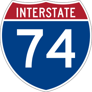
Interstate 74 (I-74) is a partially completed part of the Interstate Highway System that is planned to run from Davenport, Iowa, to Myrtle Beach, South Carolina. In the US state of North Carolina, I-74 currently exists in three distinct segments; from I-77 at the Virginia state line to US Highway 52 (US 52) near Mount Airy, from I-40 in Winston-Salem to US 220 near Ellerbe, and from US 74 and US 74 Business near Maxton to US 74/North Carolina Highway 41 (NC 41) near Lumberton. I-74 has an extensive concurrency with I-73 from Randleman to Ellerbe in the Piedmont. When completed, I-74 will link the cities of Mount Airy, Winston-Salem, High Point, Rockingham, Laurinburg, and Lumberton.

North Carolina Highway 69 (NC 69) is a 3.876-mile-long (6.238 km) primary state highway in the U.S. state of North Carolina. It runs north–south from the Georgia state line to Hayesville, west of Chatuge Lake.
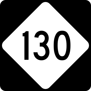
North Carolina Highway 130 (NC 130) is a primary state highway in the U.S. state of North Carolina. The highway serves the towns and rural communities in southern Robeson County, acts as a direct route between Whiteville and Shallotte through the Green Swamp, and provides access to Holden Beach.

Cape Fear is a coastal plain and Tidewater region of North Carolina centered about the city of Wilmington. The region takes its name from the adjacent Cape Fear headland, as does the Cape Fear River which flows through the region and empties into the Atlantic Ocean near the cape. Much of the region's populated areas are found along the Atlantic beaches and the Atlantic Intracoastal Waterway, while the rural areas are dominated by farms and swampland like that of the Green Swamp. The general area can be also identified by the titles "Lower Cape Fear", "Wilmington, NC Metropolitan Statistical Area", "Southeastern North Carolina", and "Azalea Coast". The latter name is derived from the North Carolina Azalea Festival held annually in Wilmington. Municipalities in the area belong to the Cape Fear Council of Governments.

North Carolina Highway 41 (NC 41) is a primary state highway in the U.S. state of North Carolina. The highway travels in a north–south orientation between the South Carolina state line to Lumberton, then switches to an east–west orientation connecting the cities and towns of Elizabethtown, White Lake, Harrells, Wallace, Beulaville and Trenton.

U.S. Route 301 (US 301) is a north–south United States highway that runs for 194 miles (312 km) in North Carolina from the South Carolina state line near Rowland to the Virginia state line near Pleasant Hill. The entire route parallels I-95. From the southern border to Hope Mills, it runs very close to I-95, crossing it several times and having a short concurrency with the freeway in Lumberton. From Hope Mills to Eastover, North Carolina it follows Interstate 95 Business, a partial freeway that passes through the center of Fayetteville. Passing through towns such as Dunn, Benson, Smithfield, and Selma that are bypassed by I-95, numerous local businesses targeted at I-95 travellers line this stretch, rarely does it veer more than a fraction of a mile from I-95. At Kenly, it leaves its close parallel of I-95, taking a route approximately 5 miles east of I-95 and passing through the center of the cities of Wilson and Rocky Mount. North of Rocky Mount it passes through several small towns, including Whitakers, Enfield, Halifax, and Weldon before passing into Virginia near Pleasant Hill. Through Rocky Mount the route divides into a Business and Bypass route, and there is also a short business loop in Halifax.
A total of at least seven special routes of U.S. Route 301 exist and at least eleven have been deleted.

North Carolina Highway 53 (NC 53) is a 126-mile-long (203 km) primary state highway in the U.S. state of North Carolina that mainly runs west–east in the eastern part of the state.

Several special routes of U.S. Route 74 exist. In order from west to east they are as follows.
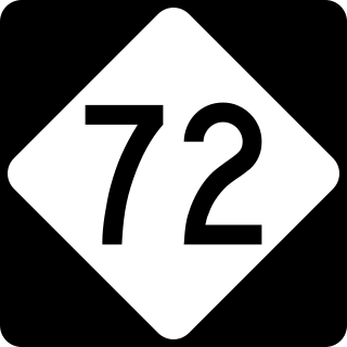
North Carolina Highway 72 (NC 72) is a primary state highway in the U.S. state of North Carolina that serves the communities of Red Springs and Lumberton. The east–west-signed highway physically runs more north and south through Robeson County.
North Carolina Highway 21 (NC 21) was a primary state highway in the U.S. state of North Carolina. Originally, NC 21 began at the South Carolina state line west of Fair Bluff. The highway travelled north connecting Lumberton, Fayetteville, and Lillington before ending in Raleigh. By 1926, the highway was realigned south of Fayetteville, beginning in Whiteville and running north through Elizabethtown and Dublin before reaching Fayetteville. The highway was realigned once again in 1929, replacing NC 231 from Elizabethtown to U.S. Route 17/NC 20 near Delco and being routed north of Raleigh to US 15/NC 75 Creedmoor.
Brunswick County Schools is a PK–12 graded school district serving Brunswick County, North Carolina. Its 19 schools serve 12,603 students as of the 2017–2018 school year.
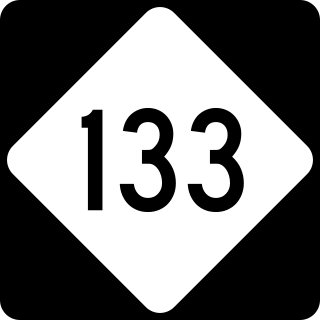
North Carolina Highway 133 (NC 133) is a primary state highway in the U.S. state of North Carolina. It traverses 46.6 miles (75.0 km) from Oak Island Drive in Oak Island to NC 210 in Bells Crossroads. The route serves communities such as Southport, Belville, Leland, Wilmington, and Castle Hayne. Additionally, NC 133 serves as an entry point for Military Ocean Terminal Sunny Point located to its east. Much of NC 133 runs parallel to the Cape Fear River and Brunswick River between Southport and Belville. West of Wilmington, NC 133 runs concurrently with U.S. Route 17 (US 17), US 74, and US 76. The road follows another concurrency along US 74 and US 421, west of Downtown Wilmington, and crosses into New Hanover County on the Isabel Holmes Bridge. North of Wilmington, NC 133 exits to the north, serving several suburban communities north of Wilmington. NC 133 runs concurrently with US 117 through Castle Hayne, before bearing northwest toward Bells Crossroads.

North Carolina Highway 70 (NC 70) was one of the original state highways in the U.S. state of North Carolina running from the South Carolina state line to the Virginia state line north of Greensboro. NC 70 connected Greensboro, Aberdeen, and Fayetteville.
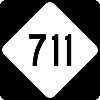
North Carolina Highway 711 (NC 711) is a primary state highway in the U.S. state of North Carolina. It connects the town of Pembroke with Interstate 95 (I-95) and U.S. Route 301 (US 301) in Lumberton. The highway travels in an east-to-west orientation but is signed as a north-south highway, entirely in Robeson County.
| | This North Carolina road or road transport-related article is a stub. You can help Wikipedia by expanding it. |