North Carr

Last updated

North Carr is NE of Crail, at the mouth of the Firth of Forth FirthofForthmap.png
North Carr is NE of Crail, at the mouth of the Firth of Forth

The Carr (also known as Carr Briggs and Carr Rock) [1] is a sandstone reef on the headland between the Firth of Forth and St Andrews Bay. There have been many ships wrecked on the reef, which lies on the busy shipping lanes into the Forth ports and the River Tay.

Contents

A buoy was first placed on the reef, at North Carr, in 1809. After much difficulty a more permanent, unlit, beacon was completed by Robert Stevenson in 1821. [2] Between 1877 and 1975 the beacon was supplemented by a series of lightships. The beacon still stands to this day, but the reef is now guarded by the Fife Ness lighthouse on the mainland.

Description

The reef extends for 1.5 miles (2.4 km) northeastwards from Fife Ness Points Coastguard station (East Coast Fife) into the North Sea and the greater Firth of Forth. It is made up of some fourteen sandstone rocks that are completely submerged at high tide. These include Englishman's Skelly, Kneestone, Tullybothy Craigs, Lochaber Rock and Mary's Skelly.

Carr is a Scots term for a coastal rock, found as an element in the names of reefs and small islands in south-east Scotland and north-east England. It may have entered Old English from a Celtic source; compare carra or carraig in Gaelic, terms for a ledge or projecting rock. [1] [3] [4]

History

Shipwrecks around the reef include the schooner Louise; the trawlers James Ross & Festing Grindall; the tanker Vildfugl; the brig Andreas; the paddle steamer Commodore; the coaster Island Magee; the cargo steamer Einar Jarl & Bjornhaug.

A buoy was first placed by the Northern Lighthouse Board in 1809, but this was found to be inadequate and would wreck in winter storms. [5] The remains can still be seen of a second project, the North Carr Beacon. This was started in 1813 by Robert Stevenson, a famous lighthouse engineer. [2] Stevenson had just finished the Bell Rock Lighthouse and was about to start a new lighthouse on the Isle of May, 8 miles to the south of North Carr. [5] Since North Carr was barely uncovered even at low tide, work could proceed on only two or three tides each fortnight, so the plan was to work on it when conditions allowed and switch the men to the Isle of May at other times. [5]

North Carr Beacon of 1821 North carr beacon.jpg
North Carr Beacon of 1821

Stevenson planned a 40 feet (12 m) hollow tower topped by a bell. [5] The bell would be rung by an ingenious mechanism powered by the tide. [5] The foundations of North Carr were confined to just 18 feet (5.5 m) of fractured sandstone, a limited "toehold" compared even to Bell Rock (42 feet (13 m)) and whilst it was under construction parts of the structure were swept away in storms in 1815, 1816 and 1817. [5] In 1817 the tower had been nearly complete when it was reduced to the fifth course of stones, so the design was changed to a pyramidal structure of cast iron columns with a ball on top. [5] This was completed in 1821; £5,000 had been spent in total. [5]

The North Carr Lightship moored at Anstruther in 1988 North carr light ship 1988.jpg
The North Carr Lightship moored at Anstruther in 1988

A lightship on loan from Trinity House joined the beacon on 7 June 1887, located one mile off North Carr. [6] The 8 feet (240 cm) fixed light could be seen for 11 miles (18 km). [6] Two years later it was replaced by a ship purpose-built for the Northern Lighthouse Board by Alexander Stephen and Sons of Dundee. [6] This was sold in 1933 and replaced by a vessel built by A. & J. Inglis of Glasgow. [6] This had a 1000W electric light, fixed at first and later flashing twice every half minute. [6] It was moved to the mouth of the Clyde during World War II. [6] The lightship broke adrift from her moorings in a gale on 8 December 1959 and all eight crew members of the Broughty Ferry lifeboat died trying to rescue her. [7] The crew of the lightship managed to set anchor off Kingsbarns and were taken off by helicopter the next day but the ship was not taken under tow until 11 December. [6] The lightship was replaced by a lighted buoy in 1975, at the same time as a lighthouse was built at Fife Ness on the mainland. [6] [2] The lightship was saved from the scrapyard in 2010 and funds are being sought by the Taymara charity to restore her as an exhibition space on the Dundee waterfront. [7]

Visiting

Site where the stone blocks for the beacon were checked for fitting. Fife Ness shoreline.jpg
Site where the stone blocks for the beacon were checked for fitting.

Visitors can park in the Crail Golfing Society carpark and follow the track that leads to the lighthouse and Coastguard Station. The North Carr rocks are only visible at low tide. When Stevenson was building the beacon, the stone blocks were cut and checked for fitting on the foreshore here prior to being shipped out to the reef. The bedrock was levelled to form a base for the first course of blocks and a higher course. These circular outlines can still be seen cut into the rock on the shore, as can the nearby remains of the quay where the finished blocks were loaded onto the workboat. Pods of dolphin and less frequently whales can be seen from the shore, with the aid of binoculars.

Related Research Articles

Lightvessel Ship that acts as a lighthouse

A lightvessel, or lightship, is a ship that acts as a lighthouse. They are used in waters that are too deep or otherwise unsuitable for lighthouse construction. Although some records exist of fire beacons being placed on ships in Roman times, the first modern lightvessel was off the Nore sandbank at the mouth of the River Thames in England, placed there by its inventor Robert Hamblin in 1734. The type has become largely obsolete; lighthouses replaced some stations as the construction techniques for lighthouses advanced, while large, automated buoys replaced others.

Bell Rock Lighthouse Worlds oldest working sea-washed lighthouse, off the coast of Angus, Scotland

The Bell Rock Lighthouse, off the coast of Angus, Scotland, is the world's oldest surviving sea-washed lighthouse. It was built between 1807 and 1810 by Robert Stevenson on the Bell Rock in the North Sea, 11 miles (18 km) east of the Firth of Tay. Standing 35 metres (115 ft) tall, its light is visible from 35 statute miles (56 km) inland.

Robert Stevenson (civil engineer) Civil engineer and lighthouse designer (1772–1850)

Robert Stevenson, FRSE, FGS, FRAS, FSA Scot, MWS was a Scottish civil engineer, and designer and builder of lighthouses. His works include the Bell Rock Lighthouse.

Portland Bill

Portland Bill is a narrow promontory at the southern end of the Isle of Portland, and the southernmost point of Dorset, England. One of Portland's most popular destinations is Portland Bill Lighthouse. Portland's coast has been notorious for the number of shipwrecked vessels over the centuries. The dangerous coastline features shallow reefs and the Shambles sandbank, made more hazardous due to the strong Portland tidal race.

Runnel Stone

The Runnel Stone, or Rundle Stone, is a hazardous rock pinnacle about 1-mile (1.6 km) south of Gwennap Head, Cornwall, United Kingdom. It used to show above the surface at low water until a steamship struck it in 1923.

The Isle of May is located in the north of the outer Firth of Forth, approximately 8 km (5.0 mi) off the coast of mainland Scotland. It is about 1.5 kilometres long and 0.5 kilometres wide. The island is owned and managed by NatureScot as a national nature reserve. There are now no permanent residents, but the island was the site of St Adrian's Priory during the Middle Ages.

Skerryvore is a remote island that lies off the west coast of Scotland, 12 miles south-west of the island of Tiree. Skerryvore Lighthouse is located on these rocks, built with some difficulty between 1838 and 1844 by Alan Stevenson.

Lightship Nantucket

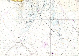
The station named Nantucket or Nantucket Shoals was served by a number of lightvessels that marked the hazardous Nantucket Shoals south of Nantucket Island. The vessels, given numbers as their "name," had the station name painted on their hulls when assigned to the station. Several ships have been assigned to the Nantucket Shoals lightship station and have been called Nantucket. It was common for a lightship to be reassigned and then have the new station name painted on the hull. The Nantucket station was a significant US lightship station for transatlantic voyages. Established in 1854, the station marked the limits of the dangerous Nantucket Shoals. She was the last lightship seen by vessels departing the United States, as well as the first beacon seen on approach. The position was 40 miles (64 km) southeast of Nantucket Island, the farthest lightship in North America, and experienced clockwise rotary tidal currents.

United States lightship <i>Huron</i> (LV-103) 1920 lightvessel, now a museum ship in Port Huron, Michigan, United States

The United States lightship Huron (LV-103) is a lightvessel that was launched in 1920. She is now a museum ship moored in Pine Grove Park, Port Huron, St. Clair County, Michigan.

Inchcape

Inchcape or the Bell Rock is a reef about 11 miles (18 km) off the east coast of Angus, Scotland, near Dundee and Fife, occupied by the Bell Rock Lighthouse. The name Inchcape comes from the Scottish Gaelic Innis Sgeap, meaning "Beehive isle", probably comparing the shape of the reef to old-style skep beehives. According to legend, probably folk etymology, the alternative name Bell Rock derives from a 14th-century attempt by the Abbot of Arbroath ("Aberbrothock") to install a warning bell on the reef; the bell was removed by a Dutch pirate who perished a year later on the rocks, a story that is immortalised in "The Inchcape Rock" (1802), a poem by Robert Southey.

Elie and Earlsferry Human settlement in Scotland

Elie and Earlsferry is a coastal town and former royal burgh in Fife, and parish, Scotland, situated within the East Neuk beside Chapel Ness on the north coast of the Firth of Forth, eight miles east of Leven. The burgh comprised the linked villages of Elie to the east and to the west Earlsferry, which were formally merged in 1930 by the Local Government (Scotland) Act 1929. To the north is the village of Kilconquhar and Kilconquhar Loch.

United States lightship <i>Swiftsure</i> (LV-83)

Light Vessel Number 83 (LV-83) Swiftsure is a lightship and museum ship owned by Northwest Seaport in Seattle, Washington. Launched in 1904 at Camden, New Jersey and in active service until 1960 after serving on all five of the American west coast's lightship stations, it is the oldest surviving lightship in the United States, the only one still fitted with its original steam engine, and the last lightship with wooden decks. LV-83 was designated a National Historic Landmark in 1989, and has been undergoing major restoration since 2008.

Fife Ness Headland and most eastern point of Fife, Scotland

Fife Ness is a headland forming the most eastern point in Fife, Scotland. Anciently the area was called Muck Ross, which is a corruption of the Scottish Gaelic Muc-Rois meaning "Headland of the Pigs". It is situated in the area of Fife known as the East Neuk, and forms the muzzle of the dog-like outline of the latter when viewed on a map. Ness is an archaic Norse word meaning "nose".

Islands of the Forth Group of islands in the Firth of Forth, Scotland

The Islands of the Forth are a group of small islands located in the Firth of Forth and in the estuary of the River Forth on the east coast of Scotland. Most of the group lie in the open waters of the firth, between the Lothians and Fife, with the majority to the east of the city of Edinburgh. Two islands lie further west in the river estuary.

Winterton Lighthouse Lighthouse

Winterton Lighthouse is located in Winterton-on-Sea in the English county of Norfolk. In 1845 Winterton Ness was described as being 'well known to the mariner as the most fatal headland between Scotland and London'. As well as marking the headland, the lighthouse was intended to help guide vessels into the Cockle Gat, which provided the northern entry into the safe water of Yarmouth Roads. The lighthouse was known to Daniel Defoe and is mentioned in his novel Robinson Crusoe.

Spectacle Reef Light Lighthouse in Michigan, United States

Spectacle Reef Light is a lighthouse 11 miles (18 km) east of the Straits of Mackinac and is located at the northern end of Lake Huron, Michigan. It was designed and built by Colonel Orlando Metcalfe Poe and Major Godfrey Weitzel, and was the most expensive lighthouse ever built on the Great Lakes.

North Carr Lightship

North Carr is the last remaining Scottish lightship. She is 101 feet (31 m) in length, 25 feet (7.6 m) in beam and 268 tons.

Orfordness Lighthouse Grade II listed lighthouse in the United kingdom

Orfordness Lighthouse was a lighthouse on Orford Ness, in Suffolk, England. The 30 metres (98 ft) tower was completed in 1792. Work began on demolition in July 2020, and was completed in August. The light had a range of 25 nautical miles. It was equipped with an AIS transmitter with MMSI 992351016.

References

  1. 1 2 Taylor, Simon; Márkus, Gilbert (2009). The Place-Names of Fife, Volume Three. Donington: Shaun Tyas. p. 89. ISBN   978-1-900289-979.
  2. 1 2 3 "North Carr Rock: Overview". Gazetteer for Scotland. Retrieved 31 July 2018.
  3. Taylor, Simon; Márkus, Gilbert (2012). The Place-Names of Fife, Volume Five. Donington: Shaun Tyas. p. 321. ISBN   978-1-907730-08-5.
  4. Maclennan, Malcolm (1925). Gaelic Dictionary. Edinburgh: Acair Mercat. p. 73. ISBN   1873644116.
  5. 1 2 3 4 5 6 7 8 "Stevenson v. North Carr Rocks". David Taylor, FSA.Scot. 2000–2011. Retrieved 15 September 2011.
  6. 1 2 3 4 5 6 7 8 "North Carr Lightships". David Taylor, FSA.Scot. 2000–2011. Retrieved 15 September 2011.
  7. 1 2 Urquhart, Frank (10 September 2010). "Just £1 saves the last lightship from scrapyard - but now £½m is needed". The Scotsman.

Coordinates: 56°17′23″N2°34′54″W / 56.28972°N 2.58167°W / 56.28972; -2.58167