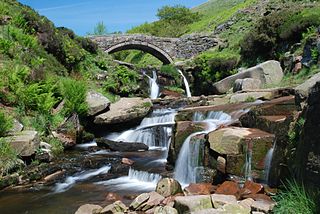
The River Dane is a tributary of the River Weaver that originates in the Peak District area of England. The name of the river is probably from the Old Welsh dafn, meaning a "drop or trickle", implying a slow-moving river.
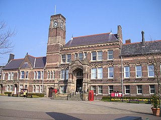
The Metropolitan Borough of St Helens is a metropolitan borough of Merseyside, in North West England. It is named after its largest town St Helens, and covers an area which includes the settlements of Earlestown, Rainhill, Eccleston, Clock Face, Haydock, Billinge, Rainford and Newton-le-Willows.

The River Blakewater is a river running through Lancashire, giving its name to the town of Blackburn.
Bassetts Island is a "Y"-shaped island within Pocasset Harbor and Red Brook Harbor, in Bourne, Massachusetts, USA. 41-40’48” North x 070-38’13” West
Westville is a residential area to the west of Hucknall. It is approximately eight miles north-west of Nottingham, England.
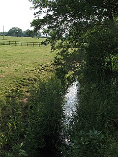
The River Croco is a small river in Cheshire in England. It starts as lowland field drainage west of Congleton, flows along the south edge of Holmes Chapel, and joins the River Dane at Middlewich. It is about 8 miles (13 km) long.
George's Brook is a village located north of Clarenville. The town was unincorporated and was a Local service district with the neighboring community of Milton. In 1950, when it became a Canada Post Office, the first Postmistress was Mona Pelley. By 1956 it had a population of 197.

Moxie Falls is a waterfall in Somerset County, Maine. At a vertical drop of over 90 feet (30 m) into a pool about 17 feet (5 m) deep, Moxie Falls is one of the highest falls in New England. The falls are part of Moxie Stream which flows from Moxie Pond into the Kennebec River approximately 1 kilometer (0.62 mi) downstream the falls. Moxie Stream drains Moxie Pond approximately 5 miles (8.0 km) upstream of the falls.
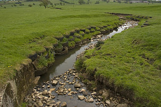
The River Loud is a river of Lancashire, England.

Sabden Brook is a small river, running through Lancashire in England. It is 7.59 miles (12.21 km) long, and has a catchment area of 6.84 square miles (17.723 km2). Rising just to the west of Newchurch-in-Pendle, Sabden Brook moves westward, through its well defined valley, past Sabden Hall to the village of Sabden, east of the town of Whalley.
Stydd Brook is a watercourse in Lancashire, England.

Pendleton Brook is a small river in Lancashire. The brook rises on Pendleton Moor and flows through the village of Pendleton, travelling north west to Higher Standen, then west past Standen Hall. From there, Pendleton Brook flows south of Clitheroe before meeting the River Ribble near Siddows.

Skirden Beck is a minor river in Lancashire, England. It is approximately 4.3 miles (6.85 km) long and has a catchment area of 18.87 square miles (48.882 km2).
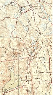
The Broad Brook Canal is a water-supply canal feeding the Springfield Reservoir in Ludlow, Massachusetts, a public water supply for the city of Springfield, Massachusetts. Its northern segment is also known as the Jabish Canal.

The Bonavista Peninsula is a large peninsula on the east coast of the island of Newfoundland in the Canadian province of Newfoundland and Labrador. It consists of 50 incorporated towns/unincorporated communities which have a population of 12,176 as of the 2016 Canadian Census.

Wayne Township is one of fifteen townships in Wayne County, Indiana, United States. As of the 2010 census, its population was 41,217 and it contained 19,510 housing units.
Savick Brook is a watercourse in Lancashire, England, which runs from the outskirts of Longridge westward north of Preston to the River Ribble.
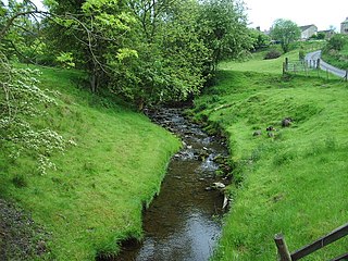
Trawden Brook is a minor river in Lancashire, England. It is 3.48 miles (5.6 km) long and has a catchment area of 4.40 square miles (11.4 km2).

Green Brook is a minor river in Lancashire, England. It is 2.32 miles (3.73 km) long, and including tributaries, has the catchment area of 7.02 square miles (1,818.28 ha).

