
Interstate 95 (I-95) is the main north–south Interstate Highway on the East Coast of the United States, running from U.S. Route 1 (US 1) in Miami, Florida, north to the Houlton–Woodstock Border Crossing between Maine and the Canadian province of New Brunswick. The highway largely parallels the Atlantic coast and US 1, except for the portion between Savannah, Georgia, and Washington, D.C., and the portion between Portland and Houlton in Maine, both of which follow a more direct inland route.

Interstate 83 (I-83) is an Interstate Highway located in the states of Maryland and Pennsylvania in the Eastern United States. Its southern terminus is at a signalized intersection with Fayette Street in Baltimore, Maryland; its northern terminus is at I-81 near Harrisburg, Pennsylvania. I-83 runs from Downtown Baltimore north to I-695 near the northern suburb of Timonium on the Jones Falls Expressway before forming a concurrency with I-695. After splitting from I-695, the route follows the Baltimore–Harrisburg Expressway north to the border between Maryland and Pennsylvania. Upon crossing the state line, I-83 becomes the Veterans of Foreign Wars of the United States Memorial Highway and continues north through York toward the Harrisburg area. The route runs along the southern and eastern portion of the Capital Beltway that encircles Harrisburg before reaching its northern terminus.
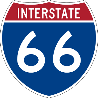
Interstate 66 (I-66) is a 76.32 mile east–west Interstate Highway in the eastern United States. The highway runs from an interchange with I-81 near Middletown, Virginia, on its western end to an interchange with U.S. Route 29 (US 29) in Washington, D.C., at the eastern terminus. Much of the route parallels US 29 or State Route 55 (SR 55) in Virginia. I-66 has no physical or historical connection to US 66, which was located in a different region of the United States.

The Baltimore–Washington Parkway is a controlled-access parkway in the U.S. state of Maryland, running southwest from Baltimore to Washington, D.C. The road begins at an interchange with U.S. Route 50 (US 50) near Cheverly in Prince George's County at the Washington, D.C. border, and continues northeast as a parkway maintained by the National Park Service (NPS) to MD 175 near Fort Meade, serving many federal institutions. This portion of the parkway is dedicated to Gladys Noon Spellman, a representative of Maryland's 5th congressional district, and has the unsigned Maryland Route 295 (MD 295) designation. Commercial vehicles, including trucks, are prohibited within this stretch. This section is administered by the NPS's Greenbelt Park unit. After leaving park service boundaries the highway is maintained by the state and signed with the MD 295 designation. This section of the parkway passes near Baltimore–Washington International Thurgood Marshall Airport.

The Capital Beltway is a 64-mile (103 km) auxiliary Interstate Highway in the Washington metropolitan area that surrounds Washington, D.C., the capital of the United States, and its inner suburbs in adjacent Maryland and Virginia. It is the basis of the phrase "inside the Beltway", used when referring to issues dealing with US federal government and politics. The highway is signed as Interstate 495 (I-495) for its entire length, and its southern and eastern half runs concurrently with I-95.

Interstate 695 (I-695) is a 51.46-mile-long (82.82 km) auxiliary Interstate Highway that constitutes a beltway extending around Baltimore, Maryland, United States. I-695 is officially designated the McKeldin Beltway but is colloquially referred to as either the Baltimore Beltway or 695. The route is an auxiliary route of I-95, intersecting that route southwest of Baltimore near Arbutus and northeast of the city near White Marsh. It also intersects other major roads radiating from the Baltimore area, including I-97 near Glen Burnie, the Baltimore–Washington Parkway near Linthicum, I-70 near Woodlawn, I-795 near Pikesville, and I-83 in the Timonium area. The 19.37-mile (31.17 km) portion of the Baltimore Beltway between I-95 northeast of Baltimore and I-97 south of Baltimore is officially Maryland Route 695 (MD 695) and is not part of the Interstate Highway System but is signed as I-695. The Francis Scott Key Bridge that crossed over the Patapsco River was included in this section of the route before the bridge's collapse on March 26, 2024. The bridge and its approaches were maintained by the Maryland Transportation Authority (MDTA), while the remainder of the Baltimore Beltway is maintained by the Maryland State Highway Administration (MDSHA).
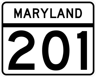
Maryland Route 201 is a state highway in the U.S. state of Maryland. Known for most of its length as Kenilworth Avenue, the highway runs 9.40 miles (15.13 km) from the District of Columbia boundary in Tuxedo, where the highway continues south as District of Columbia Route 295, north to MD 212 in Beltsville. MD 201 is a four to six-lane divided highway that connects Washington, D.C., with the northern Prince George's County municipalities of Cheverly, Bladensburg, Edmonston, Riverdale Park, College Park, Berwyn Heights, and Greenbelt. The highway also provides part of the connections from Interstate 95 (I-95)/I-495 to a pair of Washington Metro stations. MD 201 was built as two separate highways in the late 1920s: MD 201 from Washington, D.C., to Bladensburg and MD 205 from Bladensburg to Greenbelt. These highways, some of which became MD 769, were replaced with a relocated Kenilworth Avenue in the mid 1950s, including the Kenilworth Interchange with U.S. Route 50 and the Baltimore–Washington Parkway in Tuxedo. MD 201 was extended north to Beltsville in the early 1960s. The Maryland State Highway Administration (MDSHA) plans to extend MD 201 north toward Laurel.

Interstate 295 (I-295) in the US state of Maryland and in Washington, D.C., also known as the Anacostia Freeway, is a six-mile (9.7 km) auxiliary Interstate Highway connecting I-95/I-495 and Maryland Route 210 near the Potomac River to I-695 and District of Columbia Route 295 (DC 295) in the Anacostia neighborhood of Washington, D.C.

Interstate 395 (I-395) in Virginia and Washington, D.C., is a 13.79-mile-long (22.19 km) spur route of I-95 that begins at an interchange with I-95 in Springfield and ends at an interchange with US Route 50 (US 50) in Northwest Washington, D.C. It passes underneath the National Mall near the US Capitol and ends at a junction with US 50 at New York Avenue, roughly one mile (1.6 km) north of the 3rd Street Tunnel. Despite its proximity to I-395 in Maryland, the route is unrelated and unconnected.

The Henry G. Shirley Memorial Highway, often shortened to Shirley Highway, consists of a 17.3-mile (27.8 km) portion of Interstates 95 and 395 in the U.S. Commonwealth of Virginia. Shirley Highway was the first limited-access freeway in Virginia. Begun in 1941, the road was completed from U.S. Route 1 in Colchester, Virginia, just north of Woodbridge, to the 14th Street Bridge over the Potomac River between Virginia and Washington, D.C. in 1952.
Interstate 495 (I-495) is an 11.47-mile-long (18.46 km) auxiliary Interstate Highway in the US state of Delaware. The highway, named the Vietnam Veterans Memorial Highway, serves as a six-lane bypass of I-95 around the city of Wilmington. I-495 begins at an interchange with I-95 and I-295 near Newport to the southwest of Wilmington. From here, the road heads east to the Port of Wilmington, where it turns northeast and crosses the Christina River as it heads to the east of downtown Wilmington. Upon reaching Edgemoor, I-495 runs between the Delaware River to the east and U.S. Route 13 (US 13) to the west, continuing to Claymont. In Claymont, I-495 turns north and merges into northbound I-95 at an interchange with Delaware Route 92 (DE 92) just south of the Pennsylvania state line.

Interstate 270 (I-270) is a 34.7-mile (55.8 km) auxiliary Interstate Highway in the U.S. state of Maryland that travels from I-495 just north of Bethesda in Montgomery County north to I-70 in the city of Frederick in Frederick County. It consists of the 32.6-mile (52.5 km) mainline as well as a 2.1-mile (3.4 km) spur that provides access to and from southbound I-495. I-270 is known as the Washington National Pike, and makes up the easternmost stretch of the Dwight D. Eisenhower Highway. Most of the southern part of the route in Montgomery County passes through suburban areas around Rockville and Gaithersburg that are home to many biotech firms. This portion of I-270 is up to 12 lanes wide and consists of a local–express lane configuration as well as high-occupancy vehicle lanes that are in operation during peak travel times. North of the Gaithersburg area, the road continues through the northern part of Montgomery County, passing Germantown and Clarksburg as a six- to eight-lane highway with an HOV lane in the northbound direction only. North of here, I-270 continues through rural areas into Frederick County and toward the city of Frederick as a four-lane freeway.
The Inner Loop was two planned freeways around downtown Washington, D.C. The innermost loop would have formed an oval centered on the White House, with a central freeway connecting the southern segment to the northern segment and then continuing on to Interstate 95. Interstate 95 would have met Interstate 66, Interstate 295, Interstate 695, and US 50 while traversing the Inner Loop. A second loop was an arc across the northern section of the city, beginning at East Capitol Street at the Anacostia River and using the Missouri Avenue NW and Nebraska Avenue NW commercial corridors to terminate in Georgetown.

U.S. Route 50 is a major east–west route of the U.S. Highway system, stretching just over 3,000 miles (4,800 km) from West Sacramento, California, east to Ocean City, Maryland, on the Atlantic Ocean. In the U.S. state of Maryland, US 50 exists in two sections. The longer of these serves as a major route connecting Washington, D.C., with Ocean City; the latter is the eastern terminus of the highway. The other section passes through the southern end of Garrett County for less than 10 miles (16 km) as part of the Northwestern Turnpike, entering West Virginia at both ends. One notable section of US 50 is the dual-span Chesapeake Bay Bridge across the Chesapeake Bay, which links the Baltimore–Washington metropolitan area with the Eastern Shore region, allowing motorists to reach Ocean City and the Delaware Beaches.
Interstate 95 (I-95) is an Interstate Highway running along the East Coast of the United States from Miami, Florida, north to the Canada–United States border at Houlton, Maine. In Maryland, the route is a major highway that runs 110.01 miles (177.04 km) diagonally from southwest to northeast, entering from the District of Columbia and Virginia at the Woodrow Wilson Bridge over the Potomac River, northeast to Maryland's border with Delaware near Elkton. It is the longest Interstate Highway within Maryland and is one of the most traveled Interstate Highways in the state, especially between Baltimore and Washington, D.C., despite alternate routes along the corridor, such as the Baltimore–Washington Parkway, U.S. Route 1 (US 1), and US 29. I-95 also has eight auxiliary routes in the state, the most of any state along the I-95 corridor. Portions of the highway, including the Fort McHenry Tunnel and the Millard E. Tydings Memorial Bridge, are tolled.
Interstate 95 (I-95) is a part of the Interstate Highway System that parallels the East Coast of the United States from Miami, Florida, in the south to Houlton, Maine, in the north. In the US state of Massachusetts, it spans 92 miles (148 km) along a north–south axis. It is the third-longest Interstate Highway in Massachusetts, behind I-90 and I-495, while I-95 in full is the longest north–south Interstate and sixth-longest Interstate Highway in the US.

Interstate 70 (I-70) is a part of the Interstate Highway System that runs from Cove Fort, Utah, to Woodlawn just outside of Baltimore, Maryland. In Maryland, the Interstate Highway runs 91.85 miles (147.82 km) from the Pennsylvania state line in Hancock east to the Interstate's eastern terminus at its junction with I-695. I-70 is the primary east–west Interstate in Maryland; the Interstate Highway connects Baltimore—and Washington, D.C., via I-270—with Western Maryland. The Interstate serves Frederick and Hagerstown directly and provides access to Cumberland via its junction with I-68 at Hancock. I-70 runs concurrently with its predecessor highway, U.S. Route 40 (US 40), from Hancock to Indian Springs in Washington County and from Frederick to West Friendship in Howard County.

U.S. Route 29 (US 29) is a north–south United States Numbered Highway that runs for 1,043.3 miles (1,679.0 km) from Pensacola, Florida, to the western suburbs of Baltimore, Maryland. In the U.S. state of Maryland, US 29 is a major highway that emerges from Washington DC and runs north into eastern Montgomery County, stretching over 25.86 miles (41.62 km) through the state and terminating at Maryland Route 99 (MD 99) outside of Ellicott City. It serves the cities of Columbia and Ellicott City and provides the westernmost north–south route between Washington DC and Baltimore.
The North Central Freeway was a planned freeway in the District of Columbia that would have run from the Inner Loop in D.C. to the Capital Beltway (I-495) at Silver Spring.
Highway revolts have occurred in cities and regions across the United States. In many cities, there remain unused highways, abruptly terminating freeway alignments, and short stretches of freeway in the middle of nowhere, all of which are evidence of larger projects which were never completed. In some instances, freeway revolts have led to the eventual removal or relocation of freeways that had been built.

