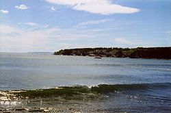
Northern Bay Sands

Last updated
Northern Bay Sands
Northern Bay Sands Sparkling Surf, Newfoundland.jpg
Northern Bay Sands surf
Canada Newfoundland and Labrador relief location map.jpg
Red pog.svg
LocationNL-70, Northern Bay, Newfoundland and Labrador A0A 3B0, Canada
Coordinates 47°56′10″N53°04′37″W / 47.93611°N 53.07694°W / 47.93611; -53.07694 Coordinates: 47°56′10″N53°04′37″W / 47.93611°N 53.07694°W / 47.93611; -53.07694
GeologyBeach
Patrolled by Lifeguards
AccessOpen

Northern Bay Sands is a popular beach and campgrounds in Northern Bay, Newfoundland and Labrador, Canada. In 1775, a ship supposedly crashed off the coast of the beach due to the Great Hurricane of 1775. Throughout the 19th and early 20th century the beach was used as a site for gutting, cleaning and salting fish in the small-boat cod fishery. After Confederation, the beach became a provincial park.

Contents

Tourism at the park – which presently has upwards of 50 campsites – steadily increased over the next few decades. In 1997, a majority of provincial parks in Newfoundland and Labrador were privatized.

The beach is frequented by many tourists between Victoria Day weekend (May 24) and Labour Day weekend in September. In the past there were music festivals, with a large one called The Beach Bash, that took place at least once a summer at the park. Presently, The Beach Bash and other festivals are no longer held and the stage where musicians performed for the festival has been removed. Coincidentally, the current owner and operator of the beach is Neal O'Leary, the independent Newfoundland musician who first started The Beach Bash.

Northern Bay Sands has two freshwater pools on the northern end of the beach and the majority of its campsites on the southern end. There are two bars, a laundromat, a café and a take-out restaurant within walking distance of the beach.

See also

Related Research Articles

Labrador Mainland portion of Newfoundland and Labrador

Labrador is a geographic and cultural region within the Canadian province of Newfoundland and Labrador. It is the primarily continental portion of the province and constitutes 71% of the province's area but is home to only 6% of the province's population. It is separated from the island of Newfoundland by the Strait of Belle Isle. It is the largest and northernmost geographical region in Atlantic Canada.

St. Johns, Newfoundland and Labrador Capital and largest city of Newfoundland and Labrador, Canada

St. John's is the capital and largest city of the Canadian province of Newfoundland and Labrador, located on the eastern tip of the Avalon Peninsula on the island of Newfoundland.

Corner Brook City in Newfoundland and Labrador, Canada

Corner Brook is a city located on the west coast of the island of Newfoundland in the province of Newfoundland and Labrador, Canada. Corner Brook is the fifth largest settlement in Newfoundland and Labrador.

Stephenville, Newfoundland and Labrador Town in Newfoundland and Labrador, Canada

Stephenville is a town in Newfoundland and Labrador, Canada, on the west coast of the island of Newfoundland.

Pancake Bay Provincial Park

Pancake Bay Provincial Park was established in 1968 by Ontario Parks. It is a recreation-class Provincial Park created to help preserve the fragile beach dune ecology. Pancake Bay Provincial Park has one of the highest visitor rates of all the Provincial Parks in the north-east region, and the highest number of campsites. There are 325 campsites, including 160 with electricity. There are three comfort stations. Yurt camping is available in the park. Group camping sites are also available.

Nain, Newfoundland and Labrador Inuit community in Newfoundland and Labrador, Canada

Nain is the northernmost permanent settlement in the Canadian province of Newfoundland and Labrador, within the Nunatsiavut region, located about 370 km (230 mi) by air from Happy Valley-Goose Bay. The town was established as a Moravian mission in 1771 by Jens Haven and other missionaries. As of 2021, the population is 847 mostly Inuit and mixed Inuit-European. Nain is the administrative capital of the autonomous region of Nunatsiavut.

Twillingate Place in Newfoundland and Labrador, Canada

Twillingate is a town of 2,121 people located on the Twillingate Islands ("Toulinquet") in Notre Dame Bay, off the north eastern shore of the island of Newfoundland in the province of Newfoundland and Labrador, Canada. The town is about 100 kilometres (62 mi) north of Lewisporte and Gander.

Conception Bay South Town in Newfoundland and Labrador, Canada

Conception Bay South is a town located on the southern shore of Conception Bay on the Avalon Peninsula of the island of Newfoundland, Province of Newfoundland and Labrador, Canada. The town is commonly called C.B.S. Conception Bay South is the second largest settlement in Newfoundland and Labrador and is part of the St. John's Metropolitan Area.

Carbonear Town in Newfoundland and Labrador, Canada

Carbonear is a town on the Avalon Peninsula in Newfoundland and Labrador, Canada. It overlooks the west side of Conception Bay and had a history long tied to fishing and shipbuilding. Since the late 20th century, its economy has changed to emphasize education, health care, retail, and industry. As of 2018, there were 5,015 people in the community.

Northern Bay, Newfoundland and Labrador

Northern Bay is a small community on the northern tip of Conception Bay on the Bay de Verde Peninsula, Subdivision 1G, Newfoundland and Labrador, Canada.

Great Northern Peninsula Peninsula of Newfoundland, Canada

The Great Northern Peninsula is the largest and longest peninsula of Newfoundland, Canada, approximately 270 km long and 90 km wide at its widest point and encompassing an area of 17,483 km2. It is defined as that part of Newfoundland from Bonne Bay northwards around Cape Norman and Cape Bauld and thence southwards to the head of White Bay, bounded by the Gulf of St. Lawrence on the west, the Strait of Belle Isle on the north and the Labrador Sea and White Bay on the east.

Golden Ears Provincial Park

Golden Ears Provincial Park is a Provincial park in British Columbia, Canada and is 555.9 square kilometres (214.6 sq mi). It is named after the prominent twin peaks which are commonly referred to as Golden Ears. The park's southern end is located on the northern edge of the district municipality of Maple Ridge on the north side of the Fraser River.

Burin, Newfoundland and Labrador Town in Newfoundland and Labrador, Canada

Burin is a town on the Burin Peninsula in Placentia Bay, Newfoundland and Labrador, Canada. The Burin Peninsula is often affectionately nicknamed "The Boot" due to its resemblance to the footwear when seen on a map, with the town of Burin located near the "heel". Burin is approximately 318 km from the capital of St. John's. Settlement in Burin dates to the early 18th century, although documentary evidence indicates that French fishermen had been fishing and exploring the area even earlier.

East Coast Trail

The East Coast Trail (ECT) is a long-distance coastal footpath located in the Canadian province of Newfoundland and Labrador. It is a developed trail over 336 kilometres (209 mi) long, creation of which began in 1994. It is made up of 25 linked wilderness paths and passes through more than 30 communities. It was named one of the best adventure destinations by National Geographic in 2012 and is extended and improved yearly.

North West River Town in Newfoundland and Labrador, Canada

North West River is a small town located in central Labrador. Established in 1743 as a trading post by French Fur Trader Louis Fornel, the community later went on to become a hub for the Hudson's Bay Company and home to a hospital and school serving the needs of coastal Labrador. North West River is the oldest modern settlement in Labrador.

Dildo Run Provincial Park

Dildo Run Provincial Park is a provincial park located on New World Island, Newfoundland and Labrador, Canada. It was opened to the public in 1967. The nearest major town is Twillingate. There are 55 campsites, each with a picnic table, fireplace, garbage can, and room for a vehicle. Fifteen picnic sites offer a view of the ocean. There is also a 1.3 km hiking trail through the forest.

Franco-Newfoundlander

Franco-Newfoundlanders, also known as Franco-Terreneuvians in English or Franco-Terreneuviens in French, are francophone and/or French Canadian residents of the Canadian province of Newfoundland and Labrador. The name Franco-Terreneuvian derives from Terre-Neuve, the French name of Newfoundland.

Newfoundland (island) Island portion of Newfoundland and Labrador, Canada

Newfoundland is a large island off the east coast of the North American mainland and the most populous part of the Canadian province of Newfoundland and Labrador. It has 29 percent of the province's land area. The island is separated from the Labrador Peninsula by the Strait of Belle Isle and from Cape Breton Island by the Cabot Strait. It blocks the mouth of the Saint Lawrence River, creating the Gulf of Saint Lawrence, the world's largest estuary. Newfoundland's nearest neighbour is the French overseas collectivity of Saint Pierre and Miquelon.

Salmon Cove Sands is a provincial park in the Newfoundland and Labrador province of Canada. It is located on Conception Bay in the southeast of the island of Newfoundland where the Salmon Cove River enters Salmon Cove. The majority of the park is a wide beach with gray to black sand. It is surrounded in part by high cliffs. The park lies within the Salmon Cove municiplaity. Usage fees apply.

References