Related Research Articles

The Tlingit are indigenous peoples of the Pacific Northwest Coast of North America. Their language is the Tlingit language, in which the name means 'People of the Tides'. The Russian name Koloshi or the related German name Koulischen may be encountered referring to the people in older historical literature, such as Grigory Shelikhov's 1796 map of Russian America.
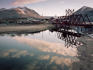
Carcross, originally known as Caribou Crossing, is an unincorporated community in Yukon, Canada, on Bennett Lake and Nares Lake. It is home to the Carcross/Tagish First Nation.
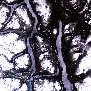
Tagish Lake is a lake in Yukon and northern British Columbia, Canada. The lake is more than 100 km (62 mi) long and about 2 km (1 mi) wide.
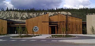
The Kwanlin Dün First Nation (KDFN) or Kwänlin Dän kwächʼǟn is located in and around Whitehorse in Yukon, Canada.

The Carcross/Tagish First Nation is a First Nation native to the Canadian territory of Yukon. Its original population centres were Carcross and Tagish, and Squanga, although many of its citizens also live in Whitehorse. The languages originally spoken by Carcross/Tagish people were Tagish and Tlingit.
The Ta'an Kwach'an Council or Ta'an Kwäch’än Council is a self-governing Indigenous government whose traditional territory is located around the Whitehorse and Lake Laberge area in Canada's Yukon Territory. It split from the Kwanlin Dün First Nation to negotiate a separate land claim. The language originally spoken by the Ta’an Kwäch’än was Southern Tutchone. The Ta’an Kwäch’än comprise people of Southern Tutchone, Tagish and Tlingit descent. Approximately 50 per cent of the Ta’an Kwäch’än citizens now live in Whitehorse, Yukon Territory, with the balance disbursed throughout the rest of Canada, in the United States of America, and abroad. The Ta'an Kwäch’än take their name from Tàa'an Män in the heart of their traditional territory - so they called themselves ″People from Lake Laberge″.
The Teslin Tlingit Council (TTC) is a First Nation band government in the central Yukon in Canada, located in Teslin, Yukon along the Alaska Highway and Teslin Lake. The language originally spoken by the Teslin Tlingit or Deisleen Ḵwáan is Tlingit. Together with the Taku River Tlingit or Áa Tlein Ḵwáan around Atlin Lake of the Taku River Tlingit First Nation in British Columbia, they comprise the Inland Tlingit.
The Yukon Land Claims refer to the process of negotiating and settling Indigenous land claim agreements in Yukon, Canada between First Nations and the federal government. Based on historic occupancy and use, the First Nations claim basic rights to all the lands.
Tagish was a language spoken by the Tagish or Carcross-Tagish, a First Nations people that historically lived in the Northwest Territories and Yukon in Canada. The name Tagish derives from /ta:gizi dene/, or "Tagish people", which is how they refer to themselves, where /ta:gizi/ is a place name meaning "it is breaking up.
Yukon Energy Corporation is a Crown corporation which is the primary producer of electricity in the Canadian territory of Yukon. It also distributes electricity to a small number of locations not served by the privately-owned ATCO Electric Yukon. YEC was established in 1987 to take over the Yukon assets of the Northern Canada Power Commission and is currently organised as a subsidiary of the Yukon Development Corporation. The company's headquarters is in Whitehorse, Yukon near the Whitehorse Rapids hydroelectric generating station.
Southern Lakes was an electoral district in rural Yukon which returned a member to the Legislative Assembly of the Yukon in Canada. It was one of the eight rural ridings in the Yukon at the time.
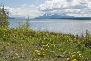
Teslin Lake is a large lake spanning the border between British Columbia and Yukon, Canada. It is one of a group of large lakes in the region of far northwestern BC, east of the upper Alaska Panhandle, which are the southern extremity of the basin of the Yukon River, and which are known in Yukon as "the Southern Lakes". The lake is fed and drained primarily by the Teslin River, south and north, but is also fed from the east by the Jennings River and the Swift River, and from the west by the Hayes River.
Kusawa Lake is a lake in the southern Yukon, Canada. Kusawa means "long narrow lake" in the Tlingit language. The Kusawa Lake is a lake in Canada's Yukon Territory. It is located at an altitude of 671 m (2,201 ft) and is 60 km (37 mi) southwest of Whitehorse near the British Columbia border. It meanders over a length of 75 km (47 mi) with a maximum width of about 2.5 km (1.6 mi) through the mountains in the north of the Boundary Ranges. It is fed by the Primrose River and Kusawa River. The Takhini outflows to the Yukon River from the northern tip of Kusawa Lake. Kusawa Lake has an area of 142 km2 (55 sq mi). The lake has a maximum depth of 140 m (460 ft) and is of glacial origin. It is a common tourist destination and is also popular for fishing.
The Taku River Tlingit First Nation are the band government of the Inland Tlingit in far northern British Columbia, Canada and also in Yukon. They comprise two ḵwaan (tribes) of the Tlingit people, who are otherwise coastal, the Áa Tlein Ḵwáan of the Atlin Lake area and the Deisleen Ḵwáan of Teslin Lake, whose main focus is the Teslin Tlingit Council in Teslin, Yukon. Their band offices are in Atlin, British Columbia.
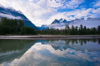
The Transboundary Watershed Region is a region of northwest British Columbia and southeast Alaska that includes the Tatshenshini-Alsek, Chilkat, Chilkoot, Skagway, Taiya, Taku, Iskut-Stikine, Unuk, and Whiting watersheds. The region extends from high alpine tundra, through boreal landscapes and coastal rainforests, to the island marine environment of southeast Alaska, covering over 130,000 square kilometres.

Mount Lorne-Southern Lakes is an electoral district which returns a member to the Legislative Assembly of Yukon in Canada. It is one of the Yukon's eight rural ridings.

The Indigenous peoples of Yukon are ethnic groups who, prior to European contact, occupied the former countries now collectively known as Yukon. While most First Nations in the Canadian territory are a part of the wider Dene Nation, there are Tlingit and Métis nations that blend into the wider spectrum of indigeneity across Canada. Traditionally hunter-gatherers, indigenous peoples and their associated nations retain close connections to the land, the rivers and the seasons of their respective countries or homelands. Their histories are recorded and passed down the generations through oral traditions. European contact and invasion brought many changes to the native cultures of Yukon including land loss and non-traditional governance and education. However, indigenous people in Yukon continue to foster their connections with the land in seasonal wage labour such as fishing and trapping. Today, indigenous groups aim to maintain and develop indigenous languages, traditional or culturally-appropriate forms of education, cultures, spiritualities and indigenous rights.
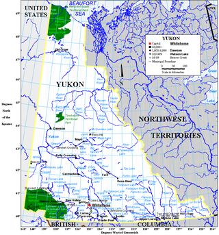
The Yukon Ice Patches are a series of dozens of ice patches in the southern Yukon discovered in 1997, which have preserved hundreds of archaeological artifacts, with some more than 9,000 years old. The first ice patch was discovered on the mountain Thandlät, west of the Kusawa Lake campground which is 60 km (37 mi) west of Whitehorse, Yukon. The Yukon Ice Patch Project began shortly afterwards with a partnership between archaeologists in partnership with six Yukon First Nations, on whose traditional territory the ice patches were found. They include the Carcross/Tagish First Nation, the Kwanlin Dün First Nation, the Ta’an Kwäch’än Council, the Champagne and Aishihik First Nations, the Kluane First Nation, and the Teslin Tlingit Council.

The Gwichʼin Tribal Council is a First Nations organization representing the Gwichʼin people of northern Canada, owning approximately 23,884 square kilometres of land in Yukon and the Northwest Territories. It was created in 1992 with the final ratification of the Gwichʼin Comprehensive Land Claim Agreement with the Government of Canada. Negotiations to achieve a Final Agreement, and thus, Gwichʼin self-government, are ongoing.
References
- 1 2 3 4 5 "Northern Regional Negotiations Table". Executive Council of British Columbia. 2009. Retrieved July 26, 2009.
- ↑ "Carcross/Tagish". Crown–Indigenous Relations and Northern Affairs Canada . Government of Canada. 2009. Retrieved July 26, 2009.
- ↑ "Champagne and Aishihik". Crown–Indigenous Relations and Northern Affairs Canada . Government of Canada. 2009. Retrieved July 26, 2009.
- ↑ "Taku River Tlingit". Crown–Indigenous Relations and Northern Affairs Canada . Government of Canada. 2009. Retrieved July 26, 2009.
- ↑ "Teslin Tlingit Council". Crown–Indigenous Relations and Northern Affairs Canada . Government of Canada. 2009. Retrieved July 26, 2009.