Related Research Articles

Namadgi National Park is a protected area in the south-west of the Australian Capital Territory (ACT), bordering Kosciuszko National Park in New South Wales. It lies approximately 40 kilometres (25 mi) southwest of Canberra, and occupies approximately 46 percent of the ACT's land area.
Mount Remarkable National Park is a protected area in the Australian state of South Australia located about 238 kilometres (148 mi) north of the state capital of Adelaide and 25 kilometres (16 mi) east of Port Augusta. It is also the name of the highest peak in the park, with a height of 960 metres (3,150 ft).

The Darling Scarp, also referred to as the Darling Range or Darling Ranges, is a low escarpment running north–south to the east of the Swan Coastal Plain and Perth, Western Australia. The escarpment extends generally north of Bindoon, to the south of Pemberton. The adjacent Darling Plateau goes easterly to include Mount Bakewell near York and Mount Saddleback near Boddington. It was named after the Governor of New South Wales, Lieutenant-General Ralph Darling.
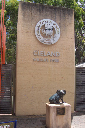
Cleland National Park, formerly Cleland Conservation Park, is a protected area located in the Adelaide Hills, South Australia about 22 kilometres (14 mi) south-east of the Adelaide city centre. It conserves a significant area of natural bushland on the Adelaide Hills face, including Mount Lofty Summit and Waterfall Gully.

The Railway Reserves Heritage Trail – also on some maps as Rail Reserve Heritage Trail or Rail Reserves Historical Trail, and frequently referred to locally as the Bridle Trail or Bridle Track – is within the Shire of Mundaring in Western Australia.

The Murchison is a loosely defined area of Western Australia located within the interior of the Mid West region. It was the subject of a major gold rush in the 1890s and remains a significant mining district. The Murchison is also included as an interim Australian bioregion. The bioregion is loosely related to the catchment area of the Murchison River and has an area of 281,205 square kilometres (108,574 sq mi).

Nuytsland Nature Reserve is a protected area of Western Australia in the south-eastern part of the state, on the south coast.

Yalgoo is an interim Australian bioregion located in Western Australia. It has an area of 5,087,577 hectares. The bioregion, together with the Avon Wheatbelt and Geraldton Sandplains bioregions, is part of the larger Southwest Australia savanna ecoregion as classified by the World Wildlife Fund.
The south coast of Western Australia comprises the Western Australian coastline from Cape Leeuwin to Eucla. This is a distance of approximately 1,600 kilometres (1,000 mi), fronting the Great Australian Bight and the Southern Ocean.
Mount Manning Range Nature Reserve is a nature reserve in the Goldfields region of Western Australia north of Southern Cross in the area known as the Northern Yilgarn, in the Coolgardie bioregion. It originally covered an area of 170,000 hectares, but, as of 2022, its size stands at 36,607 hectares.
Mount Elvire Station was a pastoral lease and sheep station located approximately 177 kilometres (110 mi) south west of Leonora in the Goldfields-Esperance region of Western Australia.
Clackline Nature Reserve is the largest nature reserve in the Shire of Northam. It is located approximately one kilometre (0.62 mi) north of Clackline, in Western Australia's Wheatbelt region. The reserve is extends east to Clackline–Toodyay Road, south to one kilometre (0.62 mi) before Great Eastern Highway, and west to an unnamed road that runs north-west from Refractory Road. In March 2005, the reserve was 693.7 hectares in size, with an additional 45 hectares added in 2008/09. It is listed on the non-statutory Register of the National Estate.
The Helena and Aurora Range or Bungalbin is a range of mountains and hills in the Wheatbelt region of Western Australia, 100 kilometres (62 mi) north-east of Southern Cross and 50 km (31 mi) north-east of Koolyanobbing within the Shire of Yilgarn. The range is the largest of six banded ironstone ranges that are situated within the Coolgardie IBRA region. The range has a length of 36.9 km (22.9 mi) and the highest point has an elevation of 702 m (2,303 ft).
The Black Jungle Conservation Reserve is a protected area in the Northern Territory of Australia near the territorial capital of Darwin. The rural area of Darwin and its development has a contrasting history to the more southern regions and their rural zones. The development of the rural area around Darwin occurred after 1950 as agricultural ventures were trialed. Prior to this the area was tropical savanna with pockets of monsoon rainforest and melaleuca swamps, unchanged for thousands of years, except by the traditional Aboriginal owners of the land who hunted and gathered and managed the landscape with fire. Black Jungle Conservation Reserve is a part of the Adelaide River Coastal Floodplain system which encompasses Black Jungle and Lambells Lagoon Conservation Reserves, Fogg Dam, Leaning Tree Lagoon Nature Park, Melacca Swamp and Djukbinj National Park. These Reserves encompass a range of wetland types and form part of the internationally significant Adelaide River floodplain.
The Department of Parks and Wildlife (DPaW) was the department of the Government of Western Australia responsible for managing lands described in the Conservation and Land Management Act 1984 and implementing the state's conservation and environment legislation and regulations. The minister responsible for the department was the Minister for the Environment.
Southern Beekeeper's Nature Reserve is a nature reserve in the Wheatbelt region of Western Australia, approximately 240 kilometres (149 mi) north of Perth. It is one of 90 nature reserves operated in the Department of Parks and Wildlife's Moora District. Access to much of the reserve is provided by Indian Ocean Drive. Information sites at Southern Beekeeper's include the Molah Hill vista point and Hill River.

Wapma Thura–Southern Flinders Ranges National Park is a protected area in the southern Flinders Ranges in South Australia, proclaimed on 25 November 2021. The area comprises several former conservation parks.
Helena and Aurora Ranges National Park, located in the Helena and Aurora Range, is a proposed national park in the Goldfields–Esperance and Wheatbelt regions of Western Australia, 440 km (270 mi) east of Perth. The proposed national park, with an initial size of 149,157 hectares, subsequently extended to 333,127 hectares, is located in the Shires of Menzies and Yilgarn and is part of the Coolgardie bioregion.
References
- ↑ "Excalibur Mining". excaliburmining.com.au.
- ↑ "Northern Yilgarn Conservation Reserves". ExplorOz.
- ↑ "WA Country Hour". abc.net.au.
- ↑ "Have your say on draft plans in preparation - Department of Environment and Conservation". Archived from the original on 13 July 2012. Retrieved 2 June 2012.
- ↑ Western Australia. Dept. of Conservation and Land Management (2006), Northern Yilgarn (Mt Manning Range Nature Reserve, Mt Elvire and Jaurdi) Conservation Reserves management plan : Management plan newsletter : edition 1 (February 2006), Dept. of Conservation & Land Management, retrieved 25 February 2015
- ↑ Chapman, Andrew; Lyons, Michael N (1997), A biological survey of the Helena and Aurora Range, eastern goldfields, Western Australia, Dept. of Conservation & Land Management, retrieved 25 February 2015
| | This article about a location in Western Australia is a stub. You can help Wikipedia by expanding it. |