The University of Hildesheim emerged from the Teacher's Training University of Lower Saxony.

The Pembina Valley is the name given to the south-central region of the province of Manitoba, Canada. It is named for its major geographical feature, the Pembina Valley, which runs through the southwestern part of the region.

Ninh Bình city is a small city in the Red River Delta of northern Vietnam; it is the capital of Ninh Bình Province.

Marymont is one of the northern neighbourhoods of Warsaw, Poland, administratively a part of the boroughs of Żoliborz (Marymont-Potok) and Bielany. Named after the queen of Poland Maria Kazimiera, wife of King John III Sobieski, it initially housed a small summer manor. In the 18th century, it became notable for the large number of windmills located there on the high escarpment of the Vistula. In the 19th century, the area became one of the favourite weekend resting places, joined with the city centre by boat communication and a horse tram. In the 1920s, parts of the neighbourhood were built-up with residential areas. The Marymont Warsaw Metro station opened here in December 2006.

Potawatomi Point is an unincorporated community in Eel Township, Cass County, Indiana.

Von Gimborn Arboretum is a large living collection of woody plants in the Netherlands.The arboretum is situated in Doorn, province of Utrecht, about 25 km to the east from the city of Utrecht, and together with its nursery currently occupies an area of 27 ha. It is named after its founder, German ink manufacturer Max Th. Von Gimborn (1872–1964), which started it in 1924 as a private collection of conifers and ericaceous plants. The collection was laid down as a 23 ha landscape garden designed by Gerard Bleeker. It is still one of the largest conifer collections in Western Europe, though now it contains many other trees and shrubs as well. It holds national plant collections of conifers, Ericaceae, Aceraceae, Betulaceae, Euonymus, Fraxinus, Laburnum, Magnolia and Syringa. A number of cultivars of woody plants originate there. The arboretum is open to the public daily for a small fee.

Nor Kyank is a village in the Shirak Province of Armenia.
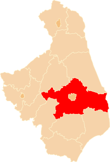
Odnoga-Kuźmy is a village in the administrative district of Gmina Michałowo, within Białystok County, Podlaskie Voivodeship, in north-eastern Poland, close to the border with Belarus.
Koźliki is a village in the administrative district of Gmina Zabłudów, within Białystok County, Podlaskie Voivodeship, in north-eastern Poland.

Shahumyani trchnafabrika is a village in the Armavir Province of Armenia.
Batogowo is a village in the administrative district of Gmina Sypniewo, within Maków County, Masovian Voivodeship, in east-central Poland.

Town Centre is a major MTR Light Rail stop. It is located at ground level at Tuen Mun Heung Sze Wui Road in Tuen Mun Town Centre, Tuen Mun District, Hong Kong. It began service on 18 September 1988 and belongs to Zone 2.

On Ting is an MTR Light Rail stop located at ground level at Tuen Mun Heung Sze Wui Road between On Ting Estate and Yau Oi Estate, in Tuen Mun District. It began service on 18 September 1988 and belongs to Zone 2.

Czachrowo is a village in the administrative district of Gmina Września, within Września County, Greater Poland Voivodeship, in west-central Poland. It lies approximately 4 kilometres (2 mi) south-west of Września and 45 km (28 mi) east of the regional capital Poznań.

Joniny Wielkie is a settlement in the administrative district of Gmina Karsin, within Kościerzyna County, Pomeranian Voivodeship, in northern Poland. It lies approximately 9 kilometres (6 mi) north-west of Karsin, 18 km (11 mi) south-west of Kościerzyna, and 66 km (41 mi) south-west of the regional capital Gdańsk.
Czółnów is a village in the administrative district of Gmina Myślibórz, within Myślibórz County, West Pomeranian Voivodeship, in north-western Poland.
Elton is a rural municipality in the Canadian province of Manitoba, located to the north of the city of Brandon. The community was incorporated in 1883, and its first officials took office the following year.
Asian Highway 76 (AH76) is a major road of northern Afghanistan. It connects Pole khomri at AH7 to Mazar-i-Sharif, passing through Samangan on the way, and then passes west and eventually ends at Herat, where it unites with AH1 and AH77 At Mazar-e-Sharif the road continues and joins the A01 and AH77 highways. Another road passes north from the A76 and connects it to Termiz in southern Uzbekistan. Note though that this "other road" is often regarded as a continuation of the A76, although it is actually part of the historical Pamir Highway, now known as the M41 highway (AH62). This road links Mazar-i-Sharif across the Amu Darya river, to Termiz. The Pamir Highway or the M41 is an extremely important highway of Uzbekistan, Tajikistan and Kyrgyzstan, which connects Termiz to Kara Balta to the west of Bishkek and links with the M39 highway twice at both cities.
Key is an unincorporated community in Belmont County, in the U.S. state of Ohio.


