Nowra Sandstone

Last updated

Nowra Sandstone
Stratigraphic range: Late Permian
Pigeon House Mountain.jpg
Type Geological formation
Thicknessup to 90 metres (300 ft)
Lithology
Primary Sandstone
Location
CountryFlag of Australia (converted).svg  Australia
Extent Sydney Basin

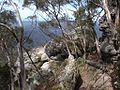
Nowra Sandstone occurs in the Sydney Basin in eastern Australia. Formed in the Late Permian, the rock stratum is up to 90 metres thick. [1] The popular bushwalking areas of Pigeon House Mountain and the Budawangs feature this rock type.

Contents

See also

Related Research Articles

Budawang National Park is a national park in New South Wales, Australia, located approximately 200 kilometres (120 mi) southwest of Sydney and 25 kilometres (16 mi) north of Batemans Bay. It contains part of the Budawang Mountain Range.

<span class="mw-page-title-main">Conjola National Park</span> Protected area in New South Wales, Australia

Conjola National Park covers 11,060 hectares and lies on the mid south coast of New South Wales, Australia, between Sussex Inlet and Lake Conjola, 165 km southwest of Sydney.

<span class="mw-page-title-main">Morton National Park</span> Protected area in New South Wales, Australia

The Morton National Park is a 199,745-hectare (493,580-acre) national park located in the Southern Highlands, South Coast and Illawarra regions of New South Wales, Australia, situated approximately 170 kilometres (110 mi) south southwest of Sydney.

<span class="mw-page-title-main">Nowra</span> Town in New South Wales, Australia

Nowra is a city in the South Coast region of New South Wales, Australia. It is located 160 kilometres (99 mi) south-southwest of the state capital of Sydney. As of the 2021 census, Nowra has an estimated population of 22,584. Situated in the southern reaches of the Sydney basin, Nowra is the seat and commercial centre of the City of Shoalhaven.

<span class="mw-page-title-main">Clyde River (New South Wales)</span> River in Australia

The Clyde River is an open intermediate tide-dominated drowned valley estuary or perennial river that flows into the Tasman Sea at Batemans Bay, located in the South Coast region of New South Wales, Australia.

<span class="mw-page-title-main">Shoalhaven River</span> River in Australia

The Shoalhaven River is a perennial river that rises from the Southern Tablelands and flows into an open mature wave dominated barrier estuary near Nowra on the South Coast of New South Wales, Australia.

<span class="mw-page-title-main">Budawang Range</span>

The Budawang Range, commonly called The Budawangs, a rugged mountain range within the Budawang National Park and the Morton National Park, are part of a spur off the Great Dividing Range and are located in the South Coast region of New South Wales, Australia.

<span class="mw-page-title-main">Sydney Basin</span> Sedimentary basin and region in New South Wales, Australia

The Sydney Basin is an interim Australian bioregion and is both a structural entity and a depositional area, now preserved on the east coast of New South Wales, Australia and with some of its eastern side now subsided beneath the Tasman Sea. The basin is named for the city of Sydney, on which it is centred.

<span class="mw-page-title-main">Pigeon House Mountain</span>

Pigeon House Mountain is a mountain at an elevation of 720 metres (2,360 ft) AHD  on the Budawang Range that is situated within the Morton National Park, located on the South Coast region of New South Wales, Australia.

<span class="mw-page-title-main">Red-crowned toadlet</span> Species of amphibian

The red-crowned toadlet is a species of Australian ground frog, restricted to the Sydney Basin, New South Wales. It is only found around sandstone escarpment areas around Sydney, from Ourimbah in the north, Nowra to the south and the Blue Mountains areas to the west.

<span class="mw-page-title-main">Geography of Sydney</span> Overview of the geography of Sydney

The geography of Sydney is characterised by its coastal location on a basin bordered by the Pacific Ocean to the east, the Blue Mountains to the west, the Hawkesbury River to the north and the Woronora Plateau to the south. Sydney lies on a submergent coastline on the east coast of New South Wales, where the ocean level has risen to flood deep river valleys (rias) carved in the Sydney sandstone. Port Jackson, better known as Sydney Harbour, is one such ria.

<span class="mw-page-title-main">Cumberland Plain</span> Plain in Australia

The Cumberland Plain, also known as Cumberland Basin, is a relatively flat region lying to the west of Sydney CBD in New South Wales, Australia. An IBRA biogeographic region, Cumberland Basin is the preferred physiographic and geological term for the low-lying plain of the Permian-Triassic Sydney Basin found between Sydney and the Blue Mountains, and it is a structural sub-basin of the Sydney Basin.

Geologically the Australian state of New South Wales consists of seven main regions: Lachlan Fold Belt, the Hunter-Bowen Orogeny or New England Orogen (NEO), the Delamerian Orogeny, the Clarence Moreton Basin, the Great Artesian Basin, the Sydney Basin, and the Murray Basin.

<i>Persoonia mollis</i> Species of flowering plant

Persoonia mollis, commonly known as soft geebung, is a plant in the family Proteaceae and is endemic to New South Wales. It is an erect to prostrate shrub with linear to oblong or spatula-shaped leaves, yellow flowers in groups of up to thirty on a rachis up to 150 mm (5.9 in) long and relatively small fruit.

<span class="mw-page-title-main">Wog Wog</span> Town in New South Wales, Australia

Wog Wog is a locality in the Queanbeyan–Palerang Regional Council, New South Wales, Australia. It is located on the south side of the Corang River and to the east of the road from Braidwood to Nowra about 34 km north of Braidwood and 96 km southwest of Nowra. At the 2021 census, it had a population of 15. It consists mainly of forest, including parts of the Morton National Park. Its eastern boundary runs along the Budawang Range and includes Wog Wog Mountain and Corang Peak.

<span class="mw-page-title-main">Corang</span> Town in New South Wales, Australia

Corang is a locality in the Queanbeyan–Palerang Regional Council, New South Wales, Australia. It is located on the north side of the Corang River and to the east of the road from Braidwood to Nowra about 46 km north of Braidwood and 75 km southwest of Nowra. At the 2016 census, it had a population of 13. It consists mainly of forest and most of it lies in the Morton National Park. Its eastern boundary runs along the Budawang Range and includes Mount Tarn, Sturgiss Mountain and Quiltys Mountain.

<span class="mw-page-title-main">The Wool Road</span> Historic road in New South Wales, Australia

The Wool Road was a historic road in New South Wales, Australia, that ran from Nerriga to what is now called Vincentia on Jervis Bay. It was constructed privately in 1841, using convict labour. Its purpose was to provide a shorter route to a seaport for wool grown at Braidwood and beyond. The historical significance of The Wool Road is that it was the first road, capable of being used by wheeled vehicles, linking the inland area around Braidwood to the South Coast. The road led to the foundation of the privately-owned port town of South Huskisson and the adjacent 'government townshIp' of Huskisson.

<i>Epacris gnidioides</i> Species of flowering plants

Epacris gnidioides, commonly known as Budawangs cliff-heath, is a species of flowering plant in the heath family Ericaceae and is endemic to a restricted area of New South Wales. It is a small, creeping shrub with hairy branches, sharply-pointed lance-shaped leaves, and tube-shaped, white flowers. Originally described as Rupicola gnidioides, it was at one time regarded as the only species in the genus Budawangia under the synonym Budawangia gnidioides.

The Corn Trail was an early bridle track linking the Southern Tablelands to the coastal valley of the Buckenbowra River, in New South Wales, Australia. It was restored and reopened as a walking track in 1988.

<span class="mw-page-title-main">Yatte Yattah</span> Suburb of City of Shoalhaven, New South Wales, Australia

Yatte Yattah is a historically significant suburb on the South Coast of New South Wales. It is located on the Princes Highway about 4 km north of Milton and 2 km south of Conjola Lake. At the 2021 Census, the population was 189.

References

  1. "Nowra Sandstone". Geoscience Australia. Australian Government. Retrieved 1 October 2012.