Konary is a village in the administrative district of Gmina Przeworno, within Strzelin County, Lower Silesian Voivodeship, in south-western Poland. Prior to 1945 it was in Germany and the name of the village was then Kunern and it belonged to the family von Gaffron.
Ciepień is a village in the administrative district of Gmina Zbójno, within Golub-Dobrzyń County, Kuyavian-Pomeranian Voivodeship, in north-central Poland.
Miłachówek is a village in the administrative district of Gmina Topólka, within Radziejów County, Kuyavian-Pomeranian Voivodeship, in north-central Poland. It lies approximately 5 kilometres (3 mi) west of Topólka, 16 km (10 mi) south-east of Radziejów, and 57 km (35 mi) south of Toruń.
Głodowo is a village in the administrative district of Gmina Nowe, within Świecie County, Kuyavian-Pomeranian Voivodeship, in north-central Poland. It lies approximately 10 kilometres (6 mi) west of Nowe, 28 km (17 mi) north of Świecie, 69 km (43 mi) north of Toruń, and 71 km (44 mi) north-east of Bydgoszcz.
Mircze is a village in Hrubieszów County, Lublin Voivodeship, in eastern Poland, close to the border with Ukraine. It is the seat of the gmina called Gmina Mircze. It lies approximately 19 kilometres (12 mi) south of Hrubieszów and 115 km (71 mi) south-east of the regional capital Lublin.
Dobromil is a village in the administrative district of Gmina Bielsk Podlaski, within Bielsk County, Podlaskie Voivodeship, in north-eastern Poland. It lies approximately 7 kilometres (4 mi) south-west of Bielsk Podlaski and 45 km (28 mi) south of the regional capital Białystok.
Kolonia Przerąb is a village in the administrative district of Gmina Masłowice, within Radomsko County, Łódź Voivodeship, in central Poland. It lies approximately 5 kilometres (3 mi) north-west of Masłowice, 22 km (14 mi) east of Radomsko, and 75 km (47 mi) south of the regional capital Łódź.
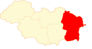
Lubanów is a village in the administrative district of Gmina Błaszki, within Sieradz County, Łódź Voivodeship, in central Poland.
Żelazna is a village in the administrative district of Gmina Skierniewice, within Skierniewice County, Łódź Voivodeship, in central Poland. It lies approximately 10 kilometres (6 mi) south of Skierniewice and 47 km (29 mi) east of the regional capital Łódź.
Mościska is a village in the administrative district of Gmina Trojanów, within Garwolin County, Masovian Voivodeship, in east-central Poland.
Gilino is a village in the administrative district of Gmina Bielsk, within Płock County, Masovian Voivodeship, in east-central Poland. It lies approximately 3 kilometres (2 mi) south of Bielsk, 14 km (9 mi) north-east of Płock, and 95 km (59 mi) north-west of Warsaw.
Józefowo is a village in the administrative district of Gmina Kleczew, within Konin County, Greater Poland Voivodeship, in west-central Poland.
Maciejowice is a village in the administrative district of Gmina Otmuchów, within Nysa County, Opole Voivodeship, in south-western Poland, close to the Czech border. It lies approximately 5 kilometres (3 mi) north-west of Otmuchów, 15 km (9 mi) west of Nysa, and 60 km (37 mi) west of the regional capital Opole.
Sarnowice is a village in the administrative district of Gmina Otmuchów, within Nysa County, Opole Voivodeship, in south-western Poland, close to the Czech border. It lies approximately 4 kilometres (2 mi) north-west of Otmuchów, 15 km (9 mi) west of Nysa, and 61 km (38 mi) west of the regional capital Opole.
Wętfie is a village in the administrative district of Gmina Kościerzyna, within Kościerzyna County, Pomeranian Voivodeship, in northern Poland. It lies approximately 4 kilometres (2 mi) north-east of Kościerzyna and 47 km (29 mi) south-west of the regional capital Gdańsk.
Polichno is a settlement in the administrative district of Gmina Kępice, within Słupsk County, Pomeranian Voivodeship, in northern Poland. It lies approximately 12 kilometres (7 mi) south of Kępice, 39 km (24 mi) south of Słupsk, and 119 km (74 mi) west of the regional capital Gdańsk.
Świchowo is a village in the administrative district of Gmina Łęczyce, within Wejherowo County, Pomeranian Voivodeship, in northern Poland. It lies approximately 8 kilometres (5 mi) north of Łęczyce, 27 km (17 mi) west of Wejherowo, and 61 km (38 mi) north-west of the regional capital Gdańsk.
Olchowo is a village in the administrative district of Gmina Nowogard, within Goleniów County, West Pomeranian Voivodeship, in north-western Poland. It lies approximately 4 kilometres (2 mi) south-west of Nowogard, 21 km (13 mi) north-east of Goleniów, and 42 km (26 mi) north-east of the regional capital Szczecin.
Pienice is a settlement in the administrative district of Gmina Police, within Police County, West Pomeranian Voivodeship, in north-western Poland, close to the German border. It lies approximately 15 kilometres (9 mi) north of Police and 27 km (17 mi) north of the regional capital Szczecin.
Zamęcie is a settlement in the administrative district of Gmina Szczecinek, within Szczecinek County, West Pomeranian Voivodeship, in north-western Poland.