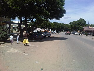
Rusape is a town in eastern Zimbabwe.

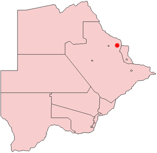
Francistown is the second-largest city in Botswana, with a population of about 103,417 and 147,122 inhabitants for its agglomeration at the 2022 census. It is located in eastern Botswana, about 400 kilometres (250 mi) north-northeast from the capital, Gaborone. Francistown is located at the confluence of the Tati and Ntshe rivers, and near the Shashe River and 90 kilometres (56 mi) from the international border with Zimbabwe.

The North-East District is one of the administrative districts of Botswana. Its capital is Francistown. In 2011, North-East had a population of 60,264 people. The district is predominantly occupied by Kalanga-speaking people, the BaKalanga. The district is administered by a district administration and district council, which are responsible for local administration.
Letlhakane is a village in the Central District of Botswana. Letlhakane is the headquarters of the Boteti sub-district. It is located south of Mmatshumo and the population of the village was 22,911 in 2011 census.
Masunga /ˈmɑːsuŋɡʌ/ is a Bakalanga settlement in the North-East District of Botswana. The village is the Headquarters of the North East District. The nearest city is Francistown which is about 120 km (75 mi) away. The Chief of the region is Kgosi Thabo Maruje Masunga III, who took over from his uncle Christopher Masunga.

Thamaga is a large village located in the Kweneng District of Botswana and about 40 km west of the capital city Gaborone. It is home to 19,547 inhabitants at the 2011 census. It is becoming year by year like a suburb part of the Gaborone agglomeration.

Tonota is a village located in the Central District of Botswana.

Tutume is a large Bakalanga village located in the Tutume District of Botswana, about 50 km from the Zimbabwe border gate at Maitengwe. The nearest city is Francistown, about 100 km away. The village is a district headquarters and has a population of 23,000 .It is made up of wards: Sitabule(Madikwe),Tjilagwani(Selolwane), Thini and Madandume (Magapatona). In each ward there is a headman and his advisers in the kgotla. The main kgotla is located in Madikwe ward near Tutume Central Primary School. The village was named after the river "TUTUME", in Kalanga they will say "gwizi go Tutuma", meaning that the river was overflowing.
Ncojane or Nojane is a town in the Kalahari desert of Ghanzi District, western Botswana. It is located 20 kilometres from the border with Namibia, and it has a primary School called Ncojane Primary School and secondary school called Marakanelo Community Junior Secondary School and a clinic. The population was 1,439 in 2001 census.
Plumtree is a town in Zimbabwe. Marula trees, wild plum trees grow abundantly in the area. The town was once called Getjenge by baKalanga. Another name by which it is often called, is Titji, meaning station and referring to the railway station which was operating in the area around 1897.
Mapoka is a small village in the North-East District of Botswana. Its neighboring villages are Nlapkhwane, Moroka, and Masukwane. The 2001 population and housing census put its population at 1,540.

Lupane ( luːpɑːnɛ) District is located in the Matabeleland North Province of Zimbabwe, and it is also the Provincial Capital. The District is situated at an elevation of 976 m with a population of 107,000 inhabitants by 2022. Lupane Town is the main center of the district located 172 km from Bulawayo along the A8 Victoria Falls Road. The Government Provincial Administrative offices are located at the Town Centre. A new university near the Town has been established under the name Lupane State University, which caters for the region and beyond. The word Lupane is thought to be a Kalanga or Lozwi word.
Goshwe is a village in Central District of Botswana. It is located close to the border with Zimbabwe and has a primary school called Goshwe primary school and a junior secondary school. The population was 1,156 in 2001 census.
Letlhakeng or Lethakeng is an urban village in Kweneng District of Botswana. The village is located 75 km north-west of Molepolole. The population of Letlhakeng was 7,229 in the 2011 census.

Many languages are spoken, or historically have been spoken, in Zimbabwe. Since the adoption of its 2013 Constitution, Zimbabwe has 16 official languages, namely Chewa, Chibarwe, English, Kalanga, Koisan, Nambya, Ndau, Ndebele, Shangani, Shona, sign language, Sotho, Tonga, Tswana, Venda, Xhosa. The country's main languages are Shona, spoken by over 70% of the population, and Ndebele, spoken by roughly 20%. English is the country's lingua franca, used in government and business and as the main medium of instruction in schools. English is the first language of most white Zimbabweans, and is the second language of a majority of black Zimbabweans. Historically, a minority of white Zimbabweans spoke Afrikaans, Greek, Italian, Polish, and Portuguese, among other languages, while Gujarati and Hindi could be found amongst the country's Indian population. Deaf Zimbabweans commonly use one of several varieties of Zimbabwean Sign Language, with some using American Sign Language. Zimbabwean language data is based on estimates, as Zimbabwe has never conducted a census that enumerated people by language.

The Kalanga or BaKalanga are a southern Bantu ethnic group mainly inhabiting Matebeleland in Zimbabwe, northern Botswana, and parts of the Limpopo Province in South Africa.
John Madawo Nswazwi (1868-1960) was a chief of the BaKalanga Baka-Nswazwi. He was born in Nswazwi in then Bechuanaland in 1875. He ruled from 1910 to 1960 having succeeded his father, Kuswani Nswazwi. He was exiled to Mafikeng in 1947 by the colonial government as a result of a conflict with the Bangwato regent Tshekedi Khama. After he was released In 1948, Chief Nswazwi went on exile to Rhodesia which later changed its name to Zimbabwe. He died on May 14, 1960. He was interred in Jetjeni but his remains were later transferred to Nswazwi village in 2002.
BaTalaote are an ethnic group found in the central district of Botswana and south-western parts of Zimbabwe. They are part of a large group of ethnic groups called Bakalanga. Over the years Batalaote lost their language and adopted Kalanga for those in Zimbabwe and Sengwato, which is spoken by the Bangwato, for those in Botswana. The Talaunda and the Wadoma could share a common ancestor. Both tribes have significantly high cases of ectrodactyly.

The people of the country called Botswana are all referred to as Batswana(pl)/ Motswana(s) in reference to the country name or the land they all hail from, that is regardless of ethnicity, language, skin colour or heritage.
Zwenshambe is a village in the North-East District of Botswana. It is situated between Gungwe village in the west, Nlapkhwane village in the east, Mulambakwena village in the south and the Zimbabwe border in the north. It is not far from the Ramokgwebana Border Post. The nearest city to Zwenshambe is Francistown which is also the second largest city in Botswana.


