Related Research Articles

The Anglo-Zulu War was fought in 1879 between the British Empire and the Zulu Kingdom. Following the Constitution Act of 1867 for the federation in Canada, by Lord Carnarvon, it was thought that similar political effort, coupled with military campaigns, might succeed with the African Kingdoms, tribal areas and Boer republics in South Africa. In 1874, Sir Bartle Frere was sent to South Africa as High Commissioner for the British Empire to effect such plans. Among the obstacles were the armed independent states of the South African Republic and the Kingdom of Zululand.

The Orange River is a river in Southern Africa. It is the longest river within the borders of South Africa and the Orange River Basin extends extensively from Lesotho into South Africa and Namibia to the north. It rises in the Drakensberg mountains in Lesotho, flowing westwards through South Africa to the Atlantic Ocean. The river forms part of the international borders between South Africa and Lesotho and between South Africa and Namibia, as well as several provincial borders within South Africa. Except for Upington, it does not pass through any major cities. The Orange River plays an important role in the South African economy by providing water for irrigation and hydroelectric power. The river was named the Orange River in honour of the Dutch ruling family, the House of Orange, by the Dutch explorer Robert Jacob Gordon. Other names include simply the word for river, in Khoekhoegowab orthography written as !Garib, which is rendered in Afrikaans as Gariep River with the intrusion of a velar fricative in place of the alveolar click, Groote River or Senqu River, derived from ǂNū "Black".

The Battle of Isandlwana on 22 January 1879 was the first major encounter in the Anglo-Zulu War between the British Empire and the Zulu Kingdom. Eleven days after the British commenced their invasion of Zululand in Southern Africa, a Zulu force of some 20,000 warriors attacked a portion of the British main column consisting of about 1,800 British, colonial and native troops and perhaps 400 civilians. The Zulus were equipped mainly with the traditional assegai iron spears and cow-hide shields, but also had a number of muskets and antiquated rifles.

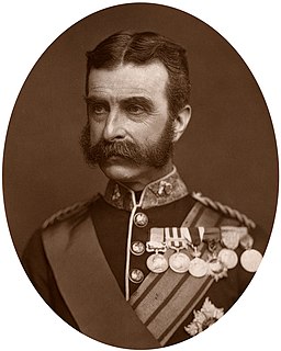
Frederic Augustus Thesiger, 2nd Baron Chelmsford, was a British Army officer who rose to prominence during the Anglo-Zulu War, when an expeditionary force under his command suffered a decisive defeat at the hands of a Zulu force at the Battle of Isandlwana in 1879. Despite this defeat, he was able to score several victories against the Zulus, culminating the British victory at the Battle of Ulundi, which ended the war and restored his reputation in Britain.

Zulu Dawn is a 1979 American adventure war film about the historical Battle of Isandlwana between British and Zulu forces in 1879 in South Africa. The screenplay was by Cy Endfield, from his book, and Anthony Storey. The film was directed by Douglas Hickox. The score was composed by Elmer Bernstein.

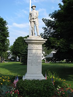
North Chelmsford is an unincorporated village in the town of Chelmsford, Massachusetts, United States. Although North Chelmsford has its own zip code (01863), library, post office, fire station, water district, and local calling area, it is run by the same local town government and shares a school district with Chelmsford.

The Essex County Ground (ECG) is a cricket venue in Chelmsford, Essex, England. It has been used by Essex County Cricket Club for first-class cricket since 1925 and List A matches since 1969, and has been the county's official home ground since 1967. The ground has a capacity of 6,500, mostly in single-tier seating with a single double-tiered stand. Its pavilion was completed in the 1970s.

Chelmsford is a constituency in Essex represented in the House of Commons of the UK Parliament. It has been represented since 2017 by Vicky Ford of the Conservative Party. She is currently serving as the Minister for Children in the Department for Education.
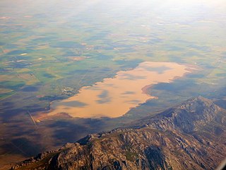
Chelmsford Nature Reserve, also known as Chelmsford Dam Nature Reserve is a nature reserve administered by Ezemvelo KZN Wildlife. It encloses Ntshingwayo Dam on the Ngagane River, and is situated some 38 kilometres (24 mi) south of Newcastle, in the KwaZulu-Natal province of South Africa. The reserve was gazetted on 31 July 1975.

The Berg River Dam is a 68-metre (223 ft) high dam on the Berg River in South Africa. It is the centerpiece of the Berg Water Project (BWP) which is designed to capture the winter rainfall and store it for supply to Cape Town during the dry summer months. The project in turn forms an important part of the Western Cape Water Supply System (WCWSS), an intricate system of dams and bulk water infrastructure that provides water to more than 3 million people. At the inauguration of the dam in 2009, then President of South Africa Kgalema Motlanthe called the project "a good example of how public infrastructure projects can be used to contribute meaningfully to poverty eradication and to foster social empowerment of the people." The Berg River Dam was the first dam in South Africa to be designed and constructed, and is due to be operated, in accordance with the guidelines of the World Commission on Dams. It has been completed on time and within budget. The Berg River basin and the adjacent metropolitan area of Cape Town are of particular importance to the Western Cape region because, although the basin generates only about 3% of the country's water resources, it is home to about 8% of South Africa's population, and produces about 12% of GDP.

Theewaterskloof Dam is an earth-fill type dam located on the Sonderend River near Villiersdorp, Western Cape, South Africa. Administratively it is located within Theewaterskloof Local Municipality. It was established in 1978 and is the largest dam in the Western Cape Water Supply System with a capacity of 480 million cubic metres, about 41% of the water storage capacity available to Cape Town, which has a population of over 4 million people. The dam mainly serves for municipal and industrial use as well as for irrigation purposes. The hazard potential of the dam has been ranked high (3).

Voëlvlei Dam is a dam located in the Western Cape, South Africa near the town of Gouda. It was established in 1971 and has the second largest capacity of dams in the Western Cape Water Supply System.

Wemmershoek Dam is an earth-fill type dam located on the Wemmershoek River near Franschhoek and Paarl in South Africa. The dam was established in 1957 with a capacity of 58 644 000 m3 behind a 55 m high wall. The dam serves mainly for municipal and industrial use as part of the Western Cape Water Supply System which supplies the city of Cape Town and surrounding areas. Its hazard potential has been ranked high (3).

Woodhead Dam is a dam on Table Mountain, Western Cape, South Africa. It was built in 1897 and supplies water to Cape Town. The dam, which was the first large masonry dam in South Africa, was designated as an International Historic Civil Engineering Landmark by the American Society of Civil Engineers in 2008.

The Eerste River, located in the Western Cape, South Africa, rises on Dwarsberg 60 km east of Cape Town at the head of Jonkershoek. The Eerste River catchment covers the eastern part of the Cape Flats lying to the west of the Hottentots Holland Mountains and south of the Tygerberg where the Kuils River tributary rises east of Kanonkop. The Eerste River is a short river; its length has been given as 40 km. The major tributary, Kuils River, is approximately 30 km long to its point of confluence with the Eerste River.
Stony Brook is a tributary of the Merrimack River in northeastern Massachusetts, joining the Merrimack at Chelmsford.