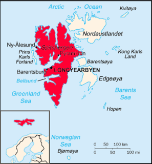
Danes Island is an island in Norway's Svalbard archipelago in the Arctic Ocean. It lies just off the northwest coast of Spitsbergen, the largest island in the archipelago, near to Magdalenefjorden. Just to the north lies Amsterdam Island. Like many of Svalbard's islands, Danes Island is uninhabited. The island has an area of 40.6 km2 (15.7 sq mi).

Wahlenbergfjorden, sometimes known in English as Waalenburg Bay, is a fjord on the southwest coast of the Arctic island of Nordaustlandet, in Norway's Svalbard archipelago. At 46 kilometres (29 mi) in length, and 15 km (9.3 mi) wide, it is the fifth longest fjord in the archipelago, and the longest on the island. The fjord lies between Gustav V Land and Gustav Adolf Land, at geographical co-ordinates 79°40′N20°00′E. Its mouth faces Spitsbergen across Hinlopen Strait, the strait separating the two islands.
Isisøyane is a group of small islands east of Nordaustlandet, Svalbard. They were earlier regarded to be part of Nordaustlandet, an ice free point named Isispynten. After the retreat of Austfonna, the islands appeared as islands. They were named Isisøyane in 2009.
Botniahalvøya is a peninsula of Nordaustlandet, Svalbard. It is located between Lady Franklinfjorden and Brennevinsfjorden. It has a length of about twelve nautical miles. The highest peak is Franklinfjellet, at 430 m.a.s.l.
Torellneset is a headland at the southwestern side of Nordaustlandet, Svalbard. The headland is named after geologist Otto Martin Torell. It is located south of the glacier Vegafonna and is the southwestern point of Gustav Adolf Land. Outside the headland is the island of Perthesøya.
Berggrenøya is an island in Hinlopen Strait in the Svalbard archipelago, the most western of the islands of Vaigattøyane. The island is named after Swedish botanist Sven Berggren. The highest point is 23 m.a.s.l. Total area approximately 0,6 km2. acc. to Norwegian Polar Institute. Beggrenøya is included in the Nordaust-Svalbard Nature Reserve.
Franzøya is an island in Hinlopen Strait, south of Nordaustlandet, Svalbard. It is located south of Karl Alexanderøya, southeast of Torellneset. The island is named after Frederick Francis II, Grand Duke of Mecklenburg-Schwerin. At the southern side of the island is the bay Pücklerhamna.
Karl Alexanderøya is an island in Hinlopen Strait, south of Nordaustlandet, Svalbard. It is located about four kilometers southeast of Torellneset, north of Franzøya. The island is possibly named after Charles Alexander, Grand Duke of Saxe-Weimar-Eisenach.
Søre Russøya is an island at the northwestern side of Nordaustlandet, Svalbard. It is located in the outer part of Murchisonfjorden, and is the largest of the group of three islands called Russøyane. The island is separated from Nordaustlandet by the strait of Søre Russøysundet. Further west is island Krossøya. The island has an area of about, 10 km2.. Highest point, 71 m.a.s.l.. Søre Russøya is part of the Nordaust-Svalbard Nature Reserve.
Nordvestøyane is an archipelago in Albert I Land at Spitsbergen, Svalbard. Among the islands in the group are Fuglesongen (4.1 km²) and Klovningen (2.2 km²).

Von Otterøya is an island in Hinlopen Strait between Spitsbergen and Nordaustlandet, Svalbard. The island belongs to Vaigattøyane, and is located south of Wahlbergøya. The highest point is 76 m.a.s.l. Total area of the island, about 20 km2.
Vonbreen is a glacier in Haakon VII Land and Andrée Land at Spitsbergen, Svalbard. It has an extension of about 25 kilometers, and is located south of Woodfjorden. The name is a translation of the German language Hoffnungs-Gletscher, suggested by Bock and Poninski in 1908. The glacier borders to Eidsvollfjellet, the highest mountain in Haakon VII Land.

Bjørnsundet is a strait between Spitsbergen and Wilhelm Island in Hinlopen Strait, Svalbard. The strait has depths between twenty and thirty meters, and can be sailed by vessels.
Tommeløyane is a group of islands in Hinlopen Strait, Svalbard. They are located towards Lomfjordhalvøya, and west of Fosterøyane. Among the islands in the group are Strilane, Tommelen and Steiløya.
Fosterøyane is a group of islands in Hinlopen Strait, Svalbard. They are located in the middle of Hinlopenstretet, north of Vaigattøyane and east of Tommeløyane. Fosterøyane are named after Arctic traveler Henry Foster. Among the islands in the group are Krylen, Pilten and Sværingen.
Gyldénøyane is the name of two islands in the mouth of Wahlenbergfjorden at Nordaustlandet, Svalbard. The islands are named after Swedish Arctic explorer Hans Olof Fredrik Gyldén. They are located between the headlands of Selanderneset and Idunneset.
Smeerenburgfjorden is a fjord in Albert I Land at Spitsbergen, Svalbard. It has a length of about twenty kilometers and a width of about four kilometers. The fjord is named after the old whaling settlement Smeerenburg, which was situated at the southern part of Amsterdam Island. The fjord is located between the peninsulas of Vasahalvøya and Reuschhalvøya, and connects westwards through the straits of Danskegattet and Sørgattet. The Smeerenburgbreen glacier debouches into the head of the fjord.
Sørgattet is a strait in Albert I Land at Spitsbergen, Svalbard. It runs between Reuschhalvøya and Danes Island, and forms the southern entrance to Smeerenburgfjorden. Moseøya in Sørgattet has a rich birdlife and is protected as a bird sanctuary.
Scottbreen is a glacier in Wedel Jarlsberg Land at Spitsbergen, Svalbard. The glacier has a length of about 4.5 kilometers. It is located between Wijkanderberget and the ridge of Bohlinryggen, which separates Scottbreen from the glacier of Renardbreen.