O Kun de Kun Falls

Last updated

O Kun de Kun Falls
O Kun de Kun Falls.jpg
O Kun de Kun Falls from a distance.
O Kun de Kun Falls
Location Stannard Township, Ontonagon County, Michigan
Coordinates 46°38′56″N89°09′01″W / 46.6489218°N 89.1503390°W / 46.6489218; -89.1503390 (O Kun de Kun Falls) [1]
Elevation919 feet (280 m)
Total height30 feet (9.1 m)
Number of drops2
Longest drop20 feet (6.1 m)
Total width20 feet (6.1 m)
Average width10 feet (3.0 m) to 30 feet (9.1 m)
Watercourse Baltimore River

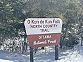
O Kun de Kun Falls is a waterfall of the Baltimore River north of Bruce Crossing, in Ontonagon County, Michigan. [1]

Contents

The Falls

There are two drops that make up O Kun de Kun Falls. The North Country Trail parallels both of the drops and allows access to the site. The falls are part of the Ottawa National Forest and are administered by the United States Forest Service. [2] The falls are named after the Chippewa Chief O Kun de Kun (ca. 1760 - 1859) who was originally from the Ontonagon area. [3]

Upper Falls

The Upper Falls is a 10-foot (3.0 m) drop along the river. It is also sometimes referred to as Peanut Butter Falls. [4]

O Kun de Kun Falls

The lower of the two falls has a 20-foot (6.1 m) drop, with widths between 10 feet (3.0 m) and 30 feet (9.1 m) depending on the time of year. The North Country Trail follows the river and a suspension bridge crosses the river just after the falls. [5]

Access

The falls are approximately 1.3 miles (2.1 km) from US Highway 45. The North Country Trail runs past the falls in both gravel and boardwalk sections. [6] There is parking near the highway and camping sites near the base of O Kun de Kun Falls. [7]

Images

Related Research Articles

<span class="mw-page-title-main">Yosemite Falls</span> Waterfall in California, United States

Yosemite Falls is the highest waterfall in Yosemite National Park, dropping a total of 2,425 feet (739 m) from the top of the upper fall to the base of the lower fall. Located in the Sierra Nevada of California, it is a major attraction in the park, especially in late spring when the water flow is at its peak.

<span class="mw-page-title-main">Multnomah Falls</span> Waterfall in Oregon, U.S.

Multnomah Falls is a waterfall located on Multnomah Creek in the Columbia River Gorge, east of Troutdale, between Corbett and Dodson, Oregon, United States. The waterfall is accessible from the Historic Columbia River Highway and Interstate 84. Spanning two tiers on basalt cliffs, it is the tallest waterfall in the state of Oregon at 620 ft (189 m) in height. The Multnomah Creek Bridge, built in 1914, crosses below the falls, and is listed on the National Register of Historic Places.

<span class="mw-page-title-main">Pictured Rocks National Lakeshore</span> U.S. National Lakeshore on Lake Superior

Pictured Rocks National Lakeshore is a U.S. National Lakeshore in the Upper Peninsula of Michigan, United States. It extends for 42 mi (68 km) along the shore of Lake Superior and covers 73,236 acres. The park has extensive views of the hilly shoreline between Munising and Grand Marais in Alger County, with picturesque rock formations, waterfalls, and sand dunes.

<span class="mw-page-title-main">Oneonta Gorge</span> Waterfall in Oregon, United States

Oneonta Gorge is a scenic gorge located in the Columbia River Gorge area of the American state of Oregon. The U.S. Forest Service has designated it as a botanical area because of the unique aquatic and woodland plants that grow there. Exposed walls of 25-million-year-old basalt are home to a wide variety of ferns, mosses, hepatics, and lichens, many of which grow only in the Columbia River Gorge. Oneonta Gorge with its 50 species of wildflowers, flowering shrubs and trees has been described as "one of the true dramatic chasms in the state." The Oneonta Gorge Creek Bridge is listed on the National Register of Historic Places.

<span class="mw-page-title-main">Bond Falls</span> Waterfall on the Ontonagon River in Michigan, United States

Bond Falls is a waterfall on the middle branch of the Ontonagon River, a few miles east of Paulding in Haight Township in southern Ontonagon County, Michigan. The site is near U.S. Highway 45 in the western portion of the Upper Peninsula of Michigan. The waterfalls are listed by the state of Michigan as the Bond Falls Scenic Site.

<span class="mw-page-title-main">Judge C. R. Magney State Park</span> State park in Minnesota, United States

Judge C. R. Magney State Park is a state park in the U.S. state of Minnesota, on the North Shore of Lake Superior. It was named for Clarence R. Magney, a former mayor of Duluth and justice of the Minnesota Supreme Court, who was instrumental in getting 11 state parks and scenic waysides established along the North Shore. The park is best known for the Devil's Kettle, an unusual waterfall and rock formation in which half of the Brule River disappears into a pothole.

<span class="mw-page-title-main">Ottawa National Forest</span> National forest in Michigan, United States

The Ottawa National Forest is a national forest that covers 993,010 acres (401,860 ha) in the Upper Peninsula of the U.S. state of Michigan. It includes much of Gogebic and Ontonagon counties, as well as slices of Iron, Houghton, Baraga, and Marquette counties. The forest is under the jurisdiction of the U.S. Forest Service.

<span class="mw-page-title-main">Salmon River (Clackamas County, Oregon)</span> River in Oregon, United States

The Salmon River is a 33.5-mile (53.9 km) river in the Cascade Range in the U.S. state of Oregon that drains part of southwestern Mount Hood. The entire length of the river is a protected National Wild and Scenic River. Several portions are in protected wilderness. It is affluent to the Sandy River, a tributary of the Columbia River.

<span class="mw-page-title-main">Wallace Falls State Park</span> State park

Wallace Falls State Park is a public recreation area that encompasses 1,380 acres (560 ha) along the Wallace River in Snohomish County, Washington. The state park is located on the west side of the Cascade Mountains with an entrance point one mile (1.6 km) northeast of the community of Gold Bar. The park features three waterfalls, three backcountry lakes, old-growth coniferous forests, rushing mountain rivers and streams, and the evidence of its logging history in the ruins of railroad trestles, disused railroad grades, and springboard notches in stumps.

<span class="mw-page-title-main">DeSoto Falls (Georgia)</span> Waterfall in Lumpkin County, Georgia

The DeSoto Falls of Georgia are located in Lumpkin County, Georgia along Frogtown Creek. There are actually three waterfalls on Frogtown Creek, called Upper DeSoto Falls, Middle Desoto Falls and Lower DeSoto Falls. The upper waterfall drops 200 feet (61 m), the middle waterfall drops 67 feet (20 m) and the lower waterfall drops 35 feet (11 m). The overall height of the falls, as measured inclusive of non-vertical falls, cascades and steep stream bed, is 480 feet (150 m). DeSoto Falls are located at an elevation of 3,560-foot (1,090 m) on Rocky Mountain.

<span class="mw-page-title-main">Foothills Trail</span> Long-distance hiking trail in the United States

The Foothills Trail is a 76-mile (122 km) National Recreation Trail in South and North Carolina, United States, for recreational hiking and backpacking. It extends from Table Rock State Park to Oconee State Park. It passes through the Andrew Pickens Ranger District of the Sumter National Forest, Ellicott Rock Wilderness, Whitewater Falls, and Lake Jocassee.

<span class="mw-page-title-main">Wahclella Falls</span> Waterfall in Oregon, United States

Wahclella Falls is a waterfall along Tanner Creek, a tributary of the Columbia River, Multnomah County, Oregon, United States. It enters the river within the Columbia River Gorge.

<span class="mw-page-title-main">Whitewater Falls (North Carolina)</span>

Whitewater Falls is a series of waterfalls and cascades on the Whitewater River in North Carolina and South Carolina. Over the 3.5 mi (5.6 km) course of the river between the two falls, the Whitewater River drops 1,500 ft (460 m), and crosses the state border. Both Falls can be hiked to via the Foothills Trail or spur trails. Lookouts allow you to view both falls.

<span class="mw-page-title-main">Agate Falls Scenic Site</span> Waterfall

The Agate Falls Scenic Site is a waterfall and scenic site located in Interior Township, in southeastern Ontonagon County, Michigan. The waterfall is 7 miles (11 km) southeast of Bruce Crossing, Michigan on the state highway M-28.

<span class="mw-page-title-main">Bonita Falls</span> Waterfall in California, United States

Bonita Falls are a set of waterfalls in the San Bernardino National Forest, formed by Bonita Creek, that is said to be 370 or 400 feet in height, but possibly up to 495 feet high because of two undocumented drops in the canyon above. It is the second tallest in the national forest, being surpassed only by 500-foot (150 m) Big Falls. These two waterfalls are reputably the tallest in southern California.

<span class="mw-page-title-main">U.S. Route 45 in Michigan</span> US Highway in Michigan

US Highway 45 (US 45) is a part of the United States Numbered Highway System that runs from Mobile, Alabama, to the Upper Peninsula (UP) of the state of Michigan. The highway forms a part of the state trunkline highway system that is maintained by the Michigan Department of Transportation (MDOT). It enters the state from Wisconsin south of Watersmeet, ending at an intersection with Ontonagon Street in Ontonagon. In between, the roadway crosses the UP running for approximately 54+34 miles (88.1 km) through the Ottawa National Forest and parallel to the Ontonagon River.

<span class="mw-page-title-main">Salt Creek Falls</span> Waterfall in Lane County, Oregon

Salt Creek Falls is a cascade and plunge waterfall on Salt Creek, a tributary of the Middle Fork Willamette River, that plunges into a gaping canyon in the Willamette National Forest near Willamette Pass in Lane County, Oregon. The waterfall is notable for its main drop of 286 feet (87 m), ranking third highest among plunge waterfalls in Oregon, after Multnomah Falls and Watson Falls.) The pool at the bottom of Salt Creek Falls waterfall is 66 feet (20 m) deep.

Upper Chush Falls is a 200-foot (61 m) waterfall on Whychus Creek, in the Cascade Range southwest of Sisters in the U.S. state of Oregon. Chush Falls, a 50-foot (15 m) waterfall, is further downstream on the same creek. Lying between Chush and Upper Chush is a third waterfall, The Cascade. These and several other falls on tributaries in the vicinity are within the Three Sisters Wilderness. The Northwest Waterfall Survey lists the fall's average flow at 40 cubic feet per second (1.1 m3/s). The highest flows occur between May and August.

<span class="mw-page-title-main">Proxy Falls</span> Waterfall in Lane County, Oregon

Proxy Falls, also known as Lower Proxy Falls, is a cascade and plunge waterfall from a collection of springs on the shoulder of North Sister, that plunges into a gaping canyon near McKenzie Pass in the Willamette National Forest, near Belknap Springs, Oregon. The waterfall is notable for its main drop of 226 feet (69 m) which makes it one of the highest plunge waterfalls in Oregon.

<span class="mw-page-title-main">North Falls</span> Waterfall in Silver Falls State Park

North Falls is a waterfall located in the Silver Falls State Park at the east end of the city of Salem, in Marion County, in the U.S. state of Oregon. It is located in a privileged area on the west foothills where Mount Hood National Forest meets with the Middle Santiam Wilderness. Several prominent waterfalls are located in the Park along Trail of Ten Falls: South Falls, Drake Falls, Lower South Falls, and Winter Falls—among others.

References

  1. 1 2 "Feature Detail Report for: O Kun de Kun Falls". USGNIS. U.S. Department of the Interior. Retrieved April 28, 2021.
  2. "O Kun de Kun Falls". United States Forest Service. Retrieved April 28, 2021.
  3. "O kun De Kun Falls". Upper Peninsula Waterfalls. Retrieved April 28, 2021.
  4. "O Kun de Kun Falls". gowaterfalling.com. Retrieved April 28, 2021.
  5. "O Kun-de-kun Falls Hiking Trail". UP North Trails.org. Retrieved April 28, 2021.
  6. Johnson, Matt. "Hike to O Kun de Kun Falls". The Out Bound. Retrieved April 28, 2021.
  7. "O Kun de Kun Falls on Baltimore River". Waterfalls of the Keweenaw Area. Retrieved April 28, 2021.