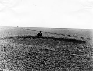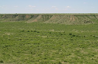
Chase County is a county in the U.S. state of Nebraska. As of the 2020 United States Census, the population was 3,893. Its county seat is Imperial.

Ogallala is a city in and the county seat of Keith County, Nebraska, United States. The population was 4,878 at the 2020 census, up from 4,737 at the 2010 census. In the days of the Nebraska Territory, the city was a stop on the Pony Express and later along the transcontinental railroad. The Ogallala Formation that carries the Ogallala Aquifer was named after the city.

The Ogallala Aquifer is a shallow water table aquifer surrounded by sand, silt, clay, and gravel located beneath the Great Plains in the United States. As one of the world's largest aquifers, it underlies an area of approximately 174,000 sq mi (450,000 km2) in portions of eight states. It was named in 1898 by geologist N. H. Darton from its type locality near the town of Ogallala, Nebraska. The aquifer is part of the High Plains Aquifer System, and resides in the Ogallala Formation, which is the principal geologic unit underlying 80% of the High Plains.

Hereford is a city in and county seat of Deaf Smith County, Texas, United States. It is 48 miles southwest of Amarillo. Its population was 14,972 at the 2020 census. It is the only incorporated locality named "Hereford" in the United States.

Brownfield is a city in and the county seat of Terry County, Texas, United States. Its population was 8,936 at the 2020 census. Brownfield is 39 miles (63 km) southwest of Lubbock.

Palo Duro Canyon is a canyon system of the Caprock Escarpment located in the Texas Panhandle near the cities of Amarillo and Canyon. A large canyon system in the south-central United States, it is roughly 25–40 mi (40–64 km) long and has an average width of 6 mi (9.7 km), but reaches a width of 20 mi (32 km) at places. Its depth is around 800 ft (240 m), but in some locations, valley bottom to surrounding hills increases to 1,000 ft (300 m). Palo Duro Canyon has been named "The Grand Canyon of Texas" both for its size and for its dramatic geological features, including the multicolored layers of rock and steep mesa walls, which are similar to those in the Grand Canyon. It is part of Palo Duro Canyon State Park. The State Park had 442,242 visitors in 2022.

U.S. Highway 26 is an east–west United States Numbered Highway that runs from Seaside, Oregon, to Ogallala, Nebraska. When the U.S. Numbered Highway System was first defined, it was limited to Nebraska and Wyoming; by the 1950s, it continued into Idaho and Oregon. The highway's eastern terminus is in Ogallala at an intersection with Interstate 80 (I-80). Its western terminus is south of Seaside at an intersection with US 101. Prior to 2004, the route's last 20 miles (32 km) were cosigned with US 101 from the highways' junction south of Seaside north to Astoria where its intersection with US 30 was also US 30's western terminus. Long segments of the highway follow the historic Oregon Trail. At its peak, immediately before the establishment of the Interstate Highway System, US 26 was 1,557 miles (2,506 km) in length and terminated in Astoria.

The Llano Estacado, sometimes translated into English as the Staked Plains, is a region in the Southwestern United States that encompasses parts of eastern New Mexico and northwestern Texas. One of the largest mesas or tablelands on the North American continent, the elevation rises from 3,000 feet (900 m) in the southeast to over 5,000 feet (1,500 m) in the northwest, sloping almost uniformly at about 10 feet per mile (2 m/km).

The High Plains are a subregion of the Great Plains, mainly in the Western United States, but also partly in the Midwest states of Nebraska, Kansas, and South Dakota, generally encompassing the western part of the Great Plains before the region reaches the Rocky Mountains. The High Plains are located in eastern Montana, southeastern Wyoming, southwestern South Dakota, western Nebraska, eastern Colorado, western Kansas, eastern New Mexico, the Oklahoma Panhandle, and the Texas Panhandle. The southern region of the Western High Plains ecology region contains the geological formation known as Llano Estacado which can be seen from a short distance or on satellite maps. From east to west, the High Plains rise in elevation from around 1,500 to 6,000 ft.

Cotton Center is an unincorporated community in western Hale County, Texas, United States, located about 12 miles southwest of Hale Center. Until the late 19th century, the Comanche tribe of Native Americans occupied the area. In 1907, with the coming of a branch of the Santa Fe Railroad, a number of farming operations were established. Cotton Center was originally created in 1925 as a consolidated school district, with a small unincorporated community site, containing the school, cotton gins, and various businesses to support the surrounding farms. In 1935, a local post office opened, and the first irrigation well was drilled. By the late 1940s, irrigation wells proliferated, pumping water from the Ogallala Aquifer. The community revolves around farming and is tied together by the school, which as of 2005 had 140 students in prekindergarten through grade 12.

Edward Earl Husmann was an American football defensive tackle who played in the American Football League (AFL) for the Houston Oilers. He also played in the National Football League (NFL) for the Chicago Cardinals and the Dallas Cowboys. He played college football for the Nebraska Cornhuskers.

U.S. Highway 26 (US-26) is an east–west highway in western Nebraska. It enters the state from Wyoming just west of Henry. The eastern terminus of US-26 is in Ogallala at an interchange with Interstate 80 (I-80). The highway largely parallels the North Platte River for the majority of its route in Nebraska and as such, runs at a northwest–southeast angle. The highway also parallels the original paths of the Oregon, California, and Mormon trails.

Lake McConaughy is a reservoir on the North Platte River. It is located 9 miles (14 km) north of Ogallala, Nebraska, United States, near U.S. Highway 26 and Nebraska Highway 61. The reservoir was named for Charles W. McConaughy, a grain merchant and mayor of Holdrege, Nebraska, one of the leading promoters of the project. Although he did not live to see the completion of the project, his leadership and perseverance eventually culminated in a public power and irrigation project that helped Nebraska become one of the nation's leading agricultural states.

KOGA-FM is a radio station broadcasting a classic hits format. Licensed to Ogallala, Nebraska, United States, the station serves the North Platte area. The station is owned by iHeartMedia. The station's nickname, "The Lake," is in reference to Lake McConaughy, located north of Ogallala.

The Niobrara Formation, also called the Niobrara Chalk, is a geologic formation in North America that was deposited between 87 and 82 million years ago during the Coniacian, Santonian, and Campanian stages of the Late Cretaceous. It is composed of two structural units, the Smoky Hill Chalk Member overlying the Fort Hays Limestone Member. The chalk formed from the accumulation of coccoliths from microorganisms living in what was once the Western Interior Seaway, an inland sea that divided the continent of North America during much of the Cretaceous. It underlies much of the Great Plains of the US and Canada. Evidence of vertebrate life is common throughout the formation and includes specimens of plesiosaurs, mosasaurs, pterosaurs, and several primitive aquatic birds. The type locality for the Niobrara Chalk is the Niobrara River in Knox County in northeastern Nebraska. The formation gives its name to the Niobrara cycle of the Western Interior Seaway.

The White River is an intermittent stream in the South Plains of Texas and a tributary of the Brazos River of the United States. It rises 8 miles (13 km) west of Floydada in southwestern Floyd County at the confluence of Callahan Draw and Running Water Draw. From there, it runs southeast for 62 miles (100 km) to its mouth on the Salt Fork Brazos River in northwestern Kent County. Besides these two headwaters, which rise near Hale Center and in Curry County, New Mexico, respectively, other tributaries include Pete, Crawfish, and Davidson Creeks. The White River drains an area of 1,690 sq mi (4,377 km2).

The Ogallala Formation is a Miocene to early Pliocene geologic formation in the central High Plains of the western United States and the location of the Ogallala Aquifer. In Nebraska and South Dakota it is also classified as the Ogallala Group. Notably, it records the North American Land Mammal Ages (NALMAs) Hemphillian, Clarendonian, and Barstovian. It also includes an excellent record of grass seeds and other plant seeds, which can be used for biostratigraphic dating within the formation. The Ogallala Formation outcrops of Lake Meredith National Recreation Area preserve fish fossils. Similar specimens from the same unit are found at Alibates Flint Quarries National Monument in Texas.

The Valentine Formation is a geologic unit formation or member within the Ogallala unit in northcentral Nebraska near the South Dakota border. It preserves fossils dating to the Miocene epoch of the Neogene period and is particularly noted for Canid fossils. This unit consists of loosely-consolidated sandstone that crumbles easily. These sands carry the water of the Ogallala Aquifer and is the source of much of the water in the Niobrara River. A particular feature of the Valentine is lenticular beds of green-gray opaline sandstone that can be identified in other states, including South Dakota, Nebraska, Kansas, and Colorado. Although three mammalian fauna stages can be mapped throughout the range of the Ogallala, no beddings of the Ogallala are mappable and all attempts of formally applying the Valentine name to any mappable lithology beyond the type location have been abandoned. Even so, opaline sandstone has been used to refer to this green-gray opalized conglomerate sandstone that is widely found in the lower Ogallala Formation.

New Almelo is an unincorporated community in Norton County, Kansas, United States.
Paul Theodore Blessing was an American football player.


