Sal is a river on the Black Sea-Caspian Steppe of southern Russia, a tributary to the river Don. Its source is in the western part of the Russian republic Kalmykia. It joins the river Don near Semikarakorsk. It rises just west of Elista, flows north, turns and flows west between the Don and Manych Rivers. It is separated from the Manych by the low Sal-Manych Rise. Maximum flow is during the March–April snowmelt. It is much used for irrigation.

The Kadéï River is a tributary of the Sangha River that flows through Cameroon and the Central African Republic. Its total drainage basin is 24,000 km². The river rises from the eastern Adamawa Plateau, southeast of Garoua-Boulaï (5°53′50″N14°33′30″E in Cameroon's East Province. The Kadéï is swelled by two tributaries, the Doumé at Mindourou and the Boumbé, before flowing east into the Central African Republic. At Nola, the Kadéï meets the Mambéré and becomes the Sangha. The Kadéï is part of the Congo River basin.
Kota Batu is a mukim (subdistrict) in the Brunei-Muara District of Brunei. It is located on the southeastern part of the Brunei-Muara District, bordering the mukims of Mentiri to the north and Lumapas to the south and west, Kianggeh and the Kampong Ayer mukims to the west, as well as the Brunei Bay to the east and Pulau Limpaku Pinang in Limbang in Sarawak, Malaysia, to the east.

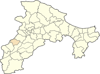
Chelata is a town in northern Algeria.

Baghramyan, Bagramyan or Baghramian; formerly known as Bashnalu, is a village in the Ararat Province of Armenia. It is named after the Soviet Armenian military commander and Marshal of the Soviet Union Hovhannes Baghramyan.

Śmiłowice is a village in the administrative district of Gmina Choceń, within Włocławek County, Kuyavian-Pomeranian Voivodeship, in north-central Poland. It lies approximately 4 kilometres (2 mi) north of Choceń, 15 km (9 mi) south of Włocławek, and 64 km (40 mi) south-east of Toruń.
Ośno is a village in the administrative district of Gmina Janowiec Wielkopolski, within Żnin County, Kuyavian-Pomeranian Voivodeship, in north-central Poland.

Nowokornino is a village in the administrative district of Gmina Hajnówka, within Hajnówka County, Podlaskie Voivodeship, in north-eastern Poland, close to the border with Belarus.

Kowale-Kolonia is a village in the administrative district of Gmina Kuźnica, within Sokółka County, Podlaskie Voivodeship, in north-eastern Poland, close to the border with Belarus. It lies approximately 3 kilometres (2 mi) north-west of Kuźnica, 16 km (10 mi) north-east of Sokółka, and 54 km (34 mi) north-east of the regional capital Białystok.

Qarqar is a village in the Martuni Province of the de facto Republic of Artsakh, de jure part of the Republic of Azerbaijan

Yusiflər is a village in the Zangilan Rayon of Azerbaijan.

Miedziana Góra is a village in the administrative district of Gmina Kluczewsko, within Włoszczowa County, Świętokrzyskie Voivodeship, in south-central Poland. It lies approximately 5 kilometres (3 mi) north-west of Kluczewsko, 14 km (9 mi) north-west of Włoszczowa, and 52 km (32 mi) west of the regional capital Kielce.

Przeciszewo is a village in the administrative district of Gmina Staroźreby, within Płock County, Masovian Voivodeship, in east-central Poland. It lies approximately 4 kilometres (2 mi) north of Staroźreby, 22 km (14 mi) north-east of Płock, and 87 km (54 mi) north-west of Warsaw.
Ludwinowo is a settlement in the administrative district of Gmina Bieżuń, within Żuromin County, Masovian Voivodeship, in east-central Poland.

Nghiên Loan is a rural commune (xã) of Pác Nặm District, Bắc Kạn Province, in Vietnam.

Gornji Dejan is a village in the municipality of Vlasotince, Serbia. According to the 2002 census, the village has a population of 208 people.

Linnaka is a village in Saaremaa Parish, Saare County in western Estonia.

Kalauzovići is a village in the municipality of Sokolac, Bosnia and Herzegovina.
Smeetsland is a neighborhood of Rotterdam, Netherlands.

Bezdonys Manor is a former residential manor near Bezdonys, Vilnius district in Lithuania.


