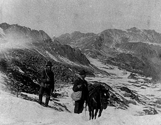
The Pike's Peak gold rush was the boom in gold prospecting and mining in the Pike's Peak Country of western Kansas Territory and southwestern Nebraska Territory of the United States that began in July 1858 and lasted until roughly the creation of the Colorado Territory on February 28, 1861. An estimated 100,000 gold seekers took part in one of the greatest gold rushes in North American history.

Gunnison County is a county located in the U.S. state of Colorado. As of the 2020 census, the population was 16,918. The county seat is Gunnison. The county was named for John W. Gunnison, a United States Army officer and captain in the Army Topographical Engineers, who surveyed for the transcontinental railroad in 1853.

The Sawatch Range or Saguache Range is a high and extensive mountain range in central Colorado which includes eight of the twenty highest peaks in the Rocky Mountains, including Mount Elbert, at 14,440 feet (4,401 m) elevation, the highest peak in the Rockies.

The Uncompahgre Plateau in western Colorado is a distinctive large uplift part of the Colorado Plateau. Uncompahgre is a Ute word that describes the water: "Dirty Water" or "Rocks that make Water Red".

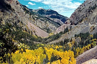
The San Juan Skyway Scenic and Historic Byway is a 236-mile (380 km) All-American Road, National Forest Scenic Byway, and Colorado Scenic and Historic Byway located in Dolores, La Plata, Montezuma, San Juan, and San Miguel counties, Colorado, United States. The byway forms a loop in southwestern Colorado traversing the heart of the San Juan Mountains. The San Juan Skyway reaches its zenith at Red Mountain Pass at elevation 11,018 feet (3,358 m). Mesa Verde National Park was one of the original UNESCO World Heritage Sites. The Silverton Historic District and the Telluride Historic District are National Historic Landmarks.
Dallas is an extinct town in Ouray County, Colorado, United States. Also known as Dallas City, it lay about 3 miles (4.8 km) north of the present town of Ridgway at the confluence of Dallas Creek and the Uncompahgre River. The Dallas post office operated from February 11, 1884, until October 31 1899. A community named in tribute to the historic town bearing the name Dallas Meadows now exists near its historic location.
The Uncompahgre Gorge is a deep mountain canyon formed by the Uncompahgre River and Red Mountain Creek in the Uncompahgre National Forest. It is located just south of Ouray, in Ouray County, Colorado.
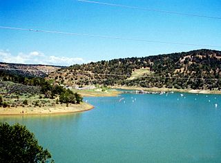
Ridgway Reservoir is a lake impounded by Ridgway Dam on the Uncompahgre River north of the town of Ridgway in Ouray County, Colorado in the western United States. Ridgway Dam was built as part of the Dallas Creek Project. Construction began in 1978 and completed in 1987. The lake was first filled in 1990 as an aid to irrigation of the Uncompahgre Valley and flood control. Today recreation opportunities are provided at Ridgway State Park along the lake.
Carp River is a 40.2-mile-long (64.7 km) river in Chippewa and Mackinac counties in the U.S. state of Michigan. 21.7 miles (34.9 km) of the river were added to the National Wild and Scenic Rivers System in 1992.
Chicago Basin comprises the upper portion of the Needle Creek watershed in the Needle Mountains (Colorado), a subrange of the San Juan Mountains in the US State of Colorado. It lies within the Weminuche Wilderness, part of the San Juan National Forest. Needle Creek is an east-side tributary of the Animas River. The basin is a popular destination in summer for climbers and backpackers. The upper portion of the basin is surrounded by three fourteeners: Mount Eolus, Windom Peak, and Sunlight Peak. Columbine Pass lies to the east of the lower basin.

Lizard Head Pass, elevation 10,222 feet (3,116 m), is a mountain pass in the San Juan Mountains of Colorado, on the border between Dolores and San Miguel counties.
Mountain County was a county of the extralegal United States Territory of Jefferson that existed from November 28, 1859, until February 28, 1861.

Cordova Pass in southern Colorado lies on the western shoulder of the West Spanish Peak, east of the Culebra Range of the Sangre de Cristo Mountains of the Western United States. Cordova Pass lies just outside the Spanish Peaks Wilderness, a designated National Wilderness Area in the San Isabel National Forest. Cordova Pass is reached via the Apishapa Road, a leg of the Scenic Highway of Legends. As the National Forest Service does not usually plow the snow, Cordova Pass is normally not accessible from mid-November to late May. Most of the time, the pass may be traversed by passenger vehicles.

Eldredge is an unincorporated community along the Uncompahgre River in Ouray County, Colorado, United States. The community is located between Colona and Ridgway - both within Ouray County - north of Ridgway State Park on the Colorado stretch of U.S. Route 550.
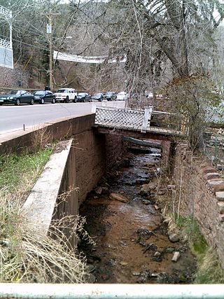
Ruxton Creek is a stream in Manitou Springs in El Paso County, Colorado. Named for British explorer and writer of the southwest, George Fredrick Augustus Ruxton, it is one of three main drainage basins in Manitou Springs. Ruxton Creek flows out of Englemann Canyon and into the town of Manitou Springs. Iron Springs geyser emanates from the creek and is one of the Manitou Mineral Springs.

A triple divide or triple watershed is a point on Earth's surface where three drainage basins meet. A triple divide results from the intersection of two drainage divides. Triple divides range from prominent mountain peaks to minor side peaks, down to simple slope changes on a ridge which are otherwise unremarkable. The elevation of a triple divide can be thousands of meters to barely above sea level. Triple divides are a common hydrographic feature of any terrain that has rivers, streams and/or lakes.
Cedar Valley is an unincorporated community in Wayne County, in the U.S. state of Ohio.

Cebolla Creek is a stream in Gunnison and Hinsdale counties in Colorado, United States, that is a tributary of the Gunnison River.
