Ohio State Route 326 (1930s)

Last updated

OH-326 (1927).svg

State Route 326

Perrysburg–Holland Road
Ohio State Route 326 (1930s)
Routing of SR 326 in relation to modern roads
Route information
Maintained by ODOT
Length1.2 mi [1]  (1.9 km)
Existed1932–1934
Major junctions
South endUS 20N (1926).svg US 20N in Springfield Township
North endOH-2 (1927).svg SR 2 in Springfield Township
Location
Country United States
State Ohio
Counties Lucas
Highway system
  • Ohio State Highway System
OH-325.svg SR 325 OH-327.svg SR 327
US 223.svg US 223 OH-223 (1927).svg US 224.svg US 224

State Route 326 (SR 326) was the final designation for a short state highway near Holland, Ohio. At the time the route was removed from the state highway system in 1934, the road had been a state highway since the system's creation but with different designations throughout its history.

Contents

Route description

SR 326 began at an intersection with Holland–Sylvania Road. The route headed northwest for about one mile (1.6 km) until curving to the north, crossing over Wolf Creek, and ending at SR 2 which was also known as Toledo–Wauseon Road. [1] [2] The entire route was in Springfield Township, though the northern terminus was located just outside the village limits of Holland.[ citation needed ]

History

The short stretch of road had been a part of the state highway system since at least 1912. Prior to 1922, the road was the northernmost mile of SR 57, a route that ran from Maumee to what was then SR 20 near Holland. [3] [4] From 1923 until 1926, the route became the westernmost mile of SR 102. [5] [6] In 1927, the mile-long roadway became the entirety of State Route 223 as the roads north and southeast of the southern terminus became a part of US 20. [7] This designation would remain until 1931 when this route became State Route 283 as a result of the creation of U.S. Route 223 within the state (located in the northern part of Lucas County). [8] [9] This designation was short-lived as the route became State Route 326 by 1932 (the route at the southern terminus also became US 20N at this time). [10] SR 326 would only be signed for about two years because in 1934, the route was removed from the state highway system altogether. [11] [12] Shortly after this route was removed, a different SR 326 was designated in Marietta, Washington County.[ citation needed ]

The road still exists today as a two-lane suburban road connecting the southwestern corner of Toledo with Holland. [1] The road is now county-maintained as Lucas County Road 1571. [13]

Major intersections

The entire route was in Springfield Township, Lucas County.

mi [1] kmDestinationsNotes
0.00.0US 20N (1926).svg US 20N (South Holland–Sylvania Road / Perrysburg–Holland Road)
1.21.9OH-2 (1927).svg SR 2 (Toledo–Wauseon Road) / McCord Road
1.000 mi = 1.609 km; 1.000 km = 0.621 mi

Related Research Articles

<span class="mw-page-title-main">Ohio State Route 281</span>

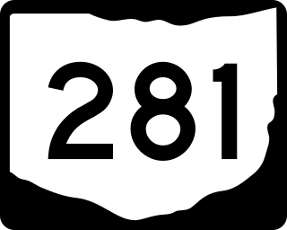
State Route 281 is an east–west state highway in the northwestern portion of the U.S. state of Ohio. Its western terminus is at U.S. Route 24 approximately four miles (6.4 km) northeast of downtown Defiance, and its eastern terminus is at US 6 nearly one mile (1.6 km) north of Bradner. The majority of the route is known as the Defiance Pike.

<span class="mw-page-title-main">Ohio State Route 269</span>

State Route 269 is a north–south state highway in the north central portion of the U.S. state of Ohio. Its southern terminus is at SR 4 on the Huron–Seneca county line nearly seven miles (11 km) south of Bellevue, and its northern terminus is at the entrance to East Harbor State Park near Marblehead.

<span class="mw-page-title-main">Ohio State Route 81</span>

State Route 81 is an east–west route in western Ohio. Its western terminus is at the Indiana state line near Willshire, and its eastern terminus is at SR 53 in Patterson. The route also goes through or close to the towns of Elgin, Lima, Ada, and Dunkirk.

<span class="mw-page-title-main">Ohio State Route 306</span>

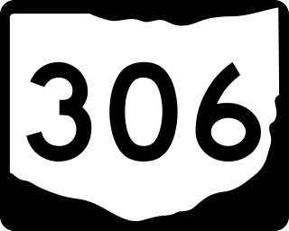
State Route 306 is a north–south state highway in northeastern Ohio, running from its southern terminus at SR 43 in Aurora to its northern terminus at SR 283 in Mentor. Most of the road from Aurora north to Kirtland is part of the former Chillicothe Turnpike and is known as Chillicothe Road. The Kirtland Temple, the first temple built by the Latter Day Saint movement (Mormons), is located on SR 306 in central Kirtland.

<span class="mw-page-title-main">Ohio State Route 26</span>

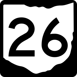
State Route 26 is a 67-mile-long (108 km) north–south route in south eastern Ohio spanning from SR 7 in Marietta to SR 148 between Jerusalem and Bethesda. SR 26 also passes through Graysville and Woodsfield. Where the state route designation ends in Wayne Township, the road continues north as Belmont County Road 26 where it connects to the Barkcamp State Park and the National Road. Much of the route parallels the Little Muskingum River and travels through the heart of Wayne National Forest's Marietta Unit.

<span class="mw-page-title-main">Ohio State Route 38</span> State highway in Ohio

State Route 38 is a south–north state highway in the state of Ohio. Its southern terminus is near Bloomingburg and Washington Court House at the U.S. Route 62 / SR 3 concurrency and its northern terminus is in Marysville at the intersection of 5th Street and Main Street where the road continues north as SR 31.

<span class="mw-page-title-main">Ohio State Route 49</span>

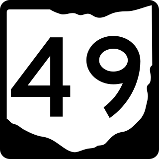
State Route 49 is a state highway in the western part of the U.S. state of Ohio. It begins in Drexel, an area within the city of Trotwood, at US 35 and runs northwesterly to Greenville, and then runs roughly along near the western edge of the state near the Indiana state line to the Michigan state line where it meets with Michigan's M-49.

<span class="mw-page-title-main">Ohio State Route 79</span> Highway in Ohio

State Route 79 is a north–south highway that traverses Central Ohio, extending from Buckeye Lake at SR 37 to Nellie at US 36. SR 79 serves Newark, providing direct-access from Downtown Newark to I-70.

<span class="mw-page-title-main">Ohio State Route 355</span>

State Route 355 was a short 1.37-mile-long (2.20 km) state highway in southwestern Ohio. The route served the former Fort St. Clair State Memorial in Eaton, Preble County. The route began at SR 122 in western Eaton, traveled south along Camden Road for about 0.3 miles (0.48 km) before turning into the memorial, looping through the entire site, and ending at itself just south of the route's start at SR 122. The route was removed from the state highway system shortly after the park's jurisdiction was transferred from the state to the City of Eaton.

<span class="mw-page-title-main">Ohio State Route 339</span>

State Route 339 (SR 339) is a north–south state highway in southeastern Ohio, a U.S. state. The southern terminus of SR 339 is at SR 618 approximately 2 miles (3.2 km) west of Belpre, and less than 0.50 miles (0.80 km) south of the U.S. Route 50 (US 50)/SR 7/SR 32 expressway. The highway's northern terminus is a T-intersection with SR 821 about 0.75 miles (1.21 km) south of Dexter City.

<span class="mw-page-title-main">Ohio State Route 571</span>

State Route 571 is an east–west state highway in west-central Ohio, part of a statewide road transportation system. It indirectly connects the cities of Union City and Greenville with Springfield via a final 10.7 miles (17.2 km) on U.S. Route 40.

<span class="mw-page-title-main">Ohio State Route 358</span>

State Route 358 (SR 358) is a 0.92-mile-long (1.48 km) north–south state highway in the northern portion of the U.S. state of Ohio. The southern terminus of SR 358 is at a T-intersection with SR 163 nearly 5.75 miles (9.25 km) east of Oak Harbor, just north of the Portage River. Its northern terminus is at SR 2 at an intersection just outside Camp Perry about three and a half miles (5.6 km) west of Port Clinton.

<span class="mw-page-title-main">Ohio State Route 751</span>

State Route 751 is an east–west state highway located in the east-central portion of Ohio. The highway runs between its western terminus at SR 93 in West Lafayette and its eastern terminus at a diamond interchange with I-77 on the outskirts of the village of Stone Creek.

<span class="mw-page-title-main">Ohio State Route 362</span>

State Route 362 is a 4.56-mile (7.34 km) north–south state highway in the western part of the U.S. state of Ohio. It serves to connect Lake Loramie State Park with SR 66. Its southern terminus is in Fort Loramie at the intersection of North Main Street (SR 66) and Elm Street. near the northern edge of Fort Loramie. SR 362 then runs about 1.1 miles (1.8 km) east, then turns north at its intersection with Fort Loramie–Swanders Road. SR 362 then runs northerly along the western edge of Lake Loramie and Lake Loramie State Park before turning northwesterly then westerly and enters Minster and reaches its northern terminus at the intersection of South Main Street (SR 66) and First Street.

<span class="mw-page-title-main">Ohio State Route 374</span>

State Route 374 is north–south state highway in Hocking County, Ohio, located in the southern portion of the state. Its southern terminus is over 4 miles (6.4 km) east of the unincorporated village of South Bloomingville at State Route 56, and its northern terminus is near the unincorporated village of Rockbridge at US 33, west of Logan. The road serves Hocking State Forest as well as Hocking Hills State Park, and the entire highway is part of the designated Hocking Hills Scenic Byway.

References

Route map:

Template:Attached KML/Ohio State Route 326 (1930s)
KML is from Wikidata
  1. 1 2 3 4 Google (December 10, 2013). "Ohio State Route 326 (1930s)" (Map). Google Maps . Google. Retrieved December 10, 2013.
  2. 1952 Topo Map (Map). United States Geological Survey. 1952. Retrieved December 10, 2013 via NETR Online, HistoricAerials.com.
  3. Map of Ohio Showing Inter-County Highways (MrSID) (Map). Cartography by James R. Marker, State Highway Commissioner. Ohio State Highway Department. 1912. Retrieved August 18, 2013.
  4. Map of Ohio State Highways Showing All Improved Roadways (MrSID) (Map). Cartography by E.C. Blosser. Ohio Department of Highways and Public Works (ODOH). 1922. Retrieved August 18, 2013.
  5. Map of Ohio Showing State Routes (MrSID) (Map). Cartography by L.A. Boulay, Director. ODOH. 1923. Retrieved August 18, 2013.
  6. Map of Ohio Showing State Routes (MrSID) (Map). Cartography by G.F. Schlesinger, Director. ODOH. 1926. Retrieved September 22, 2013.
  7. Map of Ohio Showing State Routes (MrSID) (Map). Cartography by G.F. Schlesinger, Director. ODOH. 1927. Retrieved September 22, 2013.
  8. Map of Ohio Showing State Highway System (MrSID) (Map). Cartography by Robert N. Waid, Director. ODOH. 1930. Retrieved August 18, 2013.
  9. Map of Ohio Showing State Highway System (MrSID) (Map). Cartography by O.W. Merrell, Director. ODOH. 1931. Retrieved August 19, 2013.
  10. Map of Ohio Showing State Highway System (MrSID) (Map). Cartography by O.W. Merrell, Director. ODOH. 1932. Retrieved August 19, 2013.
  11. Map of Ohio Showing State Highway System (MrSID) (Map). Cartography by O.W. Merrell, Director. ODOH. 1933. Retrieved August 19, 2013.
  12. Map of Ohio Showing State Highway System (MrSID) (Map). Cartography by O.W. Merrell, Director. ODOH. 1934. Retrieved August 19, 2013.
  13. Lucas County (PDF) (Map). Ohio Department of Transportation. June 2012. Retrieved December 10, 2013.