The Arthur R. Marshall Loxahatchee National Wildlife Refuge is a 147,392-acre (596.47 km2) wildlife sanctuary is located west of Boynton Beach, in Palm Beach County, Florida. It includes the most northern remnant of the historic Everglades wetland ecosystem.

Tosohatchee Wildlife Management Area is located along the St. Johns River east of Orlando in Christmas on Taylor Creek Road, off SR 50.

The Lake George State Forest is a designated protected area and state forest in the U.S. state of Florida. The 21,176-acre (8,570 ha) forest is located in northwestern Volusia County, Florida, near Lake George and the communities of Pierson, Barberville, and Volusia. It is overseen by the Florida Forest Service within the Florida Department of Agriculture and Consumer Services.

Elkhorn Slough is a 7-mile-long (11 km) tidal slough and estuary on Monterey Bay in Monterey County, California. The community of Moss Landing and the Moss Landing Power Plant are located at the mouth of the slough on the bay.

The Florida Fish and Wildlife Conservation Commission (FWC) is a Florida government agency founded in 1999 and headquartered in Tallahassee. It manages and regulates the state's fish and wildlife resources, and enforces related laws. Officers are managers, researchers, and support personnel, and perform law enforcement in the course of their duties.
The South Florida Water Management District (SFWMD) is a regional governmental district that oversees water resources from Orlando to the Florida Keys. The mission of the SFWMD is to manage and protect water resources by balancing and improving water quality, flood control, natural systems and water supply, covering 16 counties in Central and Southern Florida. It is the largest water management district in the state, managing water needs for 7.7 million residents. A key initiative is the restoration of America's Everglades – the largest environmental restoration project in the nation's history. The District is also working to improve the Kissimmee River and its floodplain, Lake Okeechobee and South Florida's coastal estuaries.

The Atchafalaya National Wildlife Refuge is located about 30 miles (48 km) west of Baton Rouge, Louisiana, and one mile (1.6 km) east of Krotz Springs, Louisiana, lies just east of the Atchafalaya River. In 1988 under the administration of Governor Foster the "Atchafalaya Basin Master Plan" was implemented that combined the 11,780-acre (4,770 ha) Sherburne Wildlife Management Area (WMA), the 15,220-acre (6,160 ha) Atchafalaya National Wildlife Refuge, and the 17,000-acre (6,900 ha) U.S. Army Corps of Engineers' Bayou Des Ourses into the Sherburne Complex Wildlife Management Area.

Deal Island Wildlife Management Area protects 13,565 acres (54.90 km2) in western Somerset County, Maryland near the community of Deal Island. As a wildlife management area, the area is managed by the Maryland Department of Natural Resources' Wildlife and Heritage Service to conserve wildlife populations and their habitats, while providing public recreational use of wildlife resources.

Chassahowitzka Wildlife Management Area (WMA) preserves 24,243 acres of sandhill, mesic hammock, and forested wetland habitat ten miles north of Weeki Wachee in Hernando County, Florida. The area consists of one large tract of land, with three satellite tracts nearby.

Cartier Slough Wildlife Management Area at 961 acres (3.89 km2) is an Idaho wildlife management area in Madison County west of Rexburg. The Army Corps of Engineers and Bureau of Reclamation acquired land for the WMA in 1976 and 1977 as mitigation for the Teton and Ririe dams.
Andrews Wildlife Management Area is located on the Suwannee River, five miles north of Chiefland in Levy County, Florida.

Fred C. Babcock/Cecil M. Webb Wildlife Management Area (WMA) is Florida's oldest Wildlife Management Area and protects 80,772 acres just south and east of Punta Gorda in Charlotte and Lee Counties, Florida. The area is accessed from its own exit off of Interstate-75.

Apalachicola River Wildlife and Environmental Area (ARWEA) contains 63,257 acres of pine upland, floodplain swamp, savanna, and estuary habitat north of Eastpoint and Apalachicola in Franklin County and Gulf County, Florida.

Escribano Point Wildlife Management Area (EPWMA) contains 4,057 acres of salt marsh, shrub bog, and sandhill habitat fourteen miles north of Pensacola in Santa Rosa County, Florida. In 2004, an initial 1,166 acres were acquired by the Florida Forever program and leased to the Florida Fish and Wildlife Conservation Commission to establish the EPWMA.
Apalachee Wildlife Management Area (WMA) consists of 7,952 acres of upland longleaf pine and wetland habitat three miles north of Sneads in Jackson County, Florida. The area is broken up into three management zones, all located along Lake Seminole and the Chattahoochee River.
Suwannee Ridge Wildlife and Environmental Area (WEA) conserves 1,428 acres of longleaf pine uplands, karst topography and hardwood hammocks ten miles southwest of Jasper in Hamilton County, Florida.
Fort White Wildlife and Environmental Area (WEA) protects 1,610 acres of primarily sandhill habitat four miles west of Fort White in Gilchrist County, Florida.
Aucilla Wildlife Management Area conserves 50,471 acres of hydric hammock, mesic flatwoods, upland forest, and spring-run river twelve miles southeast of Tallahassee in Jefferson County, Florida.

Mattaponi Wildlife Management Area is a 2,542-acre (10.29 km2) Wildlife Management Area (WMA) in Caroline County, Virginia. Located west of Bowling Green, the area protects a mixture of wetlands and upland forests at the confluence of the Mattaponi and South rivers.

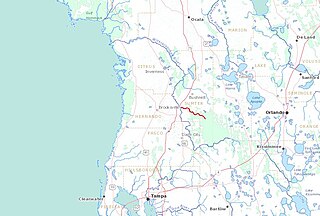
The Little Withlacoochee River is a 16-mile long river with its headwaters starting in the Richloam Wildlife Management Area in Sumter County, Florida. The Little Withlacoochee River ends near River Junction Campground just east of Silver Lake in the Croom Wildlife Management Area. It makes up a portion of the Hernando-Sumter County border. Its drainage basin covers 145 mi² (376 km²) of Hernando County and Sumter County.


