
North Omaha is a community area in Omaha, Nebraska, in the United States. It is bordered by Cuming and Dodge Streets on the south, Interstate 680 on the north, North 72nd Street on the west and the Missouri River and Carter Lake, Iowa on the east, as defined by the University of Nebraska at Omaha and the Omaha Chamber of Commerce.
Significant events in the history of North Omaha, Nebraska include the Pawnee, Otoe and Sioux nations; the African American community; Irish, Czech, and other European immigrants, and; several other populations. Several important settlements and towns were built in the area, as well as important social events that shaped the future of Omaha and the history of the nation. The timeline of North Omaha history extends to present, including recent controversy over schools.
The history of Omaha, Nebraska, began before the settlement of the city, with speculators from neighboring Council Bluffs, Iowa staking land across the Missouri River illegally as early as the 1840s. When it was legal to claim land in Indian Country, William D. Brown was operating the Lone Tree Ferry to bring settlers from Council Bluffs to Omaha. A treaty with the Omaha Tribe allowed the creation of the Nebraska Territory, and Omaha City was founded on July 4, 1854. With early settlement came claim jumpers and squatters, and the formation of a vigilante law group called the Omaha Claim Club, which was one of many claim clubs across the Midwest. During this period many of the city's founding fathers received lots in Scriptown, which was made possible by the actions of the Omaha Claim Club. The club's violent actions were challenged successfully in a case ultimately decided by the U.S. Supreme Court, Baker v. Morton, which led to the end of the organization.
The neighborhoods of Omaha are a diverse collection of community areas and specific enclaves. They are spread throughout the Omaha metro area, and are all on the Nebraska side of the Missouri River.
The Near North Side of Omaha, Nebraska is the neighborhood immediately north of downtown. It forms the nucleus of the city's historic African-American community, and its name is often synonymous with the entire North Omaha area. Originally established immediately after Omaha was founded in 1854, the Near North Side was once confined to the area around Dodge Street and North 7th Street. Eventually, it gravitated west and north, and today it is bordered by Cuming Street on the south, 30th on the west, 16th on the east, and Locust Street to the north. Countless momentous events in Omaha's African American community happened in the Near North Side, including the 1865 establishment of the first Black church in Omaha, St. John's AME; the 1892 election of the first African American state legislator, Dr. Matthew Ricketts; the 1897 hiring of the first Black teacher in Omaha, Ms. Lucy Gamble, the 1910 Jack Johnson riots, the Omaha race riot of 1919 that almost demolished the neighborhood and many other events.
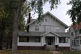
The Kountze Place neighborhood of Omaha, Nebraska is a historically significant community on the city's north end. Today the neighborhood is home to several buildings and homes listed on the National Register of Historic Places. It is located between North 16th Avenue on the east to North 30th Street on the west; Locust Street on the south to Pratt Street on the north. Kountze Place was annexed into Omaha in 1887. The neighborhood was built as a suburban middle and upper middle class enclave for doctors, lawyers, successful businessmen and other professional workers.

Little Bohemia, or Bohemian Town, is a historic neighborhood in Omaha, Nebraska. Starting in the 1880s, Czech immigrants settled in this highly concentrated area, also called "Praha" (Prague) or "Bohemian Town", bounded by South 10th Street on the east, South 16th Street on the west, Pierce Street on the north, and Martha Street on the south, with a commercial area went along South 13th and South 14th Streets, centered on William Street. It was located south of downtown, and directly west of Little Italy. A portion of the neighborhood along South 13th Street was listed on the National Register of Historic Places in 2020.

Jobbers Canyon Historic District was a large industrial and warehouse area comprising 24 buildings located in downtown Omaha, Nebraska, US. It was roughly bound by Farnam Street on the north, South Eighth Street on the east, Jackson Street on the south, and South Tenth Street on the west. In 1989, all 24 buildings in Jobbers Canyon were demolished, representing the largest National Register historic district loss to date.

The Christian Specht Building is located at 1110 Douglas Street in downtown Omaha, Nebraska. It is the only existing building with a cast-iron facade known in Nebraska today, and one of the few ever built in the state. The building was deemed an Omaha landmark in 1981, and was listed on the National Register of Historic Places in 1977.
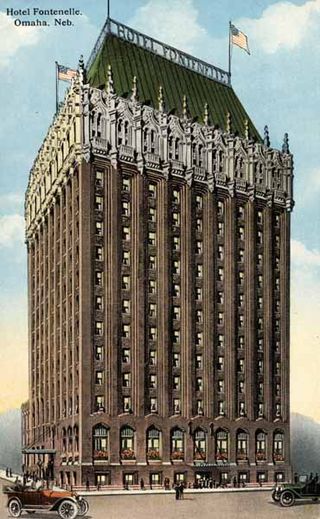
Downtown Omaha is the central business, government and social core of the Omaha–Council Bluffs metropolitan area, U.S. state of Nebraska. The boundaries are Omaha's 20th Street on the west to the Missouri River on the east and the centerline of Leavenworth Street on the south to the centerline of Chicago Street on the north, also including the CHI Health Center Omaha. Downtown sits on the Missouri River, with commanding views from the tallest skyscrapers.

The Lincoln Highway in Omaha, Nebraska, runs east–west from near North 183rd Street and West Dodge Road in Omaha, Nebraska, towards North 192nd Street outside of Elkhorn. This section of the Lincoln Highway, one of only 20 miles (32 km) that were paved with brick in Nebraska, is one of the most well-preserved in the country. The roadway was listed on the National Register of Historic Places in 1984. The Lincoln Highway was the first road across the United States, traversing coast-to-coast from Times Square in New York City to Lincoln Park in San Francisco, California.
Jefferson Square was the last of three original public parks extant in Omaha, Nebraska. Bounded by North 15th, 16th, Chicago and Cass Streets, the park was dedicated on November 25, 1865. It was razed by the city March 18, 1969 to make way for the construction of Interstate 480 in Downtown Omaha. Before that time it was the site of Omaha's first school, and considered for the location of the first Omaha Public Library and the Omaha Market House.

The Old City Hall, also known as the Red Castle, located in downtown Omaha, Nebraska was located at the corner of 18th and Farnam Streets. Completed in 1890, the building was demolished 1966 after controversy erupted over landmark preservation in the city. Along with Omaha's Old Post Office, the Old City Hall became a rallying call for more deliberate efforts by the community and city leaders.
North 24th Street is a two-way street that runs south–north in the North Omaha area of Omaha, Nebraska, United States. With the street beginning at Dodge Street, the historically significant section of the street runs from Cuming Street to Ames Avenue. A portion of North 24th near Lake Street is considered the "Main Street" of the Near North Side, and was historically referred to as "The Street of Dreams." The corridor is widely considered the heart of Omaha's African-American community.
Mendelssohn, Fisher and Lawrie was a significant architecture firm in early Omaha, Nebraska. Fisher & Lawrie continued. A number of their works are listed on the National Register of Historic Places.
The Omaha Public Library in Omaha, Nebraska, currently has 13 locations.

Old Gold Coast is the name of a historic district in south Omaha, Nebraska. With South 10th Street as the central artery, the area was home to neighborhoods such as Little Italy and Forest Hill. The area is referred to as "old" because it was replaced in prominence in the late 19th century when a new district usurped its importance. This area south of downtown was generally bounded by Leavenworth Street on the north, Bancroft Street on the south, the Missouri River on the east, and South 16th Street on the west.
Significant events in the history of Omaha, Nebraska, include social, political, cultural, and economic activities.
Rocheford & Gould were brick manufacturers and construction contractors in early Omaha, Nebraska. The firm built numerous brick structures during Omaha's transition from the wooden buildings of Nebraska's territorial days to more permanent structures. The buildings the firm built included breweries, schools, packing houses, business blocks, Vaudeville theaters, street car barns and power houses, and civic buildings. Many of the structures the firm built have been demolished but a few of their earliest structures still exist and are listed on the National Register of Historic Places.


