

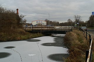
Old Quay Bridge is a Grade II listed swing bridge in Runcorn, England. [1] [2]
Old Quay Bridge is a Grade II listed swing bridge in Runcorn, England. [1] [2]
Old Quay Bridge is a swing bridge across the Manchester Ship Canal between Runcorn and Wigg Island, built circa 1894. It took its name from the Old Quay Canal, a now defunct canal which is more commonly known as the Runcorn to Latchford Canal.

The bridge is still in use and is opened for traffic along the canal. The swing mechanism is operated from a control room on the Runcorn side of the bridge.

The River Mersey is in North West England. Its name derives from Old English and means "boundary river", possibly referring to its having been a border between the ancient kingdoms of Mercia and Northumbria. For centuries it has formed part of the boundary between the historic counties of Lancashire and Cheshire.

The Manchester Ship Canal is a 36-mile-long (58 km) inland waterway in the North West of England linking Manchester to the Irish Sea. Starting at the Mersey Estuary at Eastham, near Ellesmere Port, Cheshire, it generally follows the original routes of the rivers Mersey and Irwell through the historic counties of Cheshire and Lancashire. Several sets of locks lift vessels about 60 feet (18 m) to the canal's terminus in Manchester. Landmarks along its route include the Barton Swing Aqueduct, the world's only swing aqueduct, and Trafford Park, the world's first planned industrial estate and still the largest in Europe.

Runcorn is an industrial town and cargo port in the Borough of Halton in Cheshire, England. Its population in 2011 was 61,789. The town is in the southeast of the Liverpool City Region, with Liverpool 11 mi (18 km) to the northwest across the River Mersey. Runcorn is on the southern bank of the River Mersey, where the estuary narrows to form the Runcorn Gap.
Latchford is a suburb and electoral ward of Warrington, Cheshire, England. It is around one mile south-east of Warrington town centre and has a total resident population of 7,856.

The Bridgewater Canal connects Runcorn, Manchester and Leigh, in North West England. It was commissioned by Francis Egerton, 3rd Duke of Bridgewater, to transport coal from his mines in Worsley to Manchester. It was opened in 1761 from Worsley to Manchester, and later extended from Manchester to Runcorn, and then from Worsley to Leigh.

The M56 motorway, also known as the North Cheshire motorway, serves the Cheshire and Greater Manchester areas of England. It runs east to west from junction 4 of the M60 at Gatley, south of Manchester, to Dunkirk, approximately four miles north of Chester. With a length of 33.3 miles (53.6 km), it connects North Wales and the Wirral peninsula with much of the rest of North West England, serves business and commuter traffic heading towards Manchester, particularly that from the wider Cheshire area, and provides the main road access to Manchester Airport from the national motorway network.
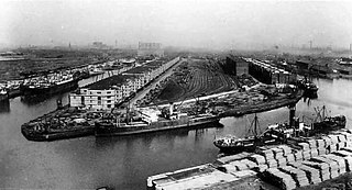
Manchester docks were a series of nine docks in Salford, Stretford and Manchester at the east end of the Manchester Ship Canal in North West England. They formed part of the Port of Manchester from 1894 until their closure in 1982. The docks marked the upper reaches of the ship canal, and were a destination for both coastal and ocean-bound vessels carrying cargo and a limited number of passengers, often travelling to and from Canada.
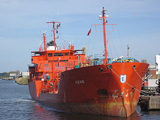
Runcorn Docks, originally the Bridgewater Docks, is an inland port on the Manchester Ship Canal in the town of Runcorn, Cheshire, England. It is operated by Peel Ports and handles bulk and project cargo.
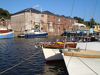
The Exeter Ship Canal, also known as the Exeter Canal is a canal leading from the River Exe to Exeter Quay in the city of Exeter, Devon, England. It was first constructed in the 1560s predating the "canal mania" period and is one of the oldest artificial waterways in the UK.

St Helens and Runcorn Gap Railway was an early railway line owned by a company of the same name in Lancashire, England, which opened in 1833. It was later known as St Helens Railway. It ran originally from the town of St Helens to the area which would later develop into the town of Widnes. Branches were opened to Garston, Warrington and Rainford. The company was taken over by the London and North Western Railway in 1864. The line from St Helens to Widnes and the branch to Rainford are now closed, the latter terminating at the Pilkington Glass' Cowley Hill works siding near Gerard's Bridge, but part of the lines to Garston and to Warrington are still in operation.
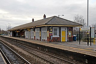
St Helens Junction railway station is a railway station serving St Helens, Merseyside, England. It is in Sutton, three miles southeast of St Helens town centre. The station is on the electrified northern route of the Liverpool to Manchester Line, 12 miles (19 km) east of Liverpool Lime Street. The station and all trains calling there are presently operated by Northern Trains.

Runcorn East railway station serves the eastern suburbs of Runcorn in Cheshire, England, offering train services to Warrington and Manchester and to Chester and North Wales.
Sankey Bridges is part of the Parish of Holy Trinity in Warrington, a unitary authority in the north-west of England. Located on the turnpike road between Warrington, Prescot and Liverpool over the Sankey Brook, which was the boundary of Great Sankey and The County Borough of Warrington, it became home to many industries after the opening of the Sankey Canal, the first wholly artificial canal built in England during the Industrial Revolution.
Keckwick is an area in the Borough of Halton in Cheshire. Although there is no village as such, numerous toponyms attest to a particular identity in the area which straddles the West Coast Main Line between the village of Daresbury and the new town of Runcorn.

The Mersey and Irwell Navigation was a river navigation in North West England, which provided a navigable route from the Mersey estuary to Salford and Manchester, by improving the course of the River Irwell and the River Mersey. Eight locks were constructed between 1724 and 1734, and the rivers were improved by the construction of new cuts several times subsequently. Use of the navigation declined from the 1870s, and it was ultimately superseded by the Manchester Ship Canal, the construction of which destroyed most of the Irwell section of the navigation and the long cut between Latchford and Runcorn.

The Runcorn to Latchford Canal was a man-made canal that ran from Runcorn, to the Latchford area of Warrington. It connected the Mersey and Irwell Navigation to the River Mersey at Runcorn.
The Turnbridge Lift Bridge is a lift bridge which spans the Huddersfield Broad Canal at Turnbridge, Kirklees, West Yorkshire, England. Officially known as Turnbridge, it is bridge number 17 on the Huddersfield Broad Canal.

Runcorn is an industrial town in the borough of Halton, Cheshire, England. This list contains the 27 buildings that are recorded in the National Heritage List for England as designated listed buildings in the part of the borough lying to the south of the River Mersey outside the urban area of Runcorn. The area covered includes the villages of Clifton, Daresbury, Preston Brook, Preston on the Hill, and Moore. Three of the buildings in the area are classified as Grade II*, and the others are at Grade II; there are no buildings in Grade I. In the United Kingdom, the term listed building refers to a building or other structure officially designated as being of special architectural, historical, or cultural significance. These buildings are in three grades: Grade I consists of buildings of outstanding architectural or historical interest; Grade II* includes particularly significant buildings of more than local interest; Grade II consists of buildings of special architectural or historical interest. Buildings in England are listed by the Secretary of State for Culture, Media and Sport on recommendations provided by English Heritage, which also determines the grading.

Wigg Island, also known as Wigg Island Community Park, is a community park and Local Nature Reserve in Runcorn, Halton, England.
Sankey Bridges railway station was in southwestern Warrington, England. It was located immediately west of a swing bridge over the Sankey Canal. The station site is to the south of Old Liverpool Road, Warrington.