
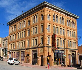
Cripple Creek is the Statutory City that is the county seat of Teller County, Colorado, United States. The city population was 1,189 at the 2010 United States Census. Cripple Creek is a former gold mining camp located 44 miles (71 km) southwest of Colorado Springs near the base of Pikes Peak. The Cripple Creek Historic District, which received National Historic Landmark status in 1961, includes part or all of the city and the surrounding area. The city is now a part of the Colorado Springs, CO Metropolitan Statistical Area.
Victor is a statutory city in Teller County, Colorado, United States. Gold was discovered in Victor in the late 19th century, an omen of the future of the town. With Cripple Creek, the mining district became the second largest gold mining district in the country and realized approximately $10 billion of mined gold in 2010 dollars. It reached its peak around the turn of the century when there were about 18,000 residents in the town. Depleted ore in mines, labor strife and the exodus of miners during World War I caused a steep decline in the city's economy, from which it has never recovered. The population was 397 at the 2010 census. There is a resumed mining effort on Battle Mountain.

Bannack is a ghost town in Beaverhead County, Montana, United States, located on Grasshopper Creek, approximately 11 miles (18 km) upstream from where Grasshopper Creek joins with the Beaverhead River south of Dillon. Founded in 1862, the town contemporarily operates as a National Historic Landmark and is managed by the state of Montana as Bannack State Park.
Neville Langrell (Bill) Barlee was a Canadian politician who was first elected to the Legislative Assembly of British Columbia as a New Democrat in 1988. He served as Minister of Agriculture, Fisheries and Food from 1991 until 1993 and then as Minister of Small Business, Tourism and Culture from 1993 until 1996.

Humula is a small country town between Tarcutta and Tumbarumba in New South Wales, Australia. Humula Station, which is just outside the town, is one of Australia's most historic farming and grazing properties. Humula was once named "American Yards" or "American Fields" during the gold rush, where many Chinese came for gold years ago. At the 2016 census, Humula had a population of 124 people.

Emory Creek Provincial Park is a provincial park in British Columbia, Canada, located on the west side of the Fraser River just south of the town of Yale. It commemorates the location of a large boomtown, variously known as Emory, Emory Bar or Emory City, that first rose during the Fraser Canyon Gold Rush but became a major construction town during the building of the Canadian Pacific Railway in the 1880s.
Emory Creek in 1858 was a tent and shack camp, established by miners in search of gold. When it became evident that the gold was not available in the amounts estimated, the miners started moving north on the Fraser River. A few Chinese remained in the area. The area came into the hands of a man named Walker, who felt Emory Creek would become the head of riverboat navigation on the Fraser. Eventually, he sold the land to the Oppenheimer Brothers in early 1879. In the fall of 1879, Emory was chosen by the C.P.R. as the western terminus. In a short time it became Emory Creek. The town consisted of thirteen streets with its own newspaper, various shops, a brewery, nine saloons and a sawmill. When Yale was made the terminus, Emory was all but abandoned by 1885, with the completion of the railway. Today, it is an easily accessible treed campground with paved roads and flush outhouses.

Caribou is a former silver-mining town, now a ghost town near Nederland in Boulder County, Colorado, United States. It was named after the Caribou silver mine nearby. The Caribou Ranch recording studio is several miles away, on the road from Nederland up to Caribou.
The Cassiar Country, also referred to simply as the Cassiar, is a historical geographic region of the Canadian province of British Columbia. The Cassiar is located in the northwest portion of British Columbia, just to the northeast of the Stikine Country, while to the south is the Omineca Country. The area is noted for the Cassiar gold rush of the 1870s, when Laketon became its unofficial capital. The ghost town of Cassiar is also located in the Cassiar region.

Mogollon, also called the Mogollon Historic District, is a former mining town located in the Mogollon Mountains in Catron County, New Mexico, in the United States. Located east of Glenwood and Alma, it was founded in the 1880s at the bottom of Silver Creek Canyon to support the gold and silver mines in the surrounding mountains. The "Little Fannie" mine became the most important employer for the town. During the 1890s Mogollon had a transient population of between 3,000 and 6,000 miners. Because of its isolation it had a reputation as one of the wildest mining towns in the West. Today Mogollon is listed as Fannie Hill Mill and Company Town Historic District on the National Register of Historic Places.
Granite Creek is a creek and townsite in British Columbia located in the Similkameen region. Granite Creek flows north into the Tulameen River and joins that river approximately one and a half miles to the east of Coalmont, British Columbia. It is assumed Granite Creek yielded more than $500,000 in placer gold since its discovery. Gold nuggets worth $50 in value were not unusual in the early years. The creek was mined by Europeans and Chinese. Granite Creek was hydraulicked near its mouth in the 1890s.
Britton Creek is a tributary of the Tulameen River in British Columbia. This creek is 8 miles (13 km) southwest of the old town of Tulameen. Britton Creek is located in a region of British Columbia called the Similkameen. The creek can be reached by road. Britton Creek was originally known as Eagle Creek. It was discovered in 1885 when gold was recovered from the creek. The gold was mainly close to the mouth of the creek. The creek also yielded placer platinum. The last great find was by Garnet Sootheran in 1926. Garnet discovered platinum and gold placer. According to historian Bill Barlee there may still be gold in the creek
Monashee Creek is located in the Old Cherryville region of British Columbia. The south fork of Cherry Creek is called Monashee Creek.
Carmi is a ghost town in the Boundary Country region of British Columbia, Canada.The town is located on the west side of West Kettle River, east of Penticton, on Hwy 33. Carmi emerged as a silver mining camp just after the turn of the 20th century, named after the nearby mine. The mine in turn was named after the home town of James Dale, Carmi, Illinois.
Lawless Creek is a creek in the Similkameen region of British Columbia. Lawless Creek flows south-east into the Tulameen River about 4 miles (6.4 km) west of the old village of Tulameen, British Columbia. Lawless Creek was originally called Bear Creek. The creek was discovered in 1885 and mined for gold. Platinum was also found there
Pass Creek is a creek located in the Boundary Country region of British Columbia. This creek flows into the Granby River 11 miles north of Grand Forks, British Columbia. Pass Creek has been mined for gold.
Rock Creek is a creek in the Boundary Country region of British Columbia. This creek is the most renowned placer gold creek in the Boundary Country. It was discovered in 1859 by a Canadian named Adam Beam. Rock Creek was originally called York Creek. Beam earned $977 in the first six weeks he worked on the creek. It has been estimated that over $250,000 in placer gold was recovered from this creek. The creek contained two types of gold. One was lemon yellow and the other coppery gold. The largest nugget recovered from Rock Creek was valued at $150. The creek was worked extensively from 1860 to 1864 with 500 miners on its banks. Rock Creek was worked again in the 1890s and 1930s. It was mined by both Europeans and Chinese. It was a rich creek for miles of its length. Rock Creek is in the traditional territory of Sinixt people.
Poplar Creek is a ghost town located in the West Kootenay region of British Columbia. The town is located 23 miles (37 km) north of the town of Lardeau at the head of Kootenay Lake. Poplar Creek is also called Poplar. Gold was discovered on the right of way of the Arrowhead and Kootenay Railway early in 1903. The discovery of gold led to the creation of the town of Poplar in 1903. Four hotels and several stores were built along one side of the only street on the townsite. R.T. Lowery, of Kootenay newspaper fame, established a newspaper called the Poplar Creek Nugget. The gold boom in the area only lasted about a year and soon Poplar was on the decline. In 1973 the remains of hotels like the Royal and the Commercial along with some log cabins are all that could be seen.
Three Forks is a ghost town located east of Slocan Lake, northeast of New Denver, in the Kootenays region of British Columbia. The town was located at the forks of three creeks: Carpenter Creek, Seaton Creek, and Kane Creek. Three Forks was founded in 1892 with the discovery of silver in the area. The Nakusp and Slocan Railway passed through Three Forks. In the summer of 1894, Three Forks was destroyed by a forest fire. The town was rebuilt. In 1897 Henderson's Gazeteer listed 15 businesses in Three Forks. Three Forks contained six hotels: Brunswick, Black's, Richelieu, Wilmington, Slocan, and Miner's Exchange. Madigan stagecoaches passed through Three Forks on the way to Cody or Sandon. Pack trains of G.B. Matthews also passed through Three Forks. Three Forks's best years were between 1892 and 1902. By 1909 the town was in decline and nearby Sandon gained prominence. A few old ruins are all that remains of Three Forks.

Roubaix, formerly known as Perry or Lewisville, is an unincorporated community in Lawrence County, South Dakota, United States. It is not monitored by the U.S. Census Bureau.


