Wahlenbergfjorden, sometimes known in English as Waalenburg Bay, is a fjord on the southwest coast of the Arctic island of Nordaustlandet, in Norway's Svalbard archipelago. At 46 kilometres (29 mi) in length, and 15 km (9.3 mi) wide, it is the fifth longest fjord in the archipelago, and the longest on the island. The fjord lies between Gustav V Land and Gustav Adolf Land, at geographical co-ordinates 79°40′N20°00′E. Its mouth faces Spitsbergen across Hinlopen Strait, the strait separating the two islands.

Svenskøya is an island in Svalbard. It is the second largest island of Kong Karls Land with an area of 137 km².
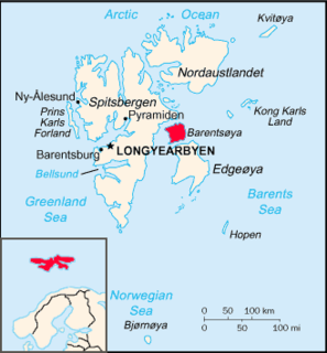
Hinlopen Strait is the strait between Spitsbergen and Nordaustlandet in Svalbard, Norway. It is 150 kilometers (93 mi) long and 10 to 60 kilometers wide. The strait is difficult to pass because of pack ice. It is believed to have been named after Thijmen Jacobsz Hinlopen.
Freemansundet is the sound separating Barentsøya, to the north, from Edgeøya, in the Svalbard archipelago, Norway. It is named after Alderman Ralph Freeman, who was involved in the English whaling trade in the early 17th century. The polar bear, Ursus maritimus, is a seasonal visitor to the Freemansundet; this species has a genetically distinct deme within the Barents Sea region.

Oscar II Land is the land area between Isfjorden and Kongsfjorden on Spitsbergen, Svalbard. The 30 km (19 mi) long glacier Sveabreen divides Oscar II Land from James I Land.
James I Land is a land area on the northwestern part of Spitsbergen, Svalbard. It is named after King James I of England and Scotland. The 30 kilometer long glacier Sveabreen divides James I Land from Oscar II Land.
Finneset is a peninsula located on the east side of Grønfjorden on Spitsbergen in Svalbard, Norway. It is located 2 kilometers (1.2 mi) south of Barentsburg. A whaling station was located there until 1905. From 1911 it became the site of the first wireless station in the Arctic, named Svalbard Radio from 19 September 1925. It was also a meteorological station operated by the Norwegian Meteorological Institute. Both services moved to Longyearbyen on 1 September 1930. It is named for being a fine place to land a ship.
St. Jonsfjorden is a fjord in Oscar II Land at Spitsbergen, Svalbard. It has a length of 21 kilometer, and opens westwards into the strait of Forlandsundet. Several glaciers debouche into the fjord, including Gaffelbreen and Konowbreen from the north, a merge of Osbornebreen, Devikbreen, Vintervegen, Paulbreen and Bukkebreen at the bottom, and Vegardbreen, Charlesbreen and Bullbreen from the south.
Glenhalvøya is a peninsula in Orvin Land at Nordaustlandet, Svalbard, between Finn Malmgren Fjord and Duvefjorden. It is named after Arctic explorer Alexander Richard Glen. The island of Søre Repøya is separated from the peninsula by the strait of Gilessundet.
Storøya is an island in the Svalbard archipelago. It is located east of Nordaustlandet, separated from Nordaustlandet by the strait of Storøysundet. The southern part of the island is covered by the glacier Storøyjøkulen.
Rivalensundet is a strait in the Svalbard archipelago, separating Kongsøya from Svenskøya both in Kong Karls Land. It has a width of about 14 nautical miles. According to historical records, the strait was discovered in 1859, and first sailed in 1889. It is named after the vessel Rivalen.
Lydiannasundet is a strait in the Svalbard archipelago, separating Kongsøya from Abel Island, both in Kong Karls Land. It is named after the vessel Lydianna, used for exploration of Kong Karls Land in 1872.
Kükenthaløya is an island between Barentsøya and Olav V Land, Svalbard. It is located south of the strait Heleysundet and north of Ormholet, at the inner part of Ginevra Bay. The island is named after German zoologist and Arctic explorer Willy Kükenthal.
Trollheimen is a mountainous area in Oscar II Land at Spitsbergen, Svalbard, around the glacier of Eidembreen. Among the mountains of Trollheimen are Tussekallen, Runebomma, Heksefjellet, Huldrefjellet, Huldrehatten, Tomtegubben, and parts of Gunnar Knudsenfjella. North of Eidembreen is the glacier of Huldrebreen, and to the south are Heksebreen and Stallobreen.
Hydrografbreen is a glacier in Oscar II Land at Spitsbergen, Svalbard. The glacier has a length about eight kilometers, and extends from the mountain range of Holmesletfjella to Jørgenfjellet.
Vestgötabreen is a glacier in Oscar II Land at Spitsbergen, Svalbard. It has a length of about seven kilometers, and is located between Løvliefjellet and the mountain ranges of Holmesletfjella and Motalafjella. The glacier is named from the Swedish province of Västergötland.
Jørgenfjellet is a mountain in Oscar II Land at Spitsbergen, Svalbard. It reaches a height of 681 m.a.s.l. and is located at the southern side of the mountain area of Svartfjella. The mountain is named after Norwegian naval officer and hydrographic surveyor Jørgen Petersen-Hansen. It was ascended during an expedition in 1909, for geographical surveying. Between Jørgenfjellet and Holmesletfjella is the glacier of Hydrografbreen.
Huldrebreen is a glacier in Oscar II Land at Spitsbergen, Svalbard. It is surrounded by the mountains of Huldrehatten, Huldrefjellet and Bytingen, west in the mountainous district of Trollheimen. Huldrebreen and Austgötabreen are located north of the glacier complex of Eidembreen. The glacier is named after Huldra in Scandinavian folklore.
Daudmannsodden is a headland in Oscar II Land at Spitsbergen, Svalbard. It has a length of about three kilometers. Daudmannsodden and Salpynten mark the southern entrance of the strait of Forlandsundet. The coast between Daudmannsodden and Eidembukta is characterized by foul waters, skerries and islets outside small bays.
Hahnfjella is a mountain group in Sabine Land at Spitsbergen, Svalbard, west of the bay of Wichebukta. It is named after German geographer Friedrich Gustav Hahn. The highest mountain of the group reaches 537 m.a.s.l.