Olimar Grande River | |
---|---|
Country | Uruguay |
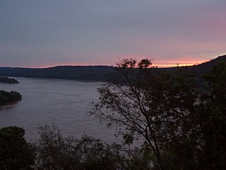
The Río Olimar River is a river in the Treinta y Tres Department of Uruguay.
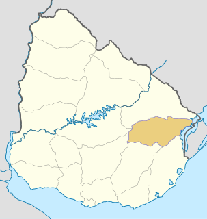
Treinta y Tres is a department of Uruguay. Its capital is Treinta y Tres. It is located in the east of the country, bordering the departments of Cerro Largo to the north, Durazno and Florida to the west, Lavalleja and Rocha to the south, while to its east is the lake Laguna Merín separating it from the southernmost end of Brazil.
Uruguay, officially the Oriental Republic of Uruguay, is a country in the southeastern region of South America. It borders Argentina to its west and Brazil to its north and east, with the Río de la Plata to the south and the Atlantic Ocean to the southeast. Uruguay is home to an estimated 3.44 million people, of whom 1.8 million live in the metropolitan area of its capital and largest city, Montevideo. With an area of approximately 176,000 square kilometres (68,000 sq mi), Uruguay is geographically the second-smallest nation in South America, after Suriname.
The river rises as a small stream in the hills of Cuchilla Grande in western Treinta y Tres Department, just southwest of Santa Clara de Olimar. Heading southeasterly, it collects the smaller streams, the most important of which are the Brazo de la Yeguada, Olimar Chico River (Small Olimar), and Arroyo Yerbal Grande. Other creeks flowing into the Olimar Grande are the Lagarto, Avestruz and Corrales. Covering some 140 kilometres (87 mi), the Olimar discharges into the Cebollatí River as the main tributary, draining some 5,320 square kilometres (2,050 sq mi) of Uruuguay.
Cuchilla Grande is a hill range that crosses the east part of Uruguay from north to south. It extends from the south part of Cerro Largo Department, through the departments of Treinta y Tres and Lavalleja and ends in Maldonado Department where it forms its highest peaks.
Santa Clara de Olimar is a small town in Treinta y Tres Department in eastern Uruguay.
The Olimar Chico River is a river in Uruguay.
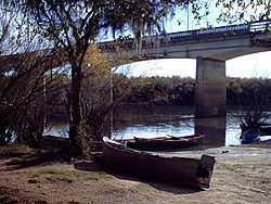
The city of Treinta y Tres, capital of the department, appears almost surrounded by the Olimar River and its affluent, the Great Yerbal stream. The two margins of the river are covered with thick native mount. At the southwest limits of the city, three bridges cross the river. The oldest one is a wood and metal bridge now suited only for pedestrians, horses and bicycles. 120 metres (390 ft) upstream, is the bridge of the railroad and another 270 metres (890 ft) upstream is the last one, a modern reinforced concrete bridge carrying the Ruta 8 to the city. These small distances separating the three bridges create a beautiful view often depicted in photos of the Treinta y Tres.
Besides these geographic characteristics, the Olimar river has an important historical and artistic meaning for the region and the country. An Uruguayan quote about it is "the river that sings more", because its surroundings have been inspiration of various local artists, mainly musicians and poets. Annually a folk music and dance festival takes place on its banks by the city of Treinta y Tres, which gathers participation and audience from all over Uruguay as well as from abroad.
The Uruguay River is a river in South America. It flows from north to south and forms parts of the boundaries of Brazil, Argentina, and Uruguay, separating some of the Argentine provinces of La Mesopotamia from the other two countries. It passes between the states of Santa Catarina and Rio Grande do Sul in Brazil; forms the eastern border of the provinces of Misiones, Corrientes, and Entre Ríos in Argentina; and makes up the western borders of the departments of Artigas, Salto, Paysandú, Río Negro, Soriano, and Colonia in Uruguay.
The Patapédia River is a tributary of the Restigouche River in Northwest New Brunswick and Southeast Quebec, in Canada.
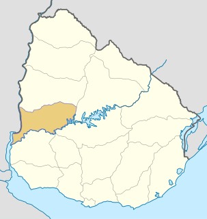
Río Negro Department is a department of the northwestern region of Uruguay. It has an area of 9,282 km2 (3,584 sq mi) and a population of 54,765. Its capital is Fray Bentos. It borders Paysandú Department to the north, Tacuarembó Department to the east, Durazno Department to the southeast, Soriano Department to the south and has the Río Uruguay flowing at its west, separating it from Argentina.
Cerro Largo Department is a department of Uruguay. Its capital is Melo. It is located in the east of the country, bordering Brazil to its northeast with Yaguaron River as the natural border, Treinta y Tres Department to its south, Durazno Department to its west and the departments of Tacuarembó and Rivera to its northwest with Negro River as its natural border with them.
Lavalleja is a department of Uruguay. Its capital is Minas. It is located in the southeast of the country, bordered to the north by the department of Treinta y Tres to the east with Rocha, to the south with Canelones and Maldonado, and to the west to Florida.
Costas del Tacuarí is a locality in the Treinta y Tres Department of Uruguay. Its limits are the river Río Tacuarí to the north, lake Laguna Merín to the east, the stream Arroyo Zapata to the south and national road Ruta 18 to the west. It is one of the main rice producing areas of Uruguay. The main town of the area is Estación Rincón
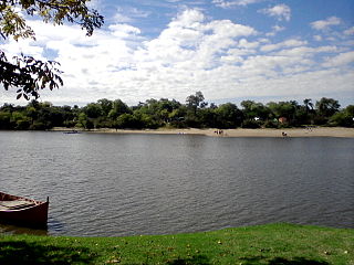
The Cebollatí River is a Uruguayan river that rises in Cuchilla Grande, flows southwest to northeast and forms a border between Treinta y Tres and Rocha.
The Chuí, or Chuy, Stream, is a short stream on the Brazilian–Uruguayan border that is celebrated as Brazil's southernmost point.
Tupambaé is a village (pueblo) in the Cerro Largo Department of eastern Uruguay.
Cerro Chato is a town of central Uruguay, which is divided in three parts belonging to Durazno Department, Florida Department and Treinta y Tres Department respectively.
José Pedro Varela is a small city in the north of Lavalleja Department of southeastern Uruguay. It is named after the sociologist and politician José Pedro Varela.
General Enrique Martínez, also known as La Charqueada, is a village in the Treinta y Tres Department of eastern Uruguay.
Vergara is a small city in the Treinta y Tres Department of eastern Uruguay.
Sierra de las Ánimas is a hill range which starts in Lavalleja Department of Uruguay and extends south into Maldonado Department.
Villa Sara is a suburb of Treinta y Tres, capital city of the Treinta y Tres Department in eastern Uruguay.
The Quebrada de los Cuervos is an important landform in Treinta y Tres Department, Uruguay.
The Depot River is a tributary of the Big Black River, flowing in the townships T12 R17 Wels, T13 R16 Wels and T14 R15 Wels, in the Aroostook County in North Maine Woods in Maine, in United States.
Coordinates: 33°16′49″S53°52′04″W / 33.28028°S 53.86778°W
A geographic coordinate system is a coordinate system that enables every location on Earth to be specified by a set of numbers, letters or symbols. The coordinates are often chosen such that one of the numbers represents a vertical position and two or three of the numbers represent a horizontal position; alternatively, a geographic position may be expressed in a combined three-dimensional Cartesian vector. A common choice of coordinates is latitude, longitude and elevation. To specify a location on a plane requires a map projection.
This article related to a river in Uruguay is a stub. You can help Wikipedia by expanding it. |