Santa Clara de Olimar

Last updated
Santa Clara de Olimar
Town
Uruguay location map.svg
Red pog.svg
Santa Clara de Olimar
Location in Uruguay
Coordinates: 32°55′S54°57′W / 32.917°S 54.950°W / -32.917; -54.950 Coordinates: 32°55′S54°57′W / 32.917°S 54.950°W / -32.917; -54.950
CountryFlag of Uruguay.svg  Uruguay
Department Treinta y Tres Department
Founded1878
Elevation
320 m (1,050 ft)
Population
 (2011)
  Total2,341
Time zone UTC -3
Postal code
37007
Dial plan +598 4464 (+4 digits)

Santa Clara de Olimar is a small town in Treinta y Tres Department in eastern Uruguay.

Contents

Location

The town is located on the border with Cerro Largo Department, on Km. 282 of Route 7, about 34 kilometres (21 mi) northeast of Cerro Chato and 20 kilometres (12 mi) southwest of Tupambaé.

History

It was founded as "Olimar" by Decree of 7 March 1878. On 12 June 1911, it was declared a "Pueblo" (village) by the Act of Ley Nº 3.776. [1] It was renamed to "Santa Clara de Olimar" and its status was elevated to "Villa" (town) on 21 August 1962 by the Act of Ley Nº 13.083. [2]

Population

In 2011, Santa Clara de Olimar had a population of 2,341. [3]

YearPopulation
19632,732
19752,829
19852,423
19962,459
20042,305
20112,341

Source: Instituto Nacional de Estadística de Uruguay [1]

Places of worship

Related Research Articles

Treinta y Tres Capital city in Uruguay

Treinta y Tres is the capital city of the Treinta y Tres Department in eastern Uruguay.
Lavalleja Department Department of Uruguay

Lavalleja is a department of Uruguay. Its capital is Minas. It is located in the southeast of the country, bordered to the north by the department of Treinta y Tres to the east with Rocha, to the south with Canelones and Maldonado, and to the west to Florida.

Rivera Department Department of Uruguay

Rivera Department is a department of the northern region of Uruguay. It has an area of 9,370 km2 (3,620 sq mi) and a population of 103,493. Its capital is the city of Rivera. It borders Brazil to the north and east, Cerro Largo Department to the southeast, Tacuarembó Department to the south and west and Salto Department to the northwest.

Treinta y Tres Department Department of Uruguay

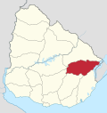
Treinta y Tres is a department of Uruguay. Its capital is Treinta y Tres. It is located in the east of the country, bordering the departments of Cerro Largo to the north, Durazno and Florida to the west, Lavalleja and Rocha to the south, while to its east is the lake Laguna Merín separating it from the southernmost end of Brazil.

Piriápolis City & Municipality in Maldonado, Uruguay

Piriápolis is a city in the Maldonado Department of Uruguay. It is an important summer resort in the country, predating the larger and better known resort town of Punta del Este. Because it is mainly used as a resort, it has a relatively small permanent population for a city of its size.

Pan de Azúcar, Uruguay City Municipality in Maldonado, Uruguay

Pan de Azúcar is a city in the southwest of the Maldonado Department in Uruguay. It takes its name from a nearby hill, topped by a huge cross.

Bella Unión City in Artigas, Uruguay

Bella Unión is a city in the north part of Artigas Department of Uruguay.

Santa Rosa, Uruguay City & Municipality in Canelones, Uruguay

Santa Rosa is a small city in the Canelones Department of southern Uruguay.

Fraile Muerto Town in Cerro Largo Department, Uruguay

Fraile Muerto is a town in the Cerro Largo Department of eastern Uruguay. Its name means "Dead Friar".

Isidoro Noblía Town in Cerro Largo Department, Uruguay

Isidoro Noblía is a small town (villa) in the Cerro Largo Department of eastern Uruguay.

Tupambaé Village in Cerro Largo Department, Uruguay

Tupambaé is a village (pueblo) in the Cerro Largo Department of eastern Uruguay.

Cerro Chato Town in Uruguay

Cerro Chato is a town in central Uruguay that is divided in three parts belonging to Durazno Department, Florida Department, and Treinta y Tres Department.

José Pedro Varela, Uruguay City in Lavalleja, Uruguay

José Pedro Varela is a small city in the north of Lavalleja Department of southeastern Uruguay. It is named after the sociologist and politician José Pedro Varela.

Minas de Corrales Town in Rivera Department, Uruguay

Minas de Corrales is a town in the Rivera Department of northeastern Uruguay.

Vichadero Town in Rivera Department, Uruguay

Vichadero is a small village in the Rivera Department of northeastern Uruguay.

Lascano City in Rocha, Uruguay

Lascano is a small town in the Rocha Department of southeastern Uruguay.

General Enrique Martínez Village in Treinta y Tres Department, Uruguay

General Enrique Martínez, also known as La Charqueada, is a village in the Treinta y Tres Department of eastern Uruguay.

Vergara, Uruguay City in Treinta y Tres, Uruguay

Vergara is a small city in the Treinta y Tres Department of eastern Uruguay.

Estación Rincón Village in Treinta y Tres Department, Uruguay

Estación Rincón or Rincón is a village in the Treinta y Tres Department of Uruguay.

Municipalities of Uruguay

Since 2009, the Uruguayan departments have been subdivided into municipalities. In the municipal elections of 2010 municipal authorities were elected for the first time and they assumed office months later. Currently there are 125 municipalities in Uruguay.

References

  1. 1 2 "Statistics of urban localities (1963–2004) (see also "Olimar")" (PDF). INE. 2012. Retrieved 6 September 2012.
  2. "Ley Nº 13.083". República Oriental del Uruguay, Poder Legislativo. 1962. Retrieved 6 September 2012.
  3. "Censos 2011 Cuadros Trenta y Tres". INE. 2012. Archived from the original on 10 October 2012. Retrieved 25 August 2012.