Oliver's Wharf

Last updated

Oliver's Wharf
Oliver's Wharf, Wapping.jpg
View from Wapping High Street
Tower Hamlets London UK location map.svg
Red pog.svg
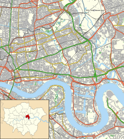
Oliver's Wharf
Location within London Borough of Tower Hamlets
Greater London UK location map 2.svg
Red pog.svg
Oliver's Wharf
Oliver's Wharf (Greater London)
General information
Architectural style Gothic
Location Wapping
Address64 Wapping High Street, E1W
Town or city London
Country United Kingdom
Coordinates 51°30′12″N0°3′41″W / 51.50333°N 0.06139°W / 51.50333; -0.06139
Completed1870
Technical details
MaterialPolychrome brick [1]
Design and construction
Architect(s)Frederick and Horace Francis
Designations
Listed Building – Grade II
Official nameOliver's Wharf
Designated27 September 1973
Reference no. 1065806

Oliver's Wharf is a Grade II listed apartment building and former warehouse on the River Thames in Wapping High Street, Wapping, London. [2] [3]

Contents

History

Construction

The warehouse was built in 1870 by architects Frederick and Horace Francis to store tea and other cargo. [3] [4] It had a capacity of 60,000 packages. [5]

Conversion to housing

In 1972, Oliver's Wharf was converted into luxury apartments by Tony Goddard of Goddard Manton Partnership. It is the first of Wapping's, and one of the first Docklands warehouses altogether, to undergo such a conversion. [3] [4]

References

  1. Rose, Millicent (1973). The East End of London. Cedric Chivers. ISBN   9780855948009 . Retrieved 14 June 2020.
  2. Historic England. "Oliver's Wharf (1065806)". National Heritage List for England . Retrieved 14 June 2020.
  3. 1 2 3 Pearson, Lynn (2016). Victorian and Edwardian British Industrial Architecture. The Crowood Press. ISBN   978-1-78500-190-1 . Retrieved 14 June 2020.
  4. 1 2 Ellmers, Chris; Werner, Alex (1988). London's lost riverscape: a photographic panorama. Viking. ISBN   978-0-670-81263-9 . Retrieved 14 June 2020.
  5. Co, Finlay (James) &; Brogan, Colm (1951). James Finlay & Company Limited: Manufactures and East India Merchants, 1750-1950. Jackson Son. Retrieved 15 June 2020.

51°30′12″N0°3′41″W / 51.50333°N 0.06139°W / 51.50333; -0.06139